Lugares de interés (POIs) del Mapa
0: 100FT. Ship and USN Intruder Plane Wrecks - (Volusia Reefs SITE 9)
Loran C: 44400.4 - 61785.5*
Lat/Long: (GPS)
29°21.23'N, 80°21.44'W
Information Compliments of: www.ScubaLessonsInc.com
Because of the depth, and sometimes strong currents, this site is not recommended for sport diving, extremely advanced divers or tech divers only should dive this site!
Más sobre 100FT. Ship and USN Intruder Plane Wrecks - (Volusia Reefs SITE 9)
1: 1990 Center Culverts Dive Site
Loran C: 44396.7 - 61973.5
Lat/Long: (GPS)
29°03.23 'N, 80°43.16'W
Loran C: 44370.7 - 61993.9*
2010 - SE Culverts
Lat/Long : (GPS)
29°02.866 N, 80°43.175' W
In July of 2010, 470 tons of large clean concrete culverts and concrete forms were placed on the SSE part of the site. The depth is 71 ft , the height of the deposit is 11 ft.
Más sobre 1990 Center Culverts Dive Site
2: 4th Window Drift Dive
GPS Coordinates: 26 42.924 N X 80 01.059 W, 26 42.687 N X 80 00.971 W, 26 42.307 N X 80 00.990 W
Information Compliments of: www.ScubaLessonsInc.com
Known for being on the 4th window across in the Breakers Hotel. This dive site is one of my favorite. I saw 2 of the largest southern sting rays I have ever seen in my life. One was over 6 feet across! This dive site is ledge, sand, ledge, sand and it is amazing life everywhere. Great in feburary to see nurse and lemon sharks. Almost any time of year you will see large turtles, eels and tons and tons of fish, from big eye travalley to golliath grouper! Western edge w/ deep undercuts. Drift covers N to S "King Neptune" to "Outfall Trench" Safety sausage is required. Depths range from: 54'-65'
Más sobre 4th Window Drift Dive
3: Abby to Rabbit Drift Dive
Más sobre Abby to Rabbit Drift Dive
4: Amaryllis Wreck [Part of the "Cooridors Drift Wreck Treck"]
Más sobre Amaryllis Wreck [Part of the "Cooridors Drift Wreck Treck"]
5: Antilles Star (Volusia County SITE 4)
Lat/Long (GPS) 29° 19.198 N, 80° 44.770'W, Loran C 44519.4, 61960.2.*
Antilles Star Photo
The Antilles Star was placed on Site 4 south of the Maxine D on 6/29/04. On sinking she was lying on her side. After the hurricanes in 2004, she is almost upright . Click to here to see a survey
1994-165 ft. steel ship, Maxine D
Lat/Long: (GPS) 29°19.40'N, 80°44.84'W, Loran C: 44521.6 - 61960.2*
The Maxine D is a 165 ft. ship. She was placed on the site in 1994 and remains upright and intact. She lies in a general N-S direction.Maxine D. Photo
Lat/Long: (GPS)
29°19.26'N, 80°44.66'W
Loran C: 44519.4 - 61959.3*
1992 - culverts/small barge
Lat/Long: (GPS)
29°19.17'N, 80°44.54'W
Loran C: 4451 7.5- 61958.4*
Más sobre Antilles Star (Volusia County SITE 4)
6: Argoil Barge
Más sobre Argoil Barge
7: Bahia Honda State Park
Big Pine Key, Florida 33043
Phone: 305-872-2353
Getting There: Bahia Honda is located 12 mile south of Marathon on US1.
SCUBA Diving - Permitted but not recommended for advanced divers because the water is shallow for several yards from shore. The shallow water does make it a good area for beginning divers and snorkelers. A Diver Down flag must be displayed.
Snorkeling - Bahia Honda has some of the best nearshore snorkeling in the Florida Keys. You can see a variety of sea life just a few hundred feet from the shore. The snorkeling is good for beginners because it is shallow, 4-6 feet. You may see soft corals, small coral heads, tropical fish, Queen Conchs and spiny lobster. There is always something different to see. In the winter months, when the water is cooler, you may need a wetsuit to be comfortable. Just remember to take nothing but photos and leave nothing but ripples.
Más sobre Bahia Honda State Park
8: Barracuda Reef Moorings
Más sobre Barracuda Reef Moorings
9: BETTY CASTOR REEF
Longitude = -83 23.000
Depth = 22 ft
Technical = NO
Name = BETTY CASTOR REEF
Material = MODULES CONCRETE
Más sobre BETTY CASTOR REEF
10: Bib Wreck, Key Largo
Más sobre Bib Wreck, Key Largo
11: Bimini, Bahama's
Recognizing how valuable tourism is to the islands' economy, the government of the Bahamas extends the welcome mat to Florida boaters each year. But they also make you pay for the privilege of using their waters.
Largely in response to negative feedback over the permit hike, in January 04 the Bahamas government announced that you can travel twice to the islands within 90 days on the same permit. More changes in the fee structure may be forthcoming. Otherwise, the procedures for obtaining permission to travel throughout this sovereign nation remain unchanged for 2005. Note, too, that penalties for violations are likely to be as stiff as ever-including huge fines and possible jail time. Obey the law and have a good time.
It's still required that every person aboard have either a passport, or a birth certificate (original or certified) and official photo I.D. (drivers' license).
Before entering any Bahamas harbor, raise the yellow quarantine flag up an outrigger or fishing rod. Have a Bahamas courtesy flag standing by to hoist upon clearance. You can get the both flags at any local marine store.
If you've made arrangements to stay at a hotel, tie up to the dock, contact the dockmaster and ask for Customs and Immigration forms. If you aren't planning to overnight in a hotel, you can still generally receive permission to temporarily moor at an available hotel dock (Weeches or Bluewater on North Bimini). Tipping the dockmaster is customary.
If you'd like to download the forms to prepare in advance, visit www.bahamas.com .
The captain is the only one who may go ashore to deliver the forms and show boat registration and passports to the Customs and Immigration offices. Offices are usually open 9 a.m. to 5 p.m.
If you have a gun on your boat to fend off pirates (more imagined than real these days), keep it there, locked away at all times per local law. On the Customs documents you must report the serial number and manufacturer of the firearm, plus the exact number of rounds. This is another one of those rules that officials take very seriously.
Return your immigration cards to the Immigration office on the last island you visit before departing for home. Keep your cruising permit.
Returning home
Big boats (over 30 feet) must possess a U.S. Customs decal, which you can purchase for $25 annually at www.cbp.gov or by calling (317) 298-1245. U.S. Customs & Border Protection (CBP), under the Dept. of Homeland Security, issues these decals, and is also the agency you'll need to contact as soon as you return to homeport-on any size boat. It's worth getting one for a smaller boat too. You will find your return home a bit easier.
Back in the U.S., before anyone gets off the boat, the captain must call the Small Boat Reporting Hotline at 1-800-432-1216 to report arrival. You'll then be instructed to drive (perhaps by car) your crew to the closest CBP office for immigration clearance. Depending on where you are, this can be something of a hassle, but for now we'll have to accept it as part of the trip.
Dive sites in Bimini
The following list is published so that boaters can get the most out of the trip. Many of these sites have mooring buoys which are maintained by several of the commercial operations on Bimini. They have first dibs on the usage of those buoys. If you are on a buoy and a dive operator asks you to leave, please do. There is NO FISHING FROM THE BUOYS.
Because storms and boats can remove buoys, this list is not always current. Please do not anchor on the sites. Drift the sight if you are set on diving it. Bimini diving is the best of the best. Enjoy!
DIVE SITE-GPS number North, GPS Number West, Depth, Mooring
Bug Bumps 25.48.271N, 079.06.735W, Depth: 40'-50', Mooring: Yes
Rockwell House 25.45.371N, 079.18.030W, Depth 35'-50' Mooring: No
Hawksbill (North) 25.45.319N, 079.18.066W, Depth 35'-50' Mooring: Yes
Hawksbill 25.45.269N, 079.18.066W, Depth 35'-50' Mooring: Yes
Sharks In The Hood 25.45.199N, 079.18.345W, Depth 50'-80' Mooring: Yes
Caverns 25.45.181N, 079.18.375W Depth: 50'-80' Mooring: Yes
Moray Alley 25.44.992N, 079.18.395W 50'-75' Mooring: Yes
The Line 25.44.203N, 079.18.161W, Depth 25'-40', Mooring: Yes
Kinks 25.44.140N, 079.18.436W, Depth: 55'-60', Mooring: Yes
Bimini Trader (wreck) 25.43.098N, 079.18.924W, Depth: 70'-80' Mooring: Yes
Bimini Barge (wreck) 24.41.875N, 079.19.019W, Depth: 75'-100' Mooring: Yes
Contenetal Shelf 25.41.623N, 079.19.150W, Depth: 145'-+++ VERY ADVANCED!
South Turtle Rocks 25.39.398N, 079.18.623W, Depth: 30'-35', Moorings: Yes
Tuna Alley North 25.31.562N, 079.17.960W, Depth: 45'-100', Mooring: Yes
Tuna Alley South 25.31.509N, 079.17.952W, Depth: 45'-100', Mooring: Yes
Pinical Leap 25.29.950N, 079.17.132W, Depth: 70-+++ ADVANCED DIVE! Mooring: Yes
North Victory 25.29.128N, 079.16.419W, Depth: 35'-85' Mooring: Yes
Middle Victory 25.28.909N, 079.16.220W, Depth: 35'-85', Mooring: Yes
South Victory 25.28.883N, 079.16.204W, Depth: 35'-85', Mooring: Yes
Más sobre Bimini, Bahama's
12: Blandas Reef
|
Latitude |
Longitude |
| 26.41975° | -82.31833° |
| 26° 25' 11" N | 82° 19' 6" W |
| 26° 25.18 N | 82° 19.1 W |
Depth: 45' Relief: 8'
Date Reef Deployed: 7/29/03
Reef Materials: Ship Steel Sailboat 45' Reef Description: 45' X 12' X 8' Ft. Steel Hulled Sailboat Hull
Popular artificial reefs near Blandas Reef
Depth: 60 ft. (18.29 m)
Distance: 5.77 miles (5.02 nautical)
Location: 26.415083° -82.411517°
Heading: W (263°)
Lee County
Depth: 57 ft. (17.37 m)
Distance: 5.80 miles (5.04 nautical)
Location: 26.41605° -82.411983°
Heading: W (265°)
Lee County
Depth: 36 ft. (10.97 m)
Distance: 7.22 miles (6.27 nautical)
Location: 26.519617° -82.2841°
Heading: N (4°)
Lee County
Depth: 34 ft. (10.36 m)
Distance: 7.24 miles (6.29 nautical)
Location: 26.519483° -82.282533°
Heading: N (4°)
Lee County
Depth: 60 ft. (18.29 m)
Distance: 10.59 miles (9.19 nautical)
Location: 26.5473° -82.413217°
Heading: N (353°)
Lee County
Depth: 24 ft. (7.32 m)
Distance: 10.65 miles (9.25 nautical)
Location: 26.558317° -82.2428°
Heading: N (5°)
Lee County
Depth: 60 ft. (18.29 m)
Distance: 10.70 miles (9.30 nautical)
Location: 26.54795° -82.415517°
Heading: N (353°)
Lee County
Depth: 60 ft. (18.29 m)
Distance: 10.71 miles (9.30 nautical)
Location: 26.548983° -82.413933°
Heading: N (354°)
Lee County
Depth: 26 ft. (7.92 m)
Distance: 10.98 miles (9.54 nautical)
Location: 26.560883° -82.23665°
Heading: N (5°)
Lee County
Depth: 30 ft. (9.14 m)
Distance: 14.81 miles (12.87 nautical)
Location: 26.632217° -82.286017°
Heading: N (1°)
Lee County
Más sobre Blandas Reef
13: BLUE SPRINGS NEAR ORANGE CITY, FL
Orange City, Florida 32763, Phone: (386) 775-3663
Diving Fees: $6.50 per diver, must have buddy or instructor and if teaching or diving must have a Florida State Springs Dive Permit ($213 Yr. good for all state parks.)
Admission Fee:
$6.00 per vehicle. Limit 2-8 people per vehicle.
$4.00 Single Occupant Vehicle.
$2.00 Pedestrians, bicyclists, extra passengers, passengers in vehicle with holder of Annual Individual Entrance Pass.
Camping Fee:
$24.00 per night, plus tax. Includes water and electricity.
Florida residents who are 65 years of age or older or who hold a social security disability award certificate or a 100 percent disability award certificate from the Federal Government are permitted to receive a 50 percent discount on current base campsite fees. Proof of eligibility
Cabin Fee:
$95.00 per night, plus tax.

Blue Spring offers swimming and scuba diving in a crystal clear, 72 degree spring run. Scuba divers must register at the entrance station between the hours of 8 a.m. and 3 p.m., with an up-to-date certification card and a partner. Swimming or diving with the manatees is NOT permitted.
Blue Spring State Park covers more than 2,600 acres, including the largest spring on the St. Johns River. Blue Spring is a designated Manatee Refuge and the winter home to a growing population of West Indian Manatees. The spring and spring run are closed during Manatee season, mid-November through March. Swimming or diving with manatees is not permitted; this rule is strictly enforced.
For centuries, the spring area was home to Native Americans. In 1766 it was visited by Colonial American botanist John Bartram, but it was not until 1856 that it was settled by Louis Thursby and his family. The Thursby house, built in 1872, remains standing. The spring´s crystal clear, 73 degree water can be enjoyed by swimmers, snorkelers, and certified scuba divers with a partner. The river is popular for fishing, canoeing, and boating. River boat tours are available; for reservations, call St. Johns River Cruises at (386) 917-0724. The park has plenty of picnic areas and a hiking trail. For overnight stays, air-conditioned cabins, a full-facility campground and primitive campsites are available. This is a very popular park on weekends. To ensure entrance into the park, we recommend arriving early; otherwise, the parking area will be full and you may not be able to enter.
Más sobre BLUE SPRINGS NEAR ORANGE CITY, FL
14: Boynton Ledge Drift Dive
Más sobre Boynton Ledge Drift Dive
15: Breakers Shallow Drift Dive
GPS Coordinates:
26 43.052 N X 80 01.80 W
Information Compliments of: www.ScubaLessonsInc.com
Great dive for beginners. Only 20-30' in depths This entire area is covered with shallow patch reef not often seen this far N, should be done via boat!
Más sobre Breakers Shallow Drift Dive
16: Boca 3rd Reef Drift Dive
Más sobre Boca 3rd Reef Drift Dive
17: Boca North End Drift Dive
Depths Range: 45'-65'
Más sobre Boca North End Drift Dive
18: Caladesi Island State Park
3 Causeway Blvd
Dunedin, FL 34698
(727) 469-5918
As one of the few completely natural islands along Florida´s Gulf Coast, Caladesi´s white sand beaches were rated America's Best Beach in 2008. Beach lovers can enjoy swimming, sunbathing and beachcombing. Saltwater anglers can cast a line from their boats or surf fish. Nature enthusiasts can spot wildlife while hiking the three mile nature trail through the island´s interior or paddling a three mile kayak trail through the mangroves and bay. Picnic tables and shelters are located near the beach, and picnic pavilions can be reserved for a fee. The park has a marina with electric and water hookups, as well as a snack bar and gift shop. The park is accessible by boat or ferry. Ferry service is provided by the Caladesi Island Ferry (727) 734-1501 and departs from Honeymoon Island State Park.
The ocean floor off this island is covered with live sand dollars, according to snorkeling enthusiasts. Caladesi’s white sand beaches were rated as America’s best in 2008.

According to some divers in the know, Clearwater diving is one of Florida's best kept secrets. This has a lot to do with the area's active artificial reef program. Although there is a small reef just about 300 yards off shore of caladesi most of the diving is just for sand dollars.
Más sobre Caladesi Island State Park
19: Cannabis Cruiser Wreck
She is a 75' Trawler. She was used to smuggle drugs in the late 70's. She was hauling a load of 30 pound bails of marijuana to off load in the Florida Keys when she was spotted by the Coast Guard. The smugglers didn’t want to get busted with the pot so they sank the trawler and jumped ship.
The ship was found several years later and she’s sitting in the upright position. It’s totally intact including all of her equipment and several bails of marijuana.
These days many fish call her home. Divers have reported seeing, jewfish, several very large snook, lots of hogfish, an occasional shark and a very curious and large green moray eel. This is a really cool Florida Keys wreck just because of its history. This wreck is for the advanced diver.
This information was provided by: http://www.ScubaLessonsInc.com
Más sobre Cannabis Cruiser Wreck
20: CARGO PIER #4 MATERIALS
Information Compliments of: www.ScubaLessonsInc.com
7 LOADS (THREE REEFS)
CONCRETE RUBBLE
Depth Range: 90' to 121', 20' relief
Strong currents, advanced divers with heavy current experience only. TONS OF BIG LIFE HERE! LOTS OF HAMMERHEADS. CAUTION BULL SHARKS HERE TOO.
Más sobre CARGO PIER #4 MATERIALS
21: Carysfort Reef
Carysfort Reef is marked by a lighthouse that stands 112 feet tall. The depth here ranges from 3' to 80'. There are thirteen mooring buoys, CS1 thru CS13. It’s located six miles south of Key Largo. The GPS Coordinates are 25'13.314N and 080'12.690W.
It was built in 1852. It’s the oldest functioning lighthouse of it’s kind in the Florida Keys and the United States. It gets it name from the H.M.S. Carysfort, a ship that ran aground here in 1770. This reef has been collecting ships ever since then.
This is a mature coral reef that covers an area four miles long. There are large Elkhorn, Staghorn, Brain, Star, Fire and Sheet corals here. Lots of fish call this place home as well. The upper part of the reef close to the lighthouse is shallow and swarms with marine life. It’s a great area to snorkel. The visibility is usually fabulous due to the closeness of the Gulfstream.
 This reef isn’t centrally located to most of the dive shops in Key Largo, because of that fewer divers visit this site.
A few points of interest you might want to check out while diving here are five cannons about ½ mile North of the lighthouse in 15' of water. I wonder if these were jarred off the H.M.S. Winchester when she ran aground here in 1695. She was armed with 60 cannons. There’s a wall that drops off from 65 to 80 feet east northeast of the light. The wall is filled with colorful corals and sponges. There’s two really big anchors in 35' to 40' of water about 1200 feet to the north northwest of the light. I’ve heard they’re old. They’re from the 1800's.
| Carysfort Reef Light | |
|---|---|
 |

Más sobre Carysfort Reef
22: Caves and Ledges Moorings
Más sobre Caves and Ledges Moorings
23: Cayo Costa State Park
Boca Grande, Florida 33921
Phone: 941-964-0375

Scuba - Scuba diving can be done off of the beaches.
Snorkeling - Snorkel in the pristine, blue waters of the Gulf of Mexico. You must provide you own equipment.
Más sobre Cayo Costa State Park
24: CEDAR KEY REEF B
Longitude = -83 13.555
Depth = 25 ft
Technical = NO
Name = CEDAR KEY REEF
Material = CONCRETE CULVERTS
Más sobre CEDAR KEY REEF B
25: CEDAR KEY REEF
Latitude = 29 07.348
Longitude = -83 13.557
Depth = 25 ft
Technical = NO
Name = CEDAR KEY REEF
Material = CONCRETE CULVERTS
Más sobre CEDAR KEY REEF
26: CEDAR KEY REEF SITE 1
Longitude = -83 13.203
Depth = 23 ft
Technical = NO
Name = CEDAR KEY REEF SITE 1
Material = MODULES CONCRETE STONE CRAB (108)
Más sobre CEDAR KEY REEF SITE 1
27: CEDAR KEY #1
Longitude = -83 13.347
Depth = 23 ft
Technical = NO
Name = CEDAR KEY #1
Material = CONCRETE CULVERTS 85
Más sobre CEDAR KEY #1
28: CEDAR KEY #1
Latitude = 29 07.334
Longitude = -83 13.408
Depth = 23 ft
Technical = NO
Name = CEDAR KEY #1
Material = CONCRETE CULVERTS 80
Más sobre CEDAR KEY #1
29: CEDAR KEY #1
Latitude = 29 07.356
Longitude = -83 13.386
Depth = 23 ft
Technical = NO
Name = CEDAR KEY #1
Material = CONCRETE CULVERTS 85
Más sobre CEDAR KEY #1
30: CEDAR KEY #1
Latitude = 29 06.412
Longitude = -83 12.896
Depth = 23 ft
Technical = NO
Name = CEDAR KEY #1
Material = MODULES CONCRETE STONE CRAB (108)
Más sobre CEDAR KEY #1
31: CEDAR KEY #1
Latitude = 29 07.365
Longitude = -83 13.402
Depth = 23 ft
Technical = NO
Name = CEDAR KEY #1
Material = CONCRETE CULVERTS 87
Más sobre CEDAR KEY #1
32: CEDAR KEY REEF SITE 2
Latitude = 28 58.930
Longitude = -83 11.910
Depth = 26 ft
Technical = NO
Name = CEDAR KEY REEF SITE 2
Material = CONCRETE CULVERTS
Más sobre CEDAR KEY REEF SITE 2
33: CEDAR KEY REEF SITE 2
Latitude = 28 58.712
Longitude = -83 12.099
Depth = 26 ft
Technical = NO
Name = CEDAR KEY REEF SITE 2
Material = CONCRETE CULVERTS
Más sobre CEDAR KEY REEF SITE 2
34: CEDAR KEY REEF SITE 2
Latitude = 28 58.910
Longitude = -83 12.000
Depth = 26 ft
Technical = NO
Name = CEDAR KEY REEF SITE 2
Material = CONCRETE CULVERTS
Más sobre CEDAR KEY REEF SITE 2
35: CEDAR KEY REEF SITE 2
Latitude = 28 58.950
Longitude = -83 12.010
Depth = 26 ft
Technical = NO
Name = CEDAR KEY REEF SITE 2
Material = CONCRETE CULVERTS
Más sobre CEDAR KEY REEF SITE 2
36: CEDAR KEY REEF SITE 3
Latitude = 29 06.840
Longitude = -83 25.570
Depth = 36 ft
Technical = NO
Name = CEDAR KEY REEF SITE 3
Material = CONCRETE CULVERTS
Más sobre CEDAR KEY REEF SITE 3
37: CEDAR KEY REEF SITE 3
Latitude = 29 06.621
Longitude = -83 25.824
Depth = 36 ft
Technical = NO
Name = CEDAR KEY REEF SITE 3
Material = CONCRETE CULVERTS
Más sobre CEDAR KEY REEF SITE 3
38: CEDAR KEY REEF SITE 3
Latitude = 29 06.629
Longitude = -83 25.892
Depth = 36 ft
Technical = NO
Name = CEDAR KEY REEF SITE 3
Material = CONCRETE CULVERTS
Más sobre CEDAR KEY REEF SITE 3
39: CEDAR KEY REEF SITE 3
Latitude = 29 06.870
Longitude = -83 25.500
Depth = 36 ft
Technical = NO
Name = CEDAR KEY REEF SITE 3
Material = CONCRETE CULVERTS
Más sobre CEDAR KEY REEF SITE 3
40: CEDAR KEY REEF SITE 3
Latitude = 29 06.920
Longitude = -83 25.720
Depth = 36 ft
Technical = NO
Name = CEDAR KEY REEF SITE 3
Material = CONCRETE CULVERTS
Más sobre CEDAR KEY REEF SITE 3
41: CEDAR KEY REEF SITE 3
Latitude = 29 06.830
Longitude = -83 25.520
Depth = 36 ft
Technical = NO
Name = CEDAR KEY REEF SITE 3
Material = CONCRETE CULVERTS
Más sobre CEDAR KEY REEF SITE 3
42: CEDAR KEY 31
Latitude = 29 07.231
Longitude = -83 13.465
Depth = 23 ft
Technical = NO
Name = CEDAR KEY 31
Material = CONCRETE CULVERTS 40
Más sobre CEDAR KEY 31
43: Christ of the Abyss
GPS Coordinates: 25 07.450N, 80 17.800W Depth: 25' Great for beginning divers but watch for crowds! Little current and surounded by a nice reef.
The Christ Statue is a replica of the Christ of the Abyss Statue that sits in the Mediterranean Sea in 50' of water off the coast of Genoa, Italy. The original was a dedication to the first Italian to use scuba equipment ever. This one is the first statue made from this mold. The second one was cast in 1954. It stands in St. George Harbor in Grenada in memory of the rescue of the Bianca C, an Italian liner that burned and sank just outside the harbor. The third one stands in 25' of water in the John Pennekamp Coral Reef State Park off Key Largo in the upper Florida Keys. It’s a 9 foot tall bronze statue weighing 4,000 pounds. It sits in a sand clearing facing a huge brain coral. The GPS Coordinates are 25'07.450N and 080'17.800 W.
It was originally made for an Italian industrialist and dive equipment manufacturer. The statue was donated to John Pennekamp Coral Reef State Park in 1966 by the Cressi family. It was donated to celebrate the creation of the first underwater park in the United States. This is a must see dive. It’s one of the most popular underwater sites on planet earth. Many couples choose to take the plunge and get married at this site, as many as 200 weddings a year are preformed underwater here. It’s in shallow water so it’s easily accessible to both snorkelers and scuba divers. Be warned this dive site usually has lots of divers in the water at the same time. This is just one of the many spectacular dive sites in the Florida Keys.
Information provided by:
Más sobre Christ of the Abyss
44: COAL ASH REEF
Latitude = 29 07.266
Longitude = -83 12.300
Depth = 25 ft
Technical = NO
Name = COAL ASH REEF
Material = CONCRETE COAL ASH
Más sobre COAL ASH REEF
45: Crocker Ridges
One of the reasons a Florida scuba charter from Islamorada may bring you to this dive site is because it is an excellent dive site to view some of the larger fish in the area.
With its close proximity to the deeper water these channels formed by the ridges are often frequented by amberjacks, rays, Green Sea Turtles and Nurse Sharks.
The ridges and surrounding area are also adorned with Seafans, gorgonians and Barrel Sponges and swimming amongst this gorgeous background you will discover various angelfish and butterflies.
Más sobre Crocker Ridges
46: Dayo Scuba
Más sobre Dayo Scuba
47: Deerfield Beach Ledges Shore Dive
Get off of the 95 at Hillsboro Blvd in Deerfield Beach. Go east to the A1A. Then go south on the A1A until you get to SE 5th Street. Once there go east for a short distance, then go S on S. Ocean way Follow this road, it will curve to the east. there will be parking at meters just south of the Cove Beach Club.
For those with a GPS the Cove
This site is adjacent to the public beach in Deerfield Beach. This end of the beach does not have a lifeguard. There are three lines of reef here running parallel to the beach. The first line of reef starts about 75 feet offshore. (Depth about 6') The second line of reef is about 50 feet beyond the first. (depth 10-12') The third line of reef is another 40 feet past the 2nd line. (Depth 14-16').
Más sobre Deerfield Beach Ledges Shore Dive
48: Delnor-Wiggins Pass State Park
11135 Gulfshore Dr.
Naples, Florida 34108
Phone: 239-597-6196
Getting There - Delnor-Wiggins Pass State Park is located six miles west of Exit exit 111, old 17, on I-75.
Scuba Diving - There is a hard bottom reef, which runs parallel to the beach where scuba diving is permitted. The closest area to the reef is area 2.
Snorkeling - Snorkeling is permitted along the beach. There is a hard bottom reef, which runs parallel to the beach where scuba diving and snorkeling is permitted. The closest area to the reef is area 2.
Más sobre Delnor-Wiggins Pass State Park
49: Delray Grouper Drift Dive
Más sobre Delray Grouper Drift Dive
50: Delray Snapper Drift Dive
Más sobre Delray Snapper Drift Dive
51: 02322694 DEVIL'S EYE SPRING NR HILDRETH, FL
Latitude: 29.83515948
Longitude: -82.69658951
Devil’s Eye Cave System

The Devil’s Eye cave system is among the most popular and frequently dived caves in the world. With over 30,000 feet of mapped passageway, divers can spend a lifetime of active cave diving and still not see all of it. There are still portions of the cave that have yet to be adequately explored and mapped.
Devil’s Eye is part of the Ginnie Springs resort complex, and provides visiting divers with unusual amenities, such as access to warm showers before and after the dive. Its location on the Santa Fe river means that, even after the Suwannee River caves have flooded, it will remain diveable. In fact, Devil’s Eye generally becomes undiveable only once or twice every decade.

The system has two entrances, Devil’s Eye and Devil’s Ear, located in close proximity to one another. They quickly join each other under water in a large passageway known as the Gallery. Devil’s Ear generally provides faster and easier access; however, divers frequently use the Devil’s Eye entrance for training purposes or simply a change of pace.
Parallelling the Gallery are a series of interconnecting tunnels known as the Catacombs. These are the only popular passageways in the cave that are not lined. This is intentional, as instructors rely on these tunnels to give students extensive reel practice.
Because of the large degree of traffic the cave receives, and the fact Ginnie Springs’ “No Lights” rule helps keep untrained divers out of the cave, the main line at Devil’s Ear runs right to the entrance. This way, the only divers likely to be running reels into the cave are students in training. (Imagine the potential calamity if ten or more teams of cave divers all tried to run reels through the narrow, high-flow entrance at one time.)
At the end of the Gallery, the cave makes an abrupt right turn, and divers must pass through a wide restriction known as the Lips. Beyond the Lips is a large room, at the far side of which the line passes through the Key Hole, Here divers drop from 70 to 90 feet, and begin snaking through a short, winding section known as the Cornflakes.

At the far side of the Cornflakes, some 450 feet into the cave, divers emerge into the Junction Room. From here the cave begins branching off in several directions, providing the opportunity for numerous circuits and exploration of offshoot tunnels.
The furthest point of penetration in the cave is almost a mile from the entrance. Exploration in this region of the cave makes use of scooters almost mandatory. Fortunately, divers can make hundreds of dives in the downstream portion of the cave before they need DPVs to see new passageway. By then they will have gained sufficient experience to graduate to scooters and staging (Ginnie Springs requires 100 cave dives or DPV certification to use scooters in Devil’s Eye).
Más sobre 02322694 DEVIL'S EYE SPRING NR HILDRETH, FL
52: ESSO Bonaire III Wreck
Más sobre ESSO Bonaire III Wreck
53: Fanning Springs State Park
18020 N.W. Highway 19
Fanning Springs, Florida 32693
Phone: 352-463-3420
Getting There - Fanning Springs State Park is located on U.S. Hwy. 19/98 in the town of Fanning Springs.
Scuba Diving - Open water scuba divers are welcome in the designated swimming area. Divers must have proper certification and are required to register with park staff before entering the water. Diving fees are $10.00 plus tax per person, minimum of two divers.
Snorkeling - Snorkeling in the spring is a refreshing activity on a hot day. Put on your mask and fins and see what lies below the spring water.
Más sobre Fanning Springs State Park
54: Flower Garden (Drift Dive)
GPS Coordinates: 26 42.185 N X 80 01.016 W, 26 41.846 N X 80 01.064 W, 26 41.620 N X 80 01.097 W Information Compliments of: www.ScubaLessonsInc.com
This is amazingly full of fan coral, brain coral, tons of small fish, walls of them, great for beginner as the current is generally mild. Covers from "East West Ledge" in the S to "Beakers S" in the N. Except for EW ledge W edge is undercut.
Más sobre Flower Garden (Drift Dive)
55: Fort de Soto Park
Roughly two miles west of Fort De Soto Park, in about 18 feet of water, lies what's left of the USS Narcissus, a Civil War tugboat that exploded after hitting a shoal in 1866, killing all 29 people on board.
When the state started surveying the wreck in the 1990s, there wasn't much for divers to see in this particular spot in the Gulf of Mexico – basically only part of the ship's steam engine.
But as time passed, the sand surrounding the wreck shifted. Maybe the busy 2005 hurricane season had something to do with it. Maybe nearby dredging, designed to re-nourish Pinellas beaches, played a part.
In any event, when another group of divers associated with the Florida Aquarium took a look a few years ago -- thanks to a state grant -- it found substantially more was now visible.
"We went out and discovered the vast majority of the site had been uncovered," said Mike Terrell, the dive training supervisor for the aquarium. "We discovered the entire engine, the propeller and part of the boiler that exploded were exposed."
That's one major reason why the aquarium and a handful of archaeologists are asking the state to designate the shipwreck site Florida's 12th Underwater Archaeological Preserve.
Más sobre Fort de Soto Park
56: Fort Pierce Inlet State Park
Fort Pierce, Florida 34949
Phone: 772-468-3985
Getting There: Fort Pierce Inlet State Park is located four miles east of Fort Pierce, via North Causeway.
Scuba Diving - Scuba diving is available; we have a reef about 100 yards from the beach. This is where you can explore our Atlantic "underwater paradise." A Diver Down flag must be displayed.
Snorkeling - Snorkeling is a popular recreational activity, weather permitting. Snorkelers can enjoy the beautiful tropical sea life that awaits them below. Most of year, our waters are so clean you just might think you’re in the Bahamas! A Diver Down flag must be displayed.
Más sobre Fort Pierce Inlet State Park
57: FSFA REEF SITE #2
STEEL SAILBOAT 40' Long, Weighing 7.5 tons, GPS Coordinates: 28 30.392N, 80 12.998W,
Information Compliments of: www.ScubaLessonsInc.com
The ship is actually: 40'X8'X'10' STEEL HULLED SAILBOAT
Depth Range 80'-120'
Releif 10'
Más sobre FSFA REEF SITE #2
58: FSFA REEF SITE #2-STEEL YACHT
Information Compliments of: www.ScubaLessonsInc.com
Sunken Yacht 72' ft. long, Steel Hull, Weight 7.5 tons, 12' relief Measures: 72'X14X'12'
Depths 90' - 120'
Rarley Dove, tons of life.. big golliath groupers, many octo's here, sharks, rays over 5 ft. wide, seen manta's and southern here, seen a whale shark once here.. pretty cool site for January Diving for Southern Right whales.. this is thier path.. huge pools of krill come through here and cause feeding frenzies for many species. Look up for sail fish as well. Watch out for a couple of aggressive hammer heads. This is a very advanced dive. You should be Advanced certified and have at least 100 strong current dives on pretty rough wrecks to do this one!
Más sobre FSFA REEF SITE #2-STEEL YACHT
59: Gap Ledge to Sharpeto Drift
Más sobre Gap Ledge to Sharpeto Drift
60: John D. MacArthur Beach State Park
North Palm Beach, Florida 33408
Phone: 561-624-6950
Getting There: John D. MacArthur Beach State Park is located 2.8 miles south of the intersection of U.S.1 and PGA Blvd. on A1A in North Palm Beach.
Scuba Diving & Snorkeling - Scuba diving and snorkeling are permitted. A "Diver Down" flag, for snorkelers and divers, is required by law and is available for rent at the Nature Center.
Más sobre John D. MacArthur Beach State Park
61: John Pennekamp Coral Reef State Park
Key Largo, Florida 33037
Phone: 305-451-1202
Getting There: John Pennekamp Coral Reef State Park is located on US highway 1 at mile marker 102.5, north of Key Largo in the Florida Keys.
Scuba Diving - To fully enjoy the diving possibilities of the park, boat trips to the reef are recommended. A new diver, or a diver that needs a refresher, finds the waters of cannon beach a great place to hone their skills.
Snorkeling - In addition to the park's snorkeling tours, there are areas in the park designated for snorkeling. These areas are in a tropical lagoon and offer a look at the various sea grass communities in the park. In these areas there are some natural ledges that do hold some interesting marine life, there are also some artifacts from an early Spanish shipwreck approximately 100 feet offshore.
Más sobre John Pennekamp Coral Reef State Park
62: John U. Lloyd Beach State Park
Scuba Diving - For those interested in the underwater beauty of South Florida, Lloyd Beach has one of the easiest and interesting shore dives in the area. You can follow the submerged Eurojacks to the first reef. This allows snorkelers and divers to see a vast array of sealife including tropical and sport fish, sharks and Florida lobster.
Snorkeling - Snorkeling is available in designated areas.
Más sobre John U. Lloyd Beach State Park
63: Jupiter "Double" Ledges Drift Dive
GPS Coordinates: 26 56.778 N X 80 01.349 W, 26 56.401 N X 80 01.270 W, 2656.401 N X 8001.270 W
AKA "DOUBLE LEDGES"
Jupiter Ledges is a 2 mile long drift dive with some pretty wicked cool life. This is a boat dive only and gets to 64'-75' feet in depth depending if your on top of the reef or on the floor. You can expect to see nurse sharks, huge sea turtles, eels, tons of colorful fish and coral, file fish, squirrel fish, grouper and much more. This is a killer ocean dive and nice for advanced divers as it is a drift dive. The currents do change direction so you need to be careful about that here. You also are required to carry a Safety sausage on this dive!
Shear 10' to 13' Walls
Más sobre Jupiter "Double" Ledges Drift Dive
64: Half Mile Drift Dive
GPS Coordinates: 26 49.327 N X 80 00.264 W, 26 48.976 N X 80 00.232 W, 26 48.861 N X 80 00.176W
Information Compliments of: www.ScubaLessonsInc.com
This is a really cool dive spot with lots of life, known for hammerhead sharks and currents that can kick up some wicked waves when they change direction. This is an advance dive and requires a safety sausage as well. Depths range from: 85'-100' deep. From N. to S. this reef stretch covers Ziegler's Zoo, Condos and Calloway's Ledge. Great Drift Dive!
Más sobre Half Mile Drift Dive
65: Hall of Fame Moorings
Más sobre Hall of Fame Moorings
66: Horseshoe Reef Drift Dive
Más sobre Horseshoe Reef Drift Dive
67: Ichetucknee Springs State Park (North Entrance) CAVE DIVING ONLY
Fort White, Florida 32038
Phone: 386-497-2511
Getting There: From the north, take I-75 south to exit 423. Take SR 47 south, turn on CR 238 and follow the park signs. From the south, take I-75 north to exit 399. Take US 441 north to the city of High Springs. Take US 27 north to Ft. White, stay on US 27 north approximately 4 miles to the South Park Entrance.
Scuba Diving - SCUBA diving is allowed at Blue Hole Spring from October through March.
* Divers must be cave certified.
* SCUBA diving is not permitted in the river or other springs.
* There is a 1/2 mile trail to Blue Hole Spring; many divers bring a cart or wheelbarrow to transport gear.
* Dives cannot extend past 5:00 p.m.
* Diving Fee: $10.00 per person, October through March.

Tubing on the crystal clear Ichetucknee River is a unique experience in Florida. Nowhere else can one enjoy the outstanding scenic qualities of the "Real Florida" while floating leisurely on a tube or float. The pristine hardwood hammock, limestone outcrops, wildlife and serenity are a combination of natural values enjoyed by thousands of tubers every year.
Más sobre Ichetucknee Springs State Park (North Entrance) CAVE DIVING ONLY
68: Ichetucknee Springs State Park (South Entrance) CAVE DIVING ONLY
12087 S.W. US Hwy 27
Fort White, Florida 32038
Phone: 386-497-2511
Getting There: From the north, take I-75 south to exit 423. Take SR 47 south, turn on CR 238 and follow the park signs. From the south, take I-75 north to exit 399. Take US 441 north to the city of High Springs. Take US 27 north to Ft. White, stay on US 27 north approximately 4 miles to the South Park Entrance.
Scuba Diving - SCUBA diving is allowed at Blue Hole Spring from October through March.
* Divers must be cave certified.
* SCUBA diving is not permitted in the river or other springs.
* There is a 1/2 mile trail to Blue Hole Spring; many divers bring a cart or wheelbarrow to transport gear.
* Dives cannot extend past 5:00 p.m.
* Diving Fee: $10.00 per person, October through March.
Snorkeling - Snorkeling is available in designated areas.
Más sobre Ichetucknee Springs State Park (South Entrance) CAVE DIVING ONLY
69: Indian Key Historic State Park
Islamorada, Florida 33036
Phone: 305-664-2540
Getting There: Indian Key is located on the ocean side of U.S. 1 at M.M. 78.5. It is accessible only by private boat or charter boats available at nearby marinas.
Note: Due to damage caused by past storms, the dock at Indian Key has sustained considerable structural damage. Currently, public access to the island is available only by canoe or kayak.
Scuba Diving - Scuba diving and snorkeling are permitted in the surrounding offshore waters. A "Diver Down" flag is required by law and must be displayed at all times.
Snorkeling - Some local marinas, as well as "Robbie's Marina," offer Eco-tours that involve brief stops at the island and snorkeling in the area around the island and out on the reef. Remember, all snorkeling requires a diver down flag. All snorkeling must be conducted at least 100 feet from the dock at all times.
Más sobre Indian Key Historic State Park
70: Lafayette Blue Springs
Mayo, Florida 32066
Phone: 386-294-3667
Getting There: Lafayette Blue Spring is located 7 miles northwest of Mayo on the west side of the Suwannee River. From Mayo, drive northwest on US 27 for 4.3 miles Turn right on CR 292 and continue for 2.1 miles. Turn east on Blue Springs Road and go 0.2 miles to the park entrance.
Scuba - An extensive aquatic cave system associated with Lafayette Blue Spring, known as the Green Sink cave system, is well documented by the local diving community. Over 12,000 feet of cavern passageways have been surveyed. The caves extend west and southwest from the main spring. The system is described as relatively large and open, averaging 20 feet wide and 10 feet tall, with "rooms" up to 100 feet wide and 30 feet tall.
Note: NO solo or open water diving is permitted. All divers must show proof of certification. Dives cannot extend past 5:00 p.m. Diving fees are $10.00 per person (includes Admission Fee).
Más sobre Lafayette Blue Springs
71: LEVY #1 BIG BEND REEFS
Longitude = -82 54.730
Depth = 21 ft
Name = LEVY #1 BIG BEND REEFS
Material = MODULES CONCRETE CUBES (24)
Más sobre LEVY #1 BIG BEND REEFS
72: LEVY #2 BIG BEND REEFS
Longitude = -82 55.020
Depth = 18 ft
Name = LEVY #2 BIG BEND REEFS
Material = MODULES CONCRETE CUBES (96)
Más sobre LEVY #2 BIG BEND REEFS
73: Madison Blue Springs State Park
8300 N.E. State Road 6
Lee, Florida 32059
Phone: 850-971-5003
Getting There: Madison Blue Spring is approximately 10 miles (16 km) east of Madison on the west bank of the Withlacoochee River. From Madison, drive east on SR 6 to the Withlacoochee River. Turn south on the west side of the bridge at the park sign. Spring is 525 ft (160 m) south of the highway.
Scuba Diving - FOR EVERYONES SAFETY THE RULES LISTED BELOW MUST BE FOLLOWED:
* Divers must dive within their certification limits
* Display C-card in full view on vehicle dash
* No open water diving
* No solo diving
* No scooters (DPV's)
* Divers must be out of the water one hour before sunset
* Note: $10 FEE PER DIVER (includes admission fee) or State Park Passes honored (display pass in full view on dash).
Más sobre Madison Blue Springs State Park
74: Manatee Springs State Park
11650 N.W. 115th St.
Chiefland, Florida 32626
Phone: 352-493-6072
Getting There: Manatee Springs State Park is located at the end of S.R. 320, off U.S. 98, six miles west of Chiefland.
Scuba Diving - Scuba divers must present their certification upon registration. Open water, cavern and cave diving is available in Manatee Spring or Catfish Hotel Sink. Dive instructors are required to purchase a Commercial Dive Permit. The fee for spring diving, open water, and cave diving is $10.00 plus tax. All divers are required to register with the office prior to diving.
Snorkeling - Snorkeling can be enjoyed in the natural feature of this beautiful first magnitude spring. Use caution, the current is swift.
Más sobre Manatee Springs State Park
75: Mercedes Wreck
GPS Coordiantes: 26 09.365 N X 80 04.510 W,Bow is on N mark Stern on S,26 09.342 N X 80 04.515
Information Compliments of:
www.ScubaLessonsInc.com
This is a 198' freighter sunk in 1985. Ship Broken in half and is sitting on top of reef. Tons of coral and life!
Depth Range: 55'-100'
Más sobre Mercedes Wreck
76: Mizpah & PC 1174 [Part of the "Cooridor's Wreck Treck"]
Más sobre Mizpah & PC 1174 [Part of the "Cooridor's Wreck Treck"]
77: MV Castor Wreck
Más sobre MV Castor Wreck
78: Ocean Quest Scuba Charters
Information Compliments of:
www.ScubaLessonsInc.com
Más sobre Ocean Quest Scuba Charters
79: Oakland Ridge Moorings
Más sobre Oakland Ridge Moorings
80: Old Port Orange Bridge Rubble
Lat/Long: (GPS)
29°07.18N, 80°48.32'W
Loran C: 44437.5 - 62019.5 *
1997- NSB bridge concrete
Lat/Long: (GPS)
29°07.1 4'N, 80°48.35'W
Loran C: 44437.4 - 62019.9*
2002- Port Orange
bridge fenders
Lat/Long: (GPS)
29°07.27N,80°48.36W
Loran C: 44438.8 - 62019.9 *
Lat/Long: (GPS) 29°07.251N,80°48.253W
Loran C: 44437.9 - 62019.1*
Lat/Long: 29°07.198N,80°48.223W
Loran C: 44436.9 - 62018.9*
Más sobre Old Port Orange Bridge Rubble
81: Paradise to Pocket Drift
Más sobre Paradise to Pocket Drift
82: Peacock Springs State Park
Live Oak, Florida 32060
Phone: 386-776-2194
(Administration Office - NOT park entrance.)
Peacock Springs State Park is a 733-acre (297 ha) Florida State Park located on Peacock Springs Road, two miles (3 km) east of Luraville and on State Road 51, 16 miles (26 km) southwest of Live Oak, Florida. Activities include picnicking, swimming and diving, and wildlife viewing. Among the wildlife of the park are deer, bobcats, raccoon, squirrels, beaver and otters, as well as turkey, blue heron and barred owls. Amenities include a nature trail, six sinkholes, and Peacock and Bonnet Springs, with miles of underwater caves popular with cave divers. The two springs are tributaries of the Suwannee River. The park is open from 8:00 am till sundown year round.
Scuba Diving - NOTE: FOR EVERYONES SAFETY THE RULES LISTED BELOW MUST BE FOLLOWED:
* All divers must show proof of certification before diving.
* Cavern and cave diving is available to certified dive teams in Orange Grove Sink & Peacock Springs.
* Open water divers are allowed in Orange Grove Sink only.
* No lights for open water dives.
* Instructors conducting a class must have a Commercial Dive Permit.
* Divers dive at their own risk.
* No solo diving is permitted
* Dives cannot extend past 5:00 p.m.
* No scooters (DPV's) or ATV's.
Scuba Diving Fee - $10.00 per person. All divers must show proof of certification before diving. Open water diving is permitted only in Orange Grove Sink. No solo diving is permitted.
Snorkeling - Snorkeling is limited to Orange Grove and Peacock Springs and is dependent upon seasonal water levels. Swimmers do so at their own risk. There are no lifeguards.
Más sobre Peacock Springs State Park
83: Phil Foster Park/Blue Heron Bridge Dive
Great place for night diving or day diving FREE. It is teaming with tiny life so get out your macro lens! This place is famous for frog fish, sea horses, star fish, and lots of big eye travally! Mostly small life here but plenty of it. CAUTION: Do not swim too far to the west into the boat channel. Don't go west of the fourth set of bridge columns. Be considerate to fisherman on the old bridge. There are very strong currents except at Slack Tides. ONLY DIVE DURING SLACK TIDES! Any local dive shop will be able to provide you with a slack tide map.
Depth Range: 6'-16'
Más sobre Phil Foster Park/Blue Heron Bridge Dive
84: Playpen (Miss Jenny)
Más sobre Playpen (Miss Jenny)
85: Pompano Ledge Moorings
Más sobre Pompano Ledge Moorings
86: Princess Ann Ferry
Más sobre Princess Ann Ferry
87: Ray's Drift Dive
Más sobre Ray's Drift Dive
88: Ray's to Oval Drift
Más sobre Ray's to Oval Drift
89: Red Reef Park
(A1A between Palmetto Park Rd and Spanish River Blvd. bridges) [For those who use GPS: use this address to find it: 1221 North Ocean Boulevard, Boca Raton, FL 33432-3027, then follow the road past the city building back to the park towards the water.
Más sobre Red Reef Park
91: Reef Balls & South Culverts
Lat/Long: (GPS)
29°07.03'N, 80°41 .85'W
Loran C: 44396.1 - 61973.9 *
2010 - South Culverts
Lat/Long: (GPS)
29°06.996'N, 80°41.681'W
Site 1 Photos, Argoil, Reef Balls
In July of 2010, 500 tons of clean concrete culverts were placed on south part of site. The pile is approx 17 ft high. The depth is 74 ft.
Más sobre Reef Balls & South Culverts
92: Rio Yuna
|
Volusia County Florida. Port Auth. Site 3
The Rio Yuna was purchased by Resolve Marine Group Salvage Company in the Dominican Republic. Resolve cleaned the Rio Yuna, towed her to Florida, and sank w/ US Navy EDO Team using C-4 explosives. Vessel was detonated and sank at the same moment w/ 2 other vessels.
Sea Dogs Dive Center dives this wreck on a regular basis also. It's favorite because of the ease of navigation. The wreck is broken into two pieces and is a great spearfishing destination for everyone. This wreck is easy to swim through and is always crowded with fish. Broken into two pieces, she rests in depths of 80' FSW.
Prior to sinking in July of 1995 |

Más sobre Rio Yuna
93: Rodeo 25 Wreck
www.ScubaLessonsInc.com
Sunk in 1999 by Pompano Reef Committee. Rodeo's bow faces North. Plenty of life. This is an erie wreck.. the helm has about 12 colums across covered in coral and to look through it you almost see the ghost of the captain. The large anchor changes on the bow hold at least one bone. This is the home of a few large goliath groupers and a few big barracuda! Lots of life, small and large!
Depths Range: 70'-122'
This is an advanced dive and generally currents are extremely strong a mooring line to the wreck is generally done. I reccomend Dixie Divers as the boat to dive off for this wreck as they really are good about taking care of everything and are affordable too! Biggest Barracuda I ever saw was here. The helm has an erie glow about it as the light passes through strangly.
Más sobre Rodeo 25 Wreck
94: San Pedro Underwater Archaeological Preserve State Park
Islamorada, Florida 33036
Phone: 305-664-2540
Getting There: San Pedro Underwater Archaeological Preserve State Park is located in 18 feet of water, approximately 1.25 nautical miles south from Indian Key at GPS coordinates: 24 degrees 51.802’N 80 degrees 40.795’W.
Scuba Diving & Snorkeling - Scuba diving and snorkeling are permitted.
Más sobre San Pedro Underwater Archaeological Preserve State Park
95: Scuba Lessons Inc. Corporate Headquaters
Underwater, where the wild things are...
Lehigh Acres, FL 33936
Scuba Lessons Inc. is a co-op that provides low cost scuba classes with NAUI & PADI professionally trained dive  instructors. We also provide scuba gear, dive trips, diving instruction, a scuba club, great adventure dives and diving gear at prices that are affordable for the general public. Scuba Lessons Inc. serves the following areas in Florida: Kissimmee, Orlando, Daytona Beach, New Smyrna, Edgewater, Daytona, Port Orange, Winter Springs, Altamonte Springs, Orlando, Longwood, Poinciana, Ft. Myers, Tampa, Clearwater Beach, Sarasota, Cape Coral and South to West Palm Beach and the Florida Keys.
In less than two weekends and for only $329.00 you can be certified to dive safely with one of our professional, kind and experienced instructors. This price includes your complete book pack and rental gear needed to dive for all classes through certification. Using a Co-Op of PADI America's and NAUI professionally trained and certified Dive Masters, Instructors and Experienced Scuba Diving Equipment Specialists Scuba Lessons, Inc. provides everything any diver at any level needs to have safe, fun dives. Click here to check out our training options: Lessons
We generally teach either in aquatic centers with heated pools in the winters, local crystal clear Florida Springs like Three Sisters, De Leon Springs, Blue Springs, Devil's Den, Blue Grotto, Alexander Springs, Lake Denton or beaches like Clearwater or Venice Beach, FL where someone just trying scuba for the first time can take away little treasures like old sharks teeth or sand dollars for thier first dive souvineer. We train and dive in the club all year long. In the winter  months the springs are a balmy 72 degrees and in the summer we are usually east coast diving in the salty realm. We also partner with the best dive boat in West Palm Beach, FL the Sandy's Sunday for terrific deals for our club members.
Scuba Lessons Inc. has programs to learn scuba from ages 8 and up! Scuba is great family fun! We have adventure dives for beginners to try scuba all the way up to leadership level scuba training.
Scuba Lessons, Inc. has an online store for all your scbua gear too.
Our dive club includes members of all ages and experience levels who enjoy sharing in the great sites, dive planning and tremendous amount of fun we all have together.
Más sobre Scuba Lessons Inc. Corporate Headquaters
97: Sea Emperor Wreck
Más sobre Sea Emperor Wreck
98: Sebastian Inlet State Park
Melbourne Beach, Florida 32951
Phone: 321-984-4852
Getting There: From Indian River County:From Interstate 95, take the Fellsmere/Sebastian exit and go east (towards Sebastian) on County Road 512. After a short distance, turn right on County Road 510. This road will intersect with U.S. Highway 1. Continue east, over the Indian River, to State Road A1A. Turn left (north) and go 7 miles on State Road A1A, you will have arrived at Sebastian Inlet.From Brevard County:From Interstate 95, take the U.S. 192 exit and go east until you reach State Road A1A in Indialantic. Turn right (south) on State Road A1A and go 18 miles to get to Sebastian Inlet.
Scuba Diving & Snorkeling - Scuba diving and snorkeling are permitted in all in the waters of Sebastian Inlet State Park, with the exception of under the Sebastian Inlet Bridge and in the boat channel. Rock reefs stretch for miles starting south of Sebastian Inlet in the nearshore waters. Water visibility is best in the summer months. All divers and snorkelers must be within 100 feet of a dive flag. Spearfishing is prohibited.
Más sobre Sebastian Inlet State Park
99: Semarca Ship
Depth 75' FSW
Location 29 09.2N, 80 40.5W
Volusia County, Florida Port Auth. Site 2, Sunk January 1994
Sea Dogs Dive Center dives this wreck on a regular basis too. It's a lot of fun and always has tons of fish on it. Under the stern section is always a good place to find grouper and snapper. The Semarca makes an excellent night dive.

The Semarca after salvage, and just prior to sinking.
The site is near Cracker Ridge, a few miles west of the Party Grounds natural reef. Several barge loads of culverts were placed near the center of this site in 1993 and 1997. In the early 80s, a few culverts were scattered to the North and NW of the Center culverts. Use your fathometer to find these old scattered culverts. The 1993 East culverts are few hundred yards east of the Center culverts. Semarca is a very popular bottom fishing and trolling location. The 76 ft steel ship, Semarca, is on the south end of the site. Site 2 Photo, Semarca
1993/1997 - Center culverts
Lat/Long: (GPS)
29°09.36', N, 80°40.59'W
Loran C: 44408.8 - 61958.6 *
1994 - 76 ft. steel ship, Semarca
Lat/Long: (GPS)
29°09.16'N, 80°40.64'W
Loran C: 44407.1- 61959.4 *
1993 - East Culverts
Lat/Long:(GPS)
29°09.31'N, 80°40.35'W
Loran C: 44406.7 - 61956.8*
Más sobre Semarca Ship
100: Separated Rocks Drift
Más sobre Separated Rocks Drift
101: Skips Reef Drift Dive
Más sobre Skips Reef Drift Dive
102: Site 11 PILES
Lat/Long: (GPS)
29°16.427'N, 80°41.906'W
Loran C: 44478.1- 61947.6*
Four other high profile piles of culverts
are located approximately 500 ft. NW, NE, SE and SW of the center pile.Más sobre Site 11 PILES
103: SITE 12 Broadway Bridge Deposits
Lat/Long: (GPS)
29°11 .89'N, 80°46.50'W
Loran C: 44467.3 - 61993.9*
2000 concrete material
Lat/Long: (GPS)
29°11.84'N., 80°46.53'W
Loran C : 44467.1, 61994.2*
2001 Broadway bridge deposit
Lat/Long:
29°11.93'N, 80°46.39'W
Loran C: 44466.8 61992.8*
2010- South West Deposit
Lat/Long:
29° 11.690' N, 80° 46.685' W
Site 12 is 9 nm NE of the inlet. The 1989 culverts are a good location for bottom fishing for mangrove snapper, sheepshead, and seabass. It is also an excellent location for underwater marco-photography.
In the spring of 2000, a barge load of concrete material was placed south of 1998 culverts.
Broadway bridge material was added in April 2001 to North and Notheast . The material is in scattered piles.
Site 12 is a good site to visit when Site 5 is crowded.
In August of 2010 400, tons of clean culverts and poles were deposited
on west part of the site. The depth was 74 feet. The height odf the deposit is 18 ft.
Más sobre SITE 12 Broadway Bridge Deposits
104: SITE 13 CAR TRANSPORT TRAILERS
Lat/Long: (GPS)
29°10.16'N, 80°41.65'W
Loran C: 44422.3 - 61964.0*
2002- N. concrete poles
Lat/Long: (GPS)
29°10.236, 80°41.521W
Loran C: 44422.2 - 61962.9*
2002 S. concrete poles
Lat/Long: (GPS)
29°10.099N, 80°41.438W
Loran C: 44420.5- 62062.7*
2010 N. deposit
29°10.362' N, 80°41.264' W
Site 13 Photos
On July 30, 2010 , 500 tons of clean concrete was placed NE of the poles . The depth is 78 ft . The maximum height of the deposit is 13 feet.
Más sobre SITE 13 CAR TRANSPORT TRAILERS
105: St. Andrews State Park
Panama City, Florida 32408
Phone: (850) 233-5140
Getting There: From Hwy 98 turn South on to Hwy 3031 (Thomas Drive) and follow it straight to Hwy 392 and turn left to enter into the gates of St. Andrews State Park. St. Andrews State Park is located approximately 3 miles east of Hwy 392.
Scuba & Snorkeling - These activites are an adventure in either swimming area. The extensive shoreline and rock jetties offer excellent opportunities to study marine life. Equipment is available for rent at any of the concession stores on the property or bring your own.
Más sobre St. Andrews State Park
106: St. Lucie Inlet Preserve State Park
4810 S.E. Cove Road
Stuart, Florida 34997
Phone: 772-219-1880
Getting There: Accessable on by boat, St. Lucie Inlet Preserve State Park is located in Port Salerno, on the Intracoastal Waterway, 2/3 of a mile south of the inlet.
Scuba Diving - An extensive Anastasia rock reef is located just offshore of the park extending 4.7 miles along the coast and up to 1 mile offshore. Depths range from 5 ft. to 35 ft. This reef is the northernmost limit for the ranges of several species of corals found in south Florida. In addition, many species of marine plants and tropical fishes are associated with the reef. No spear fishing is permitted within state park boundaries.
Snorkeling - You can see a variety of sea life just a few hundred feet from shore. Just remember to "take nothing but photos and leave nothing but ripples." A Diver Down flag must be displayed when snorkeling or diving.
Más sobre St. Lucie Inlet Preserve State Park
107: Stump Pass Beach State Park
Scuba - Scuba diving can be done off of the beaches.
Snorkeling - Snorkel in the pristine, blue waters of the Gulf of Mexico. You must provide your own equipment.

Welcome to Stump Pass Beach State Park
At the southwest corner of Charlotte County, there is a mile of beach where seashells and shark teeth wash up, and anglers fish the surf for prize catches. Visitors can enjoy an excellent view of the Gulf of Mexico, as well as a stretch of undeveloped Florida coastline. Visitors come to this secluded beach to enjoy the year-round swimming and sunbathing; shelling is best during the winter months. A hiking trail passes through five distinct natural communities that provide homes for many species of wildlife; covered picnic tables are located along the trail. While at the park, visitors might see West Indian manatees, gopher tortoises, snowy egrets, least terns, and magnificent frigatebirds. Ranger-led turtle walks and beach nature walks are available in the summer. Located at the south end of Manasota Key off I-75, exit 191.
 |
Scuba DivingScuba diving can be done off of the beaches. |
Más sobre Stump Pass Beach State Park
108: SUWANNEE REGIONAL REEF
Longitude = -83 24.774
Depth = 40 ft
Name = SUWANNEE REGIONAL REEF
Material = MODULES CONCRETE CUBES (96)
Más sobre SUWANNEE REGIONAL REEF
109: SUWANNEE REGIONAL REEFS
Longitude = -83 19.110
Depth = 40 ft
Name = SUWANNEE REGIONAL REEFS
Material = MODULES CONCRETE CUBES
Más sobre SUWANNEE REGIONAL REEFS
110: SUWANNEE REGIONAL REEF
Longitude = -83 21.250
Depth = 40 ft
Name = SUWANNEE REGIONAL REEF
Material = MODULES CONCRETE CUBES (24)
Más sobre SUWANNEE REGIONAL REEF
111: SUWANNEE REGIONAL REEF
Longitude = -83 19.063
Depth = 40 ft
Name = SUWANNEE REGIONAL REEF
Material = MODULES CONCRETE CUBES (96)
Más sobre SUWANNEE REGIONAL REEF
112: SUWANNEE REGIONAL REEF
Latitude = 29 00.011
Longitude = -83 20.060
Depth = 40 ft
Technical = NO
Name = SUWANNEE REGIONAL REEF
Material = MODULES CONCRETE CUBES (24)
Más sobre SUWANNEE REGIONAL REEF
113: SUWANNEE REGIONAL REEF
Latitude = 29 01.910
Longitude = -83 21.419
Depth = 40 ft
Technical = NO
Name = SUWANNEE REGIONAL REEF
Material = MODULES CONCRETE CUBES (96)
Más sobre SUWANNEE REGIONAL REEF
114: SUWANNEE REGIONAL REEF
Latitude = 29 05.194
Longitude = -83 24.191
Depth = 40 ft
Technical = NO
Name = SUWANNEE REGIONAL REEF
Material = MODULES CONCRETE CUBES (24)
Más sobre SUWANNEE REGIONAL REEF
115: Tenneco Tower Deep
GPS Coordinates: 25 58.936 N X 80 05.128 W
Depth Range: 62'-105'
Más sobre Tenneco Tower Deep
116: Tenneco Tower Shallow
GPS Coordiantes: 25 58.932 N X 80 05.202 W
Depth Range: 75'-94'
Más sobre Tenneco Tower Shallow
117: The Concrete Culverts -- FSFA REEF SITE #2
06/27/05 - CULVERTS (130) 520 tons of rubble, GPS Coordinates: 28 30.21N, 80 13.22W 2 OF 2 DROPS THIS DATE, 4 OF 4 DROPS THIS GRANT-ALSO $9,500 FROM FSFA 120 feet deep, 20' relief
6/27/05 CULVERTS (139) 556 tons GPS Coordinates: 28 30.23N, 80 13.25W, 120' Deep, 20' Relief
6/23/2005 CULVERTS (118) 450.4 tons, GPS Coordinates: 28 30.07N, 80 13.21W, 120' deep, 20' Relief
6/23/2005 CULVERTS (100) 381.6 tons, GPS Coordinates: 28 30.1N, 80 13.23W, 120' Deep, 20' relief.
Más sobre The Concrete Culverts -- FSFA REEF SITE #2
118: The Concrete Piles (Volusia Site 10)
Lat/Long: (GPS)
29°21 .46'N, 80°49.77'W
Loran C: 44570.4 - 61990.2*
2003 - Two large piles of concrete culverts
NE pile
Lat/Long (GPS) 29°21. 56' N, 80° 49 .65 W.
Loran C: 44570.4,619989.1*
SE pile
Lat/Long : (GPS)
29° 21.35' N, 80° 49.67W.
Loran C: 44568.8,619989.9*
2010 - NW pile
Lat/Long (GPS)
29°21.638'N, 80°49.966'W
In June of 2003, two separate 15 ft piles of culverts ( 300 tons each) were deposited to the NE and SE of the center pile
Early deposits on Site 10 have a large variety of fish.
In August of 2010 a barge load of clean culverts and concrete was placed on the NW part of the site. The depth was 65 ft.. The height of the deposit is 14 ft.
Más sobre The Concrete Piles (Volusia Site 10)
119: The Water Barge (Volusia Reefs: SITE 7)
Lat/Long:(GPS)
29°01.22'N,80°41.03'W
Loran C: 44339.8 - 61984.3*
Lat/Long:
29°01.18'N, 80°41.41'W
Loran C: 44341.7 - 61987.1*
Lat/Lon (GPS)
29º01.034' N,80º41.033' W
A 120 ft. steel water barge was placed about 1/4 mile east of the culverts in 1992. The barge is upright, intact and is covered with variety of soft corals. Large grouper are sometimes on the barge in the early spring.
In July 2010, 500 tons of concrete poles ,slabs, and culverts were placed about 1/4 of a mile south of the barge. Site 7 deposit Photos
The depth is 60 ft. Max height of deposit is 13 ft.
Más sobre The Water Barge (Volusia Reefs: SITE 7)
120: TITAN TRANSPORTER #4, STEEL SCRAP SITE
Más sobre TITAN TRANSPORTER #4, STEEL SCRAP SITE
121: Troy Spring State Park
674 N.E. Troy Springs Road
Branford, Florida 32008
Phone: 386-935-4835
For more information visit: The Florida Online Park Guide.
Getting There: From Branford go 6 miles on US 27 North. Turn right on CR 425 and go 1.3 miles. Park entrance is on the right. From Mayo take US Highway 27 South approximately 13 miles. Turn left on CR 425 and go 1.3 miles. Park entrance is on the right.
Scuba Diving - FOR EVERYONES SAFETY THE RULES LISTED BELOW MUST BE FOLLOWED:
* All divers must show proof of certification before diving.
* All diving is open water only.
* No solo diving is permitted.
* Dives cannot extend past 5:00 p.m.
* No lights for open water dives.
* Instructors conducting a class must have a Commercial Dive Permit.
* Diving fees are $10.00 per person.
Snorkeling - Snorkel down the spring run and see the remains of the scuttled Confederate steamship Madison. NO lifeguard on duty.
Más sobre Troy Spring State Park
122: TROY SPRING NEAR BRANFORD FLA
Streamflow: -0.36 cfs, Stage: 7.60 ft, 2007-06-19 18:15:00,
Más sobre TROY SPRING NEAR BRANFORD FLA
123: USS Mindanao
The USS Mindanao (1943-1962) , is the oldest artificial reef ship. She rests in 85 feet of water, 11 miles northeast of Ponce inlet. She is a 446 ft. World War II, Liberty ship. See
Wikipedia information . Her main deck is 60 ft. below the surface and lies in a general N-S direction. The superstructure was removed before the sinking. The wreck suffered damage during the 1995 winter storms and the bow is now to the N separated from the hull. Schools of bait fish, tomtate grunts, mangrove snapper, and a few anchors are often seen in her open holds. Small clumps of ivory bush coral and encrusting sponges and tunicates are growing on the steel hull. See
Site 3 Photos -- It suffered damage in 1995 during a winter storm. The USS Mindanao, an internal combustion engine repair ship, was converted from the "Liberty" ship Elbert Hubbard while under construction at Baltimore, Maryland. Commissioned in November 1943, she was soon assigned to the South Pacific to support the Navy's wartime operating forces. On 10 November 1944, while at Manus Naval Base, Admiralty Islands, Mindanao was seriously damaged by the explosion of the nearby ammunition ship USS Mount Hood. Following repairs, she continued her support functions in the South and Western Pacific until March 1946, when she sailed for the U.S. USS Mindanao was decommissioned on 17 May 1946, and remained in "mothballs" until she was stricken from the Naval Vessel Register in 1962. It is an impressive dive. and a favorite spearfishing destination for us. She currently rests in 80 FSW, and is located approximately 11 miles out of Ponce Inlet. You can dive her from Sea Dogs Dive center in Port Orange, FL and it is not cheap, about $100 per 2 tank dive. Her main deck is 60 ft. below the surface and lies in a general N-S direction. The superstructure was removed before the sinking. The wreck suffered damage during the 1995 winter storms and the bow is now separated from the hull. Schools of bait fish, tomato grunts, mangrove snapper, and a few anchors are often in her open holds. Small clumps of ivory bush coral and encrusting sponges and tunicates are growing on the steel hull.
Lat/Long: (GPS)
29°11.62N, 80°44.77'W
Loran C: 44454.0- 61982.0*
1995 - 217 ft. ship, Rio Yuna
Lat/Long: (GPS)
29°11.7 'N, 80°44.8W
Loran C: 44455.2 - 61982.1*
1995 - 100 ft.tug, Alexandra McAllister
Lat/Long: (GPS)
29°11.63'N, 80°44.81'W
Loran C: 44454.4 - 61982.3*
1995 - 81 ft. tug, Thomas H
Lat/Long:(GPS)
29°11 .74'N, 80°44.92'W
Loran C: 44456.0- 61982.6*
1995 - 100 ft. barge, Atlas
Lat/Long: (GPS)
29°11.39'N, 80°45.04'W
Loran C: 44453.7 - 61984.5*
Más sobre USS Mindanao
124: USS Oriskany
Location: 22.5NM 133* from Pensacola Pass. 32.7NM 236* from Destin.
GPS Coordinates: N30:02.6, W87:00.4 or 30*02'38"N Lat, 87*00'25"W Lon
Orientation: Sitting upright with bow facing South.
Depth: Bottom 212ft, Hangar deck 150ft, Flight deck 130ft, and Island 70ft.

This artist rendering has mooring balls, the ACTUAL WRECK/REEF DOES NOT.
 only aircraft carrier accessible for the majority of SCUBA divers and the largest artificial reef ever created.
 her sides where the abundance of marine life gathers in the many features of the top 20 ft of the ship. 120-130 ft is deep for a recreational diver and bottom times can be as short as 11 min (if all time is spent at 130ft). For technical divers diving Oriskany is a fairly shallow dive and an outstanding training site. With large overhead environments at only 150ft and a "false" bottom at 130ft the site is perfect for all training with air and nitrox, and introduction to trimix.
 We expect you to plan your dive and dive your plan. SCUBA diving is a safe sport if you follow your training, experience and judgment.
USS Oriskany reef, a long journey ending
 fire in 1966. Sold for scrap in 1995 and taken back by the Navy in 1997. Solicited for an artificial reef in 2001 then awarded to Florida and Pensacola in 2003. Scheduled for sinking in 2004 but PCB and hurricanes delayed it until 2006.
 The depth gauge measurements on the Oriskany recorded by FWC divers on November 19, 2010 (3.5 years after deployment) were as follows, and as illustrated in the diagram below:
Flight deck = 145 feet at mid-island, increasing to 150 feet towards the bow, maybe greater
Top of forward bridge = 118 feet
Top of aft gun platform = 109 feet
Top of forward gun platform = 107 feet
Top deck level on island = 84 feet
Navigational clearance = 80 feet

Please use these depths as basic reference points to plan your dive based on your level of scuba training, experience, proficiency and equipment. All divers are reminded of the likelihood of changing conditions over time and are encouraged to speak with local dive shops to determine to most recent depths and conditions on the vessel. Since all dives are to be done as a buddy team, maximum depths should be planned based on the buddy with the lowest level of training, experience, proficiency and equipment.
Más sobre USS Oriskany
125: Vandenberg Artificial Reef/Wreck
On May 27, 2009 at 10:21 AM Vandenberg was sunk to become the largest artificial reef in the Florida Keys National Marine Sanctuary, and the second largest in the world. The ship settled upright on her keel in 1 minute 44 seconds, exactly as predicted by the many model tests performed to design the sink plan. Marine life began colonizing immediately and the ship is now home to pelagic and reef fish, and many other species of marine plants and animals.
Artificial Reefs of the Keys
ARK was incorporated as a 501c(3) in 1999 with a mission to Sink The Vandenberg as an artificial reef in Key West waters. We had no idea it would take more than 10 years to accomplish! Perseverance pays, and with the help of dedicated volunteers and sponsors we created what may be the most exciting wreck dive in the world.
ARK is ready to move to the future with a new mission of promtiing and supporting artificial reefs in the Florida Keys. We will maintain this website with information about the Vandenberg and other artificial reefs. We will continue to preserve the history of the Vandenberg, and will keep up with the latest information about the development of the reef. We will keep you informed about news items and relevant new products and hope to promote future events.

Click Here for deck plans and profile.
Bonsai Diving (305) 294-2921 |
Subtropic Dive Center (305) 296-9914 |
| Divercity Inc. (305) 879-2955 | Florida Straits Diving (305) 587-4018 |
| Keys Maritime Charters 305-304-7170 | Captains Corner 305-296-8865 |
Southpoint Divers (305) 292-9778 |
Sea-clusive Charters ( 305) 872-3940 |
Lost Reef Adventures (305) 296-9737 |
Dive Key West (305) 296-3823 |
Divers Preferred Lodging Directory - Inns, B&B, Hotels - Click Here
The USS Vandenberg is the most outstanding artificial reef dive location in the US. Divers should be especially careful on this dive site, as the size and layout of the wreck increase the potential risks associated with any dive. This is not intended to be dive training, nor a complete list of all risks which may be encountered while diving, but it points out some of the most significant precautions divers can take to eliminate hazards. Getting maximum enjoyment from a dive on the USS Vandenberg starts with not having an incident during your dive.
Preparation. Go over gear and review the dive plan the night before your scheduled dive. Many accidents start with a simple oversight such as forgetting a piece of gear, or rushing to assemble your dive kit. A dive on the USS Vandenberg should get a little extra attention to detail, so that everything has been checked more than once.
Get a good dive briefing. Your dive charter operator will provide details in your dive briefing which can help keep you safe and more thoroughly enjoy the dive. Information such as currents, site conditions, safety information, and special procedures used by that operator are important.
Note your entry location. The USS Vandenberg is a big boat. There will likely be only 6 mooring buoys for over 500 feet of wreck length. Be aware of where the buoy is for your boat, and its number. As you descend, note the location of the downline where it is attached to the wreck, and nearby features. The line itself may be difficult to see when you are looking for it to ascend from your dive, but familiar large structures on the ship can help you find it. As you leave the line to explore the wreck, look BACK towards the line to see what the structures look like from that direction.
Watch your depth. The ocean floor at the dive site is actually deeper than recreational diving depths. Most of the interesting features of the wreck are shallower than 100’, but in the event that you wish to explore deeper, be aware that you can suddenly find yourself in 150 feet of water fast. Narcosis can kick in anytime, and make you even less aware of your situation. Also, at greater depths, your gas consumption will increase greatly. Watch your buoyancy and location to stay where you want to be. Also, nitrox divers should be aware that the ocean floor at the site is well beyond the depth where 32% oxygen becomes toxic.
Turn pressure. Unlike an up-and-down dive, or drift dive, on the Vandenberg you may need to travel back to the ascent line before you begin moving to the surface. If you have explored a lot of the wreck, you may have covered a lot of ground, and may be several hundred feet down the ship, away from your ascent line. It will take some time to make your way back, which will require available gas for breathing. Waiting until you have used ½ of your tank will not work. Your trip back to the line may take more gas than the outbound trip, if there is a current, or other unforeseen circumstances. Using a typical 3000 psi start pressure, turning your dive at 1500 could put you in a bad situation. Be sure to use at least the “Rule of Thirds”, or even a more conservative turn pressure on the Vandenberg, due to its large size. Ascending in open water would put you at risk or being swept away without your dive boat seeing you. In 10 minutes, a 1 knot current can pull you 1/4 mile away. Don’t rush to try and see the whole ship on one dive. The Vandenberg will still be there tomorrow. Make sure you are too.
Wreck penetration. There are numerous features to enjoy on the Vandenberg which do not require any entry into the ship. However, the lure of open doors, hatches, and passages can be strong. Gliding into an interior compartment “just to take a look” can seem like an innocent decision, but a single fin kick can silt out an entire room, obscuring the view of the door and daylight. If the thought of being in the dark, seemingly trapped underwater does not motivate you to stay out of the wrecks interior, read this account of a real-world experience of exactly that scenario.
Wreck penetration of a ship as complex as the USS Vandenberg is much like a cave dive; think of the Vandenberg as a big steel cave system. Cave divers undergo extensive training before entering an overhead environment, and follow advanced procedures with specific gear configurations, (high intensity lighting with triple backup, completely redundant regulator systems, guidelines and reels, etc.).

|
|
|
|


This information provided by:
Más sobre Vandenberg Artificial Reef/Wreck
126: Vista Park, N. Ft. Lauderdale Shore Dive

Directions:
From I-95 get off on Oakland Park Blvd in Fort Lauderdale follow that east to the A1A. Go south along the A1A until 27th street. Go east on 27th. Then turn left (north) on Atlantic and drive about two blocks, Vista park parking will be on the right. There are cheap meters, 25cents an hour as of Jan 2004. Get into the water anywhere along the beach, the reef starts just after the Buoys.
Más sobre Vista Park, N. Ft. Lauderdale Shore Dive
127: WHITE CITY BRIDGE
Latitude = 29 10.011
Longitude = -83 38.978
Depth = 55 ft
Technical = NO
Name = WHITE CITY BRIDGE
Material = BRIDGE RUBBLE
Más sobre WHITE CITY BRIDGE
128: Worth Avenue Pier Debris: Snorkel/Easy Shore Dive
I also did find a series of ledges following the shore, about 200 yards out. These were inhabited by the usual cast of characters, damsels, doctor fish, triggerfish, etc. Closer to the shore There were huge schools Barracuda-like fish. When I swam past the ledges I found a reef containing mostly soft corals, with some large orange sponges as well.
Directions:
This is at the end of worth street in Lake Worth Florida. You can get here by exiting the 95 at Okeechobee Blvd then go east This road will dead-end into US1, take a left here, then an immediate right onto the bridge (lakeview avenue). Follow this road until the A1A then go south on A1A five blocks to worth avenue. There are meters along the ocean, a dollar an hour. To enter, go straight east from the dead-end of worth avenue. you can see the reef as a dark patch in the water.
Más sobre Worth Avenue Pier Debris: Snorkel/Easy Shore Dive
129: Wreck of the Sufix I, Concrete Sailboat
Más sobre Wreck of the Sufix I, Concrete Sailboat
130: 100 Industrial Park Dr
Divealabama.com
Más sobre 100 Industrial Park Dr
131: 3 Sisters Springs Federal Park

Kings Bay and the Three Sisters Springs also attract large numbers of boaters, recreational divers, snorkelers, and swimmers, many of whom seek out manatees for a close viewing experience. The influx of visitors, primarily there to see manatees, provides a major economic impact to the Crystal River community.
The mouth of the Three Sisters run is blocked by concrete posts to prevent boat access; only swimmers, canoers, and kayakers can enter. The land around the springs is private and posted and much of it has been extensively dredged to allow homes to be built along the channels and have access to King's Bay.
At one time, Three Sisters Springs was used by Jacques Cousteau to help rehabilitate "Sewer Sam," a manatee named after he became trapped in a Miami sewer system and was subsequently rescued. Cousteau and his crew and volunteers kept Sam in Three Sisters Springs until the manatee was acclimated to the area. Upon release, Sewer Sam swam out into Kings Bay, where he joined the other manatees gathering there.
In the 1980s, the then owner of the property known as Three Sisters Springs decided to fill the hardwood swamp that spread out from the Three Sisters Springs and the adjacent Idiot's Delight and Magnolia Springs. The owner brought in a huge drag line and spent more than a year digging a 15-acre, 40-foot deep borrow pit. Dirt from this borrow pit, now called Lake Linda, was used to fill the adjacent hardwood swamp, burying trees and vegetation, filling the area one to two feet higher, and obliterating the much-needed filtering action of the entombed swamp.
The current owners of Three Sisters Springs property have plans to develop the 57 acres of land adjacent to the Three Sisters Springs second magnitude springs and Magnolia Springs first magnitude springs. This development would entail residences and multi-family residences as well as the potential removal of "spring water" to be bottled from the borrow pit dug in the 1980s. The owner initially sought a permit to extract 1.2 million gallons per day. The request was later reduced to 426,000 gallons per day, and the owner is considering building a bottling company near the site. As of February 2003, the landowner was allowed by the Southwest Florida Water Management District to withdraw up to 100,000 gallons per day, and water had to be pumped from a site away from the spring.
 |
 |
 |
Más sobre 3 Sisters Springs Federal Park
133: Alexander Springs Wilderness


Más sobre Alexander Springs Wilderness
134: Anna B Wreck 1892
GPS Coordiantes: +27° 46' 51.60", -82° 30' 12.60"
This wreck was lost on 05/03/1889. It was rammed accidentially. It was a 1892 Canadian Schooner Sailing Ship weight of 16 tons.. not much left now but only sits in 12 to 17 feet of water in Tampa Bay near MacDill AFB. Some small life abounds here.
Más sobre Anna B Wreck 1892
135: Antonia Ensen Wreck
Más sobre Antonia Ensen Wreck
136: Arc Reef
|
Latitude |
Longitude |
| 26.41508° | -82.41152° |
| 26° 24' 54" N | 82° 24' 41" W |
| 26° 24.9 N | 82° 24.68 W |
Depth: 60' Relief: 10'
Date Reef Deployed: 1/26/94
Reef Materials: Barge Steel
Reef Description: Arc Reef 100 Ft X 40 Ft Barge 1/94 Dgps
Popular artificial reefs near Arc Reef
Depth: 57 ft. (17.37 m)
Distance: 0.07 miles (0.06 nautical)
Location: 26.41605° -82.411983°
Heading: N (352°)
Lee County
Depth: 45 ft. (13.72 m)
Distance: 5.78 miles (5.02 nautical)
Location: 26.41975° -82.318333°
Heading: ENE (77°)
Lee County
Depth: 60 ft. (18.29 m)
Distance: 9.14 miles (7.93 nautical)
Location: 26.5473° -82.413217°
Heading: N (360°)
Lee County
Depth: 60 ft. (18.29 m)
Distance: 9.18 miles (7.97 nautical)
Location: 26.54795° -82.415517°
Heading: N (360°)
Lee County
Depth: 60 ft. (18.29 m)
Distance: 9.25 miles (8.03 nautical)
Location: 26.548983° -82.413933°
Heading: N (360°)
Lee County
Depth: 36 ft. (10.97 m)
Distance: 10.69 miles (9.28 nautical)
Location: 26.519617° -82.2841°
Heading: NNE (12°)
Lee County
Depth: 34 ft. (10.36 m)
Distance: 10.76 miles (9.34 nautical)
Location: 26.519483° -82.282533°
Heading: NNE (13°)
Lee County
Depth: 24 ft. (7.32 m)
Distance: 14.38 miles (12.49 nautical)
Location: 26.558317° -82.2428°
Heading: N (10°)
Lee County
Depth: 26 ft. (7.92 m)
Distance: 14.78 miles (12.83 nautical)
Location: 26.560883° -82.23665°
Heading: N (10°)
Lee County
Depth: 30 ft. (9.14 m)
Distance: 16.89 miles (14.67 nautical)
Location: 26.632217° -82.286017°
Heading: N (2°)
Lee County
Más sobre Arc Reef
137: Arch Sink (CAVE DIVE)
Latitude/Longitude (Degrees): 28.425610 / -82.578360
Latitude/Longitude (Deg Min Sec): 28 25 32.20 / -82 34 42.10
Latitude/Longitude (Deg Min): 28 25.53660 / -82 34.70160
Minimum Depth: 0 metres / 0 feet
Maximum Depth: 60.0456 metres / 197 feet
The water in this elongated pond is usually blue to blue - green, a trait shared by three other sinks in close proximity. The distinctive natural bridge or arch of limestone extending across the pond is usually submerged, but is sometimes exposed during times of drought. Visibility is usually 20ft or less in this system except for the upper ten feet of the dome room and the very back of the shallow tunnel which both contain warmer water increasing vis up to 100ft . This warmer water invades the entire system for only a few weeks each year around Oct & Nov providing a spectacular dive! Coordinates and Information provided by Mike Emanuel``s Cave Diving Page located at http://www.mejeme.com/dive/
Terms of UseMapSatelliteHybrid
Nearby Dive Site Locations - Click for details
Name Distance
Palm Sink 14.1 km / 8.78 miles
Eagles Nest Sinkhole 14.5 km / 8.99 miles
Rock Sink 18.4 km / 11.46 miles
Wall Spring 40.3 km / 25.03 miles
Más sobre Arch Sink (CAVE DIVE)
138: Alsatia Wreck
Baycon Industries, Inc. ("Baycon") was the owner of the dredge ALSATIA II which was approximately forty years old and had not been used since 1976. The ALSATIA II was moored at a Baycon facility in Bradenton, Florida where it was being held in storage. On August 21, 1981, the ALSATIA II was hooked up to the tug INDUSTRIAL STATE to be towed from Bradenton, Florida to Tampa, where it was to be examined by a prospective purchaser. The tow and barge were traveling on the main ship channel of Tampa Bay where the seas were calm. The weather was clear and the wind was two to three knots. At approximately 1:00 a.m. on August 22, the ALSATIA II began to take on water at a rapid rate. The water entered the barge faster than crewmen could pump it out and the barge began to sink. The tug captain, in an attempt to beach the tow, left the main ship channel and tried to get to shallow water. Halfway between the channel and the shore, however, the dredge sank in water approximately twelve feet deep. Though the hull of the dredge is submerged, twenty feet of superstructure and machinery remain above the water's surface. Neither party investigated the wreck to determine the cause of the sinking.
The marine superintendent employed by Baycon inspected the dredge before the voyage but admitted that he made no inspection of the external hull below the waterline. The testimony at trial revealed the marine superintendent had "no idea" regarding the condition of the outside below the waterline prior to the trip. The marine superintendent was aware that the dredge had been unused for approximately five years but limited his structural inspection to opening up the hatches to determine whether the inside was dry, looking into the holds with a flashlight to be sure "no light was shining through" and shutting all doors and hatch covers. The government contends that, under the theory of res ipsa loquitur, an inference of negligence regarding the sinking of the ALSATIA II is warranted from the facts.
The United States Army Corp of Engineers determined that the sunken dredge was a hazard to navigation and sent a "mark and remove" letter3 to Baycon. Baycon initially planned and agreed to conduct salvage and removal operations itself, but was informed by consultants that the cost would be between $200,000 and $400,000. The high cost persuaded Baycon to abandon the vessel, despite the insistence of the Army Corp of Engineers that Baycon remove it. The barge remains today in the place it sank over four years ago.
Although very shallow is marked by a red buoy and has lots and lots of life around it. Small life mostly.
Más sobre Alsatia Wreck
139: Bayronto Wreck - Venice
The British freighter BayRonto was built in 1905 by Armstrong Whitworth & Co. in Newcastle. She was originally named Tronto but was renamed when sold in 1916 to Bay S.S. Co. The Bay S.S. Co. was a company formed by the French Government to operate British ships which it had purchased and due to wartime restrictions had to remain under British Flag. The BayRonto was 400 feet long, had a 52 foot beam, displaced 6,405 gross tons and was powered by a 495 nhp triple expansion engine.
The BayRonto had been damaged when she was torpedoed by a German submarine in July of 1918, but after repairs she set out for Marseille. She foundered in heavy seas on September 13, 1919. The ship was carrying a cargo of wheat from Galveston to Marseille at the time. The NEW YORK TIMES reported that eleven of her crew were picked up by the fishing smack Ida and brought to Tampa. The steamship Calno rescued 19 survivors and brought them to Charleston, South Carolina, on September 21. Another 18 survivors were reported to have landed at Havana on September 16. After the final count, the BayRonto's full complement had been accounted for. The survivors told of how the vessel had foundered during a hurricane, and all but two of her life boats had been smashed by the monstrous waves. Chief Officer Moody and ten crew took to one of the life boats in which they had only five gallons of water and a hundred biscuits as supplies. Two days later they were out of water but were able to use their coats to catch rain water. When they ran out of biscuits, they caught a few fish and ate them raw.
The BayRonto is now located 30 miles offshore in 110 feet of water. This wreck sits upside down and broken in half on a sand bottom and is excellent for spear fishing. Big fish usually surround the wreck. Captain Laney Rinehart reports a large debris field off her stern.
Más sobre Bayronto Wreck - Venice
140: Blackthron USCGC (WLB~391) (+1980)
| latitude: | 27°52.569' N |
| longitude: | 083°11.281' W |

nationality: american
type: cutter 1 mast
propulsion: diesel and batteries
date built: 1943
weight (tons): 935 grt
dimensions: 180 x 36,1 x -- ft.
engine: 2 x Cooper-Bessemer Diesels engines driving 2 Westinghouse generators which in turn provided power to drive a 1200HP DC Motor.
power: 1200 h.p.
speed: 13 knots
cause lost: collision
date lost: 01/28/1980
casualties: † 23
depth: 118 max.
builder: Marine Ironworks & Shipbuilding Corp., D
owner: United States Coastguard
Más sobre Blackthron USCGC (WLB~391) (+1980)
141: Blue Grotto Dive Resort
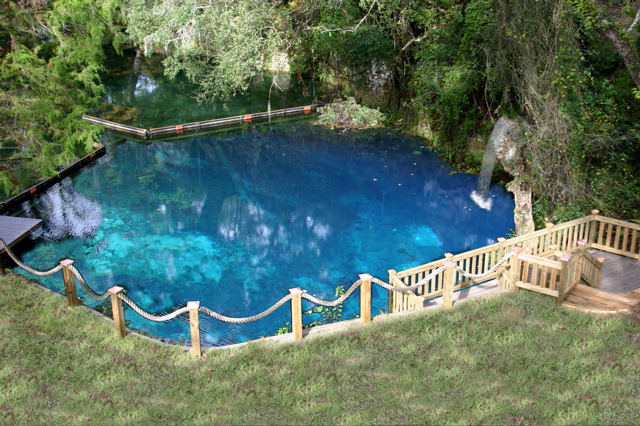

Take (75) north to exit 354, take the exit and turn left on (27). Follow (27) for 21 miles through Williston, stay on the 4 lane highway. Two miles after you pass Mc Donald's turn left opposite The Holy Family Catholic Church onto 172nd Court and continue through the stop sign to the Blue Grotto entrance gate.
From Atlanta Georgia:
Take (75) south to Gainesville, Florida (exit 382), and take (121) south for 21 miles to Williston. Bear left at Williston Tire, and turn right at the next light onto (27). Drive through Williston, stay on the 4 lane highway. Two miles after you pass Mc Donald's turn left opposite The Holy Family Catholic Church on to 172nd Court and continue through the stop sign to Blue Grotto entrance gate.
From the North east:
Take (95) south to Jacksonville, then take (10) west to (301) south to Waldo. In Waldo take (24) west to Gainesville and pick up (121) south in Gainesville. Take (121) south for 21 miles to Williston. Bear left at Williston Tire, and turn right at the next light onto (27). Drive through Williston, stay on the 4 lane highway. Two miles after you pass Mc Donald's turn left opposite The Holy Family Catholic Church onto 172nd Court and continue through the stop sign to Blue Grotto entrance gate.
From Orlando, Florida:
Take the Florida Turnpike North to (75) . Continue north on (75) to exit (354), take the exit and turn left on (27). Follow (27) for 21 miles through Williston, stay on the 4 lane highway. Two miles after you pass Mc Donald's turn left opposite The Holy Family Catholic Church onto 172nd Court and continue through the stop sign to the Blue Grotto entrance gate.

For more info call 352.528.5770 or email: info@divebluegrotto.com
Más sobre Blue Grotto Dive Resort
144: Cindy- Tug Boat Wreck
latitude: 27°34.618' N
longitude: 082°46.089' W
HISTORY NM40/65--TUG, SUNK IN 3 FT OF WATER ABOUT 1.5 MI. 196 DEG. FROM EGMONT KEY LIGHT (27-36-02N, 82-45-40W) W/ABOUT 10-15 FT OF SUPERSTRUCTURE VISIBLE
Más sobre Cindy- Tug Boat Wreck
145: Danger Reef, Charlotte County, FL
|
Latitude |
Longitude |
| 26.75923° | -82.18612° |
| 26° 45' 33" N | 82° 11' 10" W |
| 26° 45.55 N | 82° 11.16 W |
Steel Tug/Crewboat Ship on starboard side 40' long, no superstructure 50% deteriorated. Deployed 123188, Depth

Popular artificial reefs near Danger Reef
Depth: 30 ft. (9.14 m)
Distance: 10.73 miles (9.31 nautical)
Location: 26.632217° -82.286017°
Heading: S (183°)
Lee County
Depth: 42 ft. (12.80 m)
Distance: 12.26 miles (10.64 nautical)
Location: 26.806917° -82.377517°
Heading: NNW (337°)
Charlotte County
Depth: 45 ft. (13.72 m)
Distance: 12.77 miles (11.09 nautical)
Location: 26.682617° -82.3745°
Heading: S (183°)
Lee County
Depth: 26 ft. (7.92 m)
Distance: 14.05 miles (12.20 nautical)
Location: 26.560883° -82.23665°
Heading: S (182°)
Lee County
Depth: 24 ft. (7.32 m)
Distance: 14.32 miles (12.43 nautical)
Location: 26.558317° -82.2428°
Heading: S (182°)
Lee County
Depth: 34 ft. (10.36 m)
Distance: 17.60 miles (15.29 nautical)
Location: 26.519483° -82.282533°
Heading: S (184°)
Lee County
Depth: 36 ft. (10.97 m)
Distance: 17.63 miles (15.31 nautical)
Location: 26.519617° -82.2841°
Heading: S (184°)
Lee County
Depth: 60 ft. (18.29 m)
Distance: 20.22 miles (17.56 nautical)
Location: 26.548983° -82.413933°
Heading: S (190°)
Lee County
Depth: 60 ft. (18.29 m)
Distance: 20.27 miles (17.61 nautical)
Location: 26.5473° -82.413217°
Heading: S (190°)
Lee County
Depth: 60 ft. (18.29 m)
Distance: 20.34 miles (17.66 nautical)
Location: 26.54795° -82.415517°
Heading: S (190°)
Lee County
Más sobre Danger Reef, Charlotte County, FL
146: Dania Wreck
 submerged wreck, dangerous to navigation
Más sobre Dania Wreck
147: Davis Reef
N 24 55.61N, 80 30.27W
E 24 55.41N, 80 30.05W
S 24 55.11N, 80 30.35W
W 24 55.34N, 80 30.52W
| Markers | |||
| 18" Mooring Buoy | |||
| 30" Yellow Sanctuary Buoy | |||
| 3-5 ft. Spar Buoy | |||
| Bottom Type | |||
| Rubble | Shallow | ||
| Seagrass | Coral | ||
| Very Shallow | Island | ||
| Sanctuary Areas | |||
| Research Only | Sanctuary Preservation Area (SPAs) | ||
| Wildlife Management Area |
Ecological Reserve | ||
| Existing Management Area | |||

Davis Reef is a good example of a low-relief transitional reef containing well-developed gorgonian coral. The Sanctuary Preservation Area (SPA) is located approximately 4nm (7km) southeast of Plantation Key.
The SPA is a small, rectangular area covering approximately 0.2nm2, or about 58 ha. Its presence will help protect the area’s unique deepwater corals.
Davis Reef is easily accessible and heavily used. The area attracts a considerable number of divers from Islamorada, and is also used by recreational fishermen. There is some tropical fish collecting in the rubble areas, and commercial fishing is conducted offshore. There will be little displacement of current users. Because the area is heavily used, it has poor potential for research activities.
Más sobre Davis Reef
148: DeLeon Springs State Park
Diving year round is permitted here. 72 degree clear spring pool, closed off to the river by a cement wall and waterfall. The life inside includes turtles, small fish and lots of algea. Great for scuba training. Depths range from 3' to 29' in the center of the spring boil. CAUTION the force of the water in the boil is quite strong, if diving here it can blow you to the surface quickly!
Más sobre DeLeon Springs State Park
150: Devil's Den
cave entrances are blocked off with grates. This place is breathtaking! Great for training as it has 3 training platforms at varied depths.
 On a cold winter morning you can see steam, like smoke, rising from the chimney. Thus, the early settlers gave the name Devil's Den. Crystal clear water, year round 72 degree temperatures, ancient rock formations with stalactites, fossil beds, and much more. Devil's Den is truly a natural wonder. Bring the family and enjoy a day of fun and relaxation at Devil's Den. All divers must be Open Water certified, sign release, have proper training, and follow rules and regulations.
General Admission: $9.00
(snorkelers and swimmers)
Childern age 2 and under are free
Dive Fees: $37.00 (including tax)
Night Dive: $15.00
|
Night Dives are available on Saturday Night |
|
Advanced Open Water certification or instructor escort required for all night dives. |
|
There is a 10 diver minimum and advance notification is required for all night dives. |
Gear Rental
Full Package : $71 / person / day
(includes dive fee and all gear)
BCD /Regulator / Wetsuit $12.00 each
Tank: $10.00 Light: $7.00 Weight: $5.00
Air Fills: $7.00
5390 NE 180th Avenue
Williston, Florida 32696
Phone (352) 528-3344
Fax (352) 528-2400

|
 Full Dive Shop
 Volleyball court and
 Swimming in our heated pool
Information provided by: www.ScubaLessonsInc.com
Más sobre Devil's Den
151: Duane
When people talk about the world's best wreck dives, the Duane is often mentioned as a text-book example of the perfect artificial reef. Intentionally sunk on November 27, 1987, the 327 foot long Duane sits upright on the sandy bottom at 120 feet offering nearly 70 feet of relief. The majestic crow's nest tower reaches to within 50 feet of the surface, and the ship offers many decks and open rooms to explore without fear of getting lost.
The bow points into the prevailing northerly current where a gang of resident barracudas lay claim to the turf by undulating slowing in the sometimes swift current, looking as menacing as possible. Don't let that tough-guy stance fool you -- they're more scared of clumsy bubble-blowing monsters in lime-green wet suits than you are of them.
Más sobre Duane
152: Eagles Nest Sinkhole
Located Near: Weeki Wachee
GPS Coordinates / Location Deg
Latitude/Longitude (Degrees): 28.552920 / -82.609030
Latitude/Longitude (Deg Min Sec): 28 33 10.51 / -82 36 32.51
Latitude/Longitude (Deg Min): 28 33.17520 / -82 36.54180
Minimum Depth: 22.86 metres / 75 feet
Maximum Depth: 82.296 metres / 270 feet
Eagle``s Nest Sink opened on July 1, 2003. The NSS-CDS and NACD have worked for over a year with the Florida Fish and Wildlife Conservation Commission (FFWCC) to re-open the site for cave diving. Access will be through the Chassahowitzka Wildlife Management Area. Divers must check in at an iron ranger at the entrance and pay the $3.00 daily fee, or you can purchase a yearly Wildlife Management Area pass for $26.50 at most hunting supply stores, Wal-Mart or on-line at: [url=http://floridaconservation.org/license/index.html]http://floridaconservation.org/license/index.html[/url]. Either the day pass stub or the Management area pass should be displayed on the dash so that law enforcement can see them while you are in the water. This site is deep and a very advanced dive. The NACD and NSS-CDS recommends that you have the following MINIMUM qualifications to dive: 1. Full Cave Certification. 2. Trimix certification. 3. Appropriate experience with deep cave dives.
Más sobre Eagles Nest Sinkhole
153: Fanning Springs State Park
18020 N.W. Highway 19, Fanning Springs, FL 32693, Northeast Region
(352) 463-3420
Open water scuba divers are welcome in the designated swimming area. Divers must have proper certification and are required to register with park staff before entering the water. There must be a minimum of two divers.

Looking west beyond the floating dock one can see where the springs join the Suwannee River.
Visitors wishing to come by boat may enter the park via the Suwannee River. Be careful though, because Fanning Springs' short run may contain manatees and idle speeds are required. Entrance fee from the water is $2.00 per person.

Looking into the spring boil one can see several large boulders protruding from the sides of the bowl. In the background above water is the lifeguard stand. Lifeguards are on duty only during our warmer swimming season.
Más sobre Fanning Springs State Park
154: Fantastico
| Avg Rating: |
| Avg Depth: 100 ft. / 30m |
| Max Depth: 115 ft. / 35m |
| Skill Level: Advanced |
| Features: |
| • Artificial Reef |
|
• Wreck Site While carrying a load of fertilizer from Miami to Tampa, the 200 foot Honduran freighter Fantastico sunk in March 1993 as a result of the "Storm of the Century". Of the ten-man crew, only three were saved. The freighter now lies in 115 feet of water on her starboard side. Her mast, rudder, propeller, and rigging are still in place but the midship cargo areas have collapsed. The wreck is home to abundant fish life and many large goliath grouper. The surrounding sand bottom hosts fields of garden eels. UTube Video of the Wreck: http://www.youtube.com/v/rHE-B6hVJqw?fs=1&hl=en_US
|
Más sobre Fantastico
155: Ft. Desoto Park
Tierra Verde, FL 33715
(727) 582-2267
If you want to do some near shore diving to build your offshore confidence the Ft. Desoto park is a great site to dive from.
Más sobre Ft. Desoto Park
156: Fort de Soto Park
Fort De Soto Park
3500 Pinellas Bayway S., Tierra Verde, FL 33715
Park Office (727) 893-9185
Campground Office (727) 893-9185
Reserve Campground Online
Automated Information Message: (727) 582-2267
park diagram with amenities ![]() gmap
gmap ![]() Nature Walks
Nature Walks ![]() Road Closures
Road Closures
Note: Fort De Soto’s Historical Fort Undergoes Rehabilitation Work ![]()
Historic Fort De Soto, located in Pinellas County’s Fort De Soto Park, is closed to the public for rehabilitation work. The fort is scheduled to remain closed to the public until March 2011. The remainder of the park will remain open to visitors.
 | |
 |
 |
 | |
 | |
 | |
Fort De Soto Named America’s Top Beach for 2009
Pristine Area Favorite Lauded as “Portrait of Tranquility”
Fort De Soto Park was named America’s Top Beach for the second consecutive year by TripAdvisor, the world's largest online travel community. Citing a “spectacular combination of soft white sand, calm, clear water and a laid-back atmosphere,” the popular online travel network put the park’s North Beach at the top of its annual best-of list, based on TripAdvisor's Popularity Index. This marks the second time in three years the pristine Pinellas County beach has received top honors on an annual “best-of” list. In 2005 Dr. Stephen P. Leatherman, a.k.a. “Dr. Beach,” named Fort De Soto the nation’s #1 Beach .
Beaches are the number one recreational destination for Americans. These sandy playgrounds that line our coasts are the most extensive natural parks in the country.
The largest park within the Pinellas County Park System, Fort De Soto park consists of 1,136 acres made up of five interconnected islands. First opened on December 21, 1962, when the state toll road named the Pinellas Bayway was completed, this park was dedicated May 11, 1963, in perpetuity as a public park.Annual park attendance averages more than 2.7 million visitors.
The 12-inch mortar battery, located at the fort for which the park was named, was listed in the National Register of Historic Places in 1978. Adding to the historical interest at Fort De Soto, two British breech-loading, rapid-fire rifles of 1890 vintage were installed in March 1982. Markers showing the original building locations and a Quartermaster Storehouse Museum add to the park's historic interest.
History: Fort De Soto Historic Guide ![]()
The park property was first purchased from the federal government in 1938 for $12,500. In 1941 the property was sold back to the federal government for $18,404 to be used as a gunnery and bombing range during World War II. The property was repurchased from the United States in 1948 for $26,500.
Más sobre Fort de Soto Park
157: Ginnie Springs Outdoors Llc
|
Ginnie Springs has often been called "the world's favorite freshwater dive." It's no exaggeration. Over the years, thousands of divers from around the world have marveled at Ginnie Springs' crystal-clear water and startling natural beauty. Jacques Cousteau, in fact, characterized Ginnie Spring as "visibility forever." |
 |
Certified scuba divers who are first-time visitors to Ginnie Springs will want to use at least two tanks to visit the four diveable springs on Ginnie's property: one at Ginnie Spring and one at the Devil Spring system. Depending on the time of year, you may even want to use a third tank to drift dive the Santa Fe River.
A full line of rental gear is available in our rental department.
- Scuba dive in Ginnie Spring and the Devil's Springs system, or drift down the Santa Fe River.
- Certified open-water divers may explore breathtaking Ginnie Spring cavern.
- Certified cave divers may explore over 30,000 feet of passageway in the Devil's Eye/Ear system.
- Full-Service dive store on site.
Más sobre Ginnie Springs Outdoors Llc
158: Helens Barges
Reef Materials: Barge Steel (60') Barge Steel 42'
Reef Description: Two Steel Barges
Depth: 30 ft. (9.14 m) Relief: 6"
Distance: 10.73 miles (9.31 nautical)
Location: 26.632217° -82.286017°
Heading: S (183°)
Lee County
Popular artificial reefs near Helens Barges Reef
Depth: 24 ft. (7.32 m)
Distance: 5.76 miles (5.00 nautical)
Location: 26.558317° -82.2428°
Heading: S (175°)
Lee County
Depth: 26 ft. (7.92 m)
Distance: 5.80 miles (5.03 nautical)
Location: 26.560883° -82.23665°
Heading: S (174°)
Lee County
Depth: 45 ft. (13.72 m)
Distance: 6.48 miles (5.63 nautical)
Location: 26.682617° -82.3745°
Heading: N (358°)
Lee County
Depth: 36 ft. (10.97 m)
Distance: 7.78 miles (6.76 nautical)
Location: 26.519617° -82.2841°
Heading: S (180°)
Lee County
Depth: 34 ft. (10.36 m)
Distance: 7.79 miles (6.77 nautical)
Location: 26.519483° -82.282533°
Heading: S (180°)
Lee County
Depth: 60 ft. (18.29 m)
Distance: 9.77 miles (8.49 nautical)
Location: 26.548983° -82.413933°
Heading: SSW (193°)
Lee County
Depth: 60 ft. (18.29 m)
Distance: 9.81 miles (8.52 nautical)
Location: 26.5473° -82.413217°
Heading: SSW (193°)
Lee County
Depth: 60 ft. (18.29 m)
Distance: 9.89 miles (8.59 nautical)
Location: 26.54795° -82.415517°
Heading: SSW (194°)
Lee County
Depth: 12 ft. (3.66 m)
Distance: 10.73 miles (9.31 nautical)
Location: 26.759233° -82.186117°
Heading: N (3°)
Charlotte County
Depth: 42 ft. (12.80 m)
Distance: 13.33 miles (11.57 nautical)
Location: 26.806917° -82.377517°
Heading: N (357°)
Charlotte County
Más sobre Helens Barges
159: Hunter Spring Park
Crystal River, FL 34429
Más sobre Hunter Spring Park
160: Idiots Delight Spring

Más sobre Idiots Delight Spring
161: Jackson Blue
Más sobre Jackson Blue
162: Lake Denton Training and Dive Site
Max Depth: 45'
.jpg "View Full Size Image")
| Lake Denton | |
|---|---|
| Location | Highlands County, Florida |
| Coordinates | |
| Basin countries | United States |
| Surface area | 66 acres (27 ha) |
| Max. depth | 51 ft (16 m) |
Lake Denton is a 66-acre (270,000 m2) lake in Highlands County in the U.S. state of Florida. It is between the cities of Avon Park and Sebring. Its maximum depth is 51 feet (16 m). Divers use the lake for recreation and training. The Orange Blossom Baptist Camp is located on its shore.
Más sobre Lake Denton Training and Dive Site
163: Magewind
40ft.long sailboat visible from surface sunk in about 28 feet of water. Not much of it left after the hurricanes. Sunk in 1982
Más sobre Magewind
164: Manatee Springs State Park
Chiefland, Florida 32626
(352) 493-6072

Admission Fee:
$6.00 per vehicle. Limit 2-8 people per vehicle.
$4.00 Single Occupant Vehicle.
$2.00 Pedestrians, bicyclists, extra passengers, passengers in vehicle with holder of Annual Individual Entrance Pass.
DIVING IS FREE with regular admission fees per person, plus tax. Diving: spring, open water and cave diving. All divers are required to register with the office prior to diving. All divers must be registered by 3:00 p.m. and out of the water and checked out (c-cards returned) by 5:00 p.m.
Pavilion Rental Fee:
$35.00 per day plus tax. There are six picnic tables at each pavilion. Water and electricity are available at each pavilion and is included in the rental fee.
Camping Fee:
$20.00 per night, plus tax. Includes water and electricity. Florida residents who are 65 years of age or older or who hold a social security disability award certificate or a 100 percent disability award certificate from the Federal Government are permitted to receive a 50 percent discount on current base campsite fees. Proof of eligibility
Organized Youth and Adult Group Camping:
$1.00 per youth, per night.
$5.00 per adult/chaperone, per night.
The first-magnitude spring at this park produces an average of 100 million gallons of clear, cool water daily. In winter, West Indian manatees swim upriver to the warmer waters of the springs. Popular for snorkeling and scuba diving, the headwaters of the spring are also a great spot for swimming. The spring run forms a sparkling stream that meanders through hardwood wetlands to the Suwannee River. Canoe and kayaks can be rented May through September. Children enjoy the playground in the picnic area. Hiking and bicycling are available on the north end trail system. The full-facility campground is surrounded by red oak woods.


Más sobre Manatee Springs State Park
165: Paces Place Barge Reef
|
Latitude |
Longitude |
| 26.51948° | -82.28253° |
| 26° 31' 10" N | 82° 16' 57" W |
| 26° 31.16 N | 82° 16.95 W |
Depth: 34' Relief: 12'
Date Reef Deployed: 6/15/00
Reef Materials: Barge Steel Deck Steel Crane And Boom
Reef Description: 110' X 35' X 9' Steel Deck Barge And 75' X 10' X 8' Crane/Boom
Popular artificial reefs near Paces Place Barge Reef
Depth: 36 ft. (10.97 m)
Distance: 0.10 miles (0.08 nautical)
Location: 26.519617° -82.2841°
Heading: WNW (296°)
Lee County
Depth: 24 ft. (7.32 m)
Distance: 3.64 miles (3.16 nautical)
Location: 26.558317° -82.2428°
Heading: N (8°)
Lee County
Depth: 26 ft. (7.92 m)
Distance: 4.03 miles (3.50 nautical)
Location: 26.560883° -82.23665°
Heading: N (9°)
Lee County
Depth: 45 ft. (13.72 m)
Distance: 7.24 miles (6.28 nautical)
Location: 26.41975° -82.318333°
Heading: S (186°)
Lee County
Depth: 30 ft. (9.14 m)
Distance: 7.79 miles (6.77 nautical)
Location: 26.632217° -82.286017°
Heading: N (360°)
Lee County
Depth: 60 ft. (18.29 m)
Distance: 8.30 miles (7.21 nautical)
Location: 26.5473° -82.413217°
Heading: NW (325°)
Lee County
Depth: 60 ft. (18.29 m)
Distance: 8.37 miles (7.27 nautical)
Location: 26.548983° -82.413933°
Heading: NNW (327°)
Lee County
Depth: 60 ft. (18.29 m)
Distance: 8.45 miles (7.34 nautical)
Location: 26.54795° -82.415517°
Heading: NW (325°)
Lee County
Depth: 57 ft. (17.37 m)
Distance: 10.73 miles (9.32 nautical)
Location: 26.41605° -82.411983°
Heading: SSW (200°)
Lee County
Depth: 60 ft. (18.29 m)
Distance: 10.75 miles (9.34 nautical)
Location: 26.415083° -82.411517°
Heading: SSW (200°)
Lee County
Más sobre Paces Place Barge Reef
166: Palm Sink Cave Dive
Site Name: Palm Sink
Located Near: Hudson
GPS Coordinates / Location Deg
Latitude/Longitude (Degrees): 28.355330 / -82.698750
Latitude/Longitude (Deg Min Sec): 28 21 19.19 / -82 41 55.50
Latitude/Longitude (Deg Min): 28 21.31980 / -82 41.92500
Minimum Depth: 0 metres / 0 feet
Maximum Depth: 44.196 metres / 145 feet
Long Description: This has always been a popular dive site due to it``s proximity to US 19 and ease of access. It usually looks stagnant and uninviting though the addition of a fountain did help for a while. The roadside access made the sink a favorite dumping ground for cars and other stolen goods. The property surrounding the sink has been improved in the past few years, I expect that it``s only a matter of time before access is limited. Until then, the easiest entry point is just to the right of the big Oak tree. Coordinates and information provided by www.ScubaLessonsInc.com
Más sobre Palm Sink Cave Dive
167: Paradise Springs
Directions: Take Interstate 75 to State Road 40(old exit 69) and head east 3 miles to Pine Avenue (Hwy 301-441-27). Turn (right) follow about eight miles to where the road begins to split. Take the first available U-turn after the road comes back together. Now you will be heading north on 301-441-27. As the roadway divides again, you will see a mail box with a dive flag next to a dirt road. Follow the dirt road about a half mile (cross the railroad tracks) to Paradise Springs. Phone 1-904-368-5746

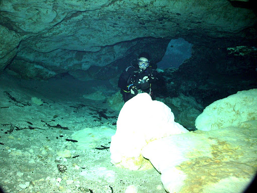
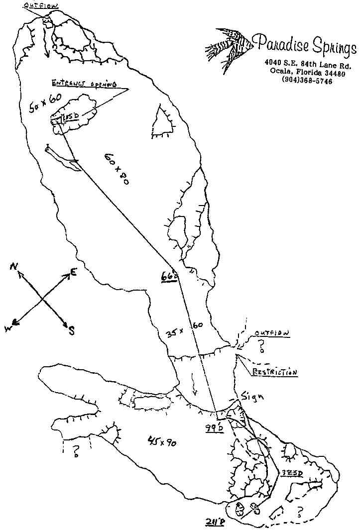
Más sobre Paradise Springs
168: Passage Key
Más sobre Passage Key
170: Rainbow Springs State Park
Dunnellon, Florida 34432
(352) 465-8555
Very Shallow site.. about 4ft. to 16 ft. deep. good for skin diving or training only, no scuba inside park. There are several vents throughout the headspring and lots of rock formations to explore. Bass and Brim swim all around you including a 15 lb. Bass thats been there awhile. The site also has tropical gardens and trails including 2 artifical waterfalls that are picturesque. There is no scuba allowed, however you can do an awesome drift dive down the Rainbow River. The Rainbow River features several other small springs that can be explored by the diver or snorkeler. Those can get as deep as 22ft. at best. Good for basic diver training. Depths in Rainbow River average about 7 feet. You can rent canoes from Rainbow Springs State Park or take one of the many tour/dive boats down
Admission Fee:
$2.00 per person at the headsprings entrance and $5.00 per vehicle, up to eight people at the tube entrance. Children under six years old are free.
Tubing Fee (Separate from the park entrance fee at the tube entrance): $10.00 plus tax per person (includes tube and tram service to and from parking area).
Tram Fee (Separate from the park entrance fee at the tube entrance): $8.00 per person (with your own tube, less than 60" in diameter).
Camping Fee:
$30.00 per night, plus tax. Includes water, sewer and electricity.
Florida residents who are 65 years of age or older or who hold a social security disability award certificate or a 100 percent disability award certificate from the Federal Government are permitted to receive a 50 percent discount on current base campsite fees. Proof of eligibility
Picnic Pavilion Rental Fees:
There are two covered pavilions available for reservation. Beyond the normal reservation fee (see below) each pavilion has a $30 cleanup deposit due on the day of reservation. The deposit will be returned after inspection upon departure.
Hours of Operation
Florida state parks are open from 8 a.m. until sundown, 365 days a year.
The Tuber Entrance, open April to September, closes at 5:00 PM. All tubers must be in the park by 2:15 p.m. to ensure they can complete their float and leave the park by closing.
$75.00 plus tax: Felburn Pavilion seats up to 75 people on plastic chairs and tables. The regular $2.00 admission/person still applies.
$75.00 plus tax: Hickory Pavilion has 14 picnic tables. The regular $2.00 admission/person still applies.
To the Marion County Park - The K.P. Hole:
The Marion County Park known as The K.P. Hole. It is located about 1.5 miles down river from the Rainbow Springs State Park and offers limited public facilities for swimming, cooking out, tub rentals, canoe rentals, dive flag rentals, restroom facilities, etc. The daily entry fee is $3.00 per person, and children under 5 years old are free.
Click here for rental information: Rental Information.
Click here for price a list: Price List.
Pets & alcohol are not allowed at the K.P. Hole; service animals are always welcome.
Hours of Operation:
Summer: 8 a.m. – 8 p.m.
Winter: 8 a.m. – 5 p.m.
Marion County Park - The K.P. Hole
9435 S.W. 190th Ave Rd
Dunnellon, FL 34432
(352) 489-3055
You can dive here: 


Click here for detailed driving directions: Detailed Driving Directions.
Más sobre Rainbow Springs State Park
171: Regina Sugar Barge, Shore Dive - Bradenton

Regina was a steel steamer built in 1904 in Belfast, Ireland, by the Workman, Clark & Co. shipyard for the Cuban Molasses Transportation Co., based in Havana. She was 247 ft. in length, with a 36 ft. beam, a 14 ft. draft, and was rated at 1,155 gross tons with a net tonnage of 669. Designed with a single deck and a single propeller powered by a triple-expansion steam engine producing 850 hp., the steamer also was rigged as a schooner for auxiliary power, and fitted with electric lighting.
Regina joined a growing fleet of large and small tankers carrying a specific liquid cargo: molasses. Shipped from several locations in Cuba, the Dominican Republic, and Puerto Rico to ports on the East and Gulf Coasts of the United States, molasses was used primarily by rum distilleries, and also by animal feed manufacturers. New Orleans was a principal port of the world’s molasses trade; cargoes were transferred to river barges for distribution inland to feed producers in the Midwest. Compared with other liquid cargoes carried by tankers at sea, such as oil, chemicals, or fresh water, molasses is much heavier. In cold weather it thickens, becoming difficult to pump during transfer and requiring a longer time in port. Various tank-heating methods were used to make the cargo more fluid and easier to pump.
Converted to a tanker barge, Regina left Havana on March 5, 1940, under tow by the tugboat Minima, bound for New Orleans with a cargo of more than 300,000 gallons of molasses. Two days later, a cold front swept across the Gulf of Mexico from the northwest, accompanied by 8 to 12-foot seas, gale force winds, and freezing temperatures. The tugboat altered course toward the shelter of Tampa Bay, but before she could reach safety, her tow lines parted near Egmont Key and Regina drifted helplessly toward Anna Maria Island. In the late afternoon on Friday, March 8, the converted tanker grounded in heavy seas on a sand bar off Bradenton Beach. Pounded by the surf and wind, the vessel began to crack and break apart as nighttime approached. Regina’s crew of eight stayed aboard the stranded tanker, afraid to abandon ship in such turbulent conditions. As word of the disaster spread, local residents gathered on the darkened beach, where they built fires to reassure the crewmen that they had been seen.
The following morning, a small bi-wing seaplane arrived from the St. Petersburg Coast Guard Station. Unable to land in the still-stormy seas, it dropped lifejackets and supplies, but they were washed ashore by the waves and wind. The plane continued to circle over the wrecked tanker, and soon was joined by a second airplane from the station. The Coast Guard cutter Nemesis arrived, but could not approach Regina due to the shallow depth of the water. The crowd of spectators watched helplessly from shore as one of the crewmen, later identified as Seferino Canneciras, attempted to swim ashore but disappeared in heavy surf about 100 yards from land. Later that morning as the storm subsided, a Coast Guardsman and two volunteer boatmen, Clayton Adams and Furman Smith, rescued Capt. José Urquida, Ernesto Crusostino, José García García, Leonard Perez, and Angel Lopez. Two other crewmen, Benjamin Alfonso and Juan León, swam the 500 yards to shore on their own.
Regina was a total loss; her cargo of molasses drained into the gulf and her stranded, battered hull became part of the underwater landscape. Today, more than sixty years of pounding surf have left the tanker a sunken hulk, partially buried under sand, but her remains are teeming with sea life. Locally known as the “Sugar Barge”, this wreck is popular with scuba divers and snorkelers due to its proximity to the beach and its vibrant tropical fish.


|
Water Type: Ocean
Salinity: Salt Access: Shore Maximum Depth: 20 Typical Visibility: Poor (11-25 ft) Wreck or Submerged Object?: Ship/boat Underwater Life: Spadefish, Stone Crab, Goliath Grouper, Sheepshead  For a virtual experience on this site visit: http://www.museumsinthesea.com/regina/index.htm |
Más sobre Regina Sugar Barge, Shore Dive - Bradenton
172: Florida Underwater Museum: Regina Sugar Barge Wreck - SHALLOW SHORE DIVE
Regina was a steel steamer built in 1904 in Belfast, Ireland, by the Workman, Clark & Co. shipyard for the Cuban Molasses Transportation Co., based in Havana. She was 247 ft. in length, with a 36 ft. beam, a 14 ft. draft, and was rated at 1,155 gross tons with a net tonnage of 669. Designed with a single deck and a single propeller powered by a triple-expansion steam engine producing 850 hp., the steamer also was rigged as a schooner for auxiliary power, and fitted with electric lighting.
Regina joined a growing fleet of large and small tankers carrying a specific liquid cargo: molasses. Shipped from several locations in Cuba, the Dominican Republic, and Puerto Rico to ports on the East and Gulf Coasts of the United States, molasses was used primarily by rum distilleries, and also by animal feed manufacturers. New Orleans was a principal port of the world’s molasses trade; cargoes were transferred to river barges for distribution inland to feed producers in the Midwest. Compared with other liquid cargoes carried by tankers at sea, such as oil, chemicals, or fresh water, molasses is much heavier. In cold weather it thickens, becoming difficult to pump during transfer and requiring a longer time in port. Various tank-heating methods were used to make the cargo more fluid and easier to pump.
Converted to a tanker barge, Regina left Havana on March 5, 1940, under tow by the tugboat Minima, bound for New Orleans with a cargo of more than 300,000 gallons of molasses. Two days later, a cold front swept across the Gulf of Mexico from the northwest, accompanied by 8 to 12-foot seas, gale force winds, and freezing temperatures. The tugboat altered course toward the shelter of Tampa Bay, but before she could reach safety, her tow lines parted near Egmont Key and Regina drifted helplessly toward Anna Maria Island. In the late afternoon on Friday, March 8, the converted tanker grounded in heavy seas on a sand bar off Bradenton Beach. Pounded by the surf and wind, the vessel began to crack and break apart as nighttime approached. Regina’s crew of eight stayed aboard the stranded tanker, afraid to abandon ship in such turbulent conditions. As word of the disaster spread, local residents gathered on the darkened beach, where they built fires to reassure the crewmen that they had been seen.
The following morning, a small bi-wing seaplane arrived from the St. Petersburg Coast Guard Station. Unable to land in the still-stormy seas, it dropped lifejackets and supplies, but they were washed ashore by the waves and wind. The plane continued to circle over the wrecked tanker, and soon was joined by a second airplane from the station. The Coast Guard cutter Nemesis arrived, but could not approach Regina due to the shallow depth of the water. The crowd of spectators watched helplessly from shore as one of the crewmen, later identified as Seferino Canneciras, attempted to swim ashore but disappeared in heavy surf about 100 yards from land. Later that morning as the storm subsided, a Coast Guardsman and two volunteer boatmen, Clayton Adams and Furman Smith, rescued Capt. José Urquida, Ernesto Crusostino, José García García, Leonard Perez, and Angel Lopez. Two other crewmen, Benjamin Alfonso and Juan León, swam the 500 yards to shore on their own.
Regina was a total loss; her cargo of molasses drained into the gulf and her stranded, battered hull became part of the underwater landscape. Today, more than sixty years of pounding surf have left the tanker a sunken hulk, partially buried under sand, but her remains are teeming with sea life. Locally known as the “Sugar Barge”, this wreck is popular with scuba divers and snorkelers due to its proximity to the beach and its vibrant tropical fish.
|
Water Type: Ocean
Salinity: Salt Access: Shore Maximum Depth: 20 Typical Visibility: Poor (11-25 ft) Wreck or Submerged Object?: Ship/boat Underwater Life: Spadefish, Stone Crab, Goliath Grouper, Sheepshead For a virtual experience on this site visit: http://www.museumsinthesea.com/regina/index.htm |
Más sobre Florida Underwater Museum: Regina Sugar Barge Wreck - SHALLOW SHORE DIVE
173: Redfish Pass Reef 1 Reef, Lee County, FL
|
Latitude |
Longitude |
| 26.56088° | -82.23665° |
| 26° 33' 39" N | 82° 14' 12" W |
| 26° 33.65 N | 82° 14.2 W |
Depth: 26' Relief: 10'
Date Reef Deployed: 6/17/89
Reef Materials: Barge Steel
Reef Description: Steel Barge. About 50'X30'X9H
Popular artificial reefs near Redfish Pass Reef 1 Reef
Depth: 24 ft. (7.32 m)
Distance: 0.42 miles (0.36 nautical)
Location: 26.558317° -82.2428°
Heading: SSW (199°)
Lee County
Depth: 34 ft. (10.36 m)
Distance: 4.03 miles (3.50 nautical)
Location: 26.519483° -82.282533°
Heading: SSW (192°)
Lee County
Depth: 36 ft. (10.97 m)
Distance: 4.09 miles (3.55 nautical)
Location: 26.519617° -82.2841°
Heading: SSW (192°)
Lee County
Depth: 30 ft. (9.14 m)
Distance: 5.80 miles (5.03 nautical)
Location: 26.632217° -82.286017°
Heading: N (357°)
Lee County
Depth: 60 ft. (18.29 m)
Distance: 10.95 miles (9.51 nautical)
Location: 26.5473° -82.413217°
Heading: WSW (248°)
Lee County
Depth: 45 ft. (13.72 m)
Distance: 10.98 miles (9.54 nautical)
Location: 26.41975° -82.318333°
Heading: S (189°)
Lee County
Depth: 60 ft. (18.29 m)
Distance: 10.99 miles (9.54 nautical)
Location: 26.548983° -82.413933°
Heading: WSW (251°)
Lee County
Depth: 60 ft. (18.29 m)
Distance: 11.09 miles (9.63 nautical)
Location: 26.54795° -82.415517°
Heading: WSW (249°)
Lee County
Depth: 45 ft. (13.72 m)
Distance: 11.97 miles (10.39 nautical)
Location: 26.682617° -82.3745°
Heading: N (359°)
Lee County
Depth: 12 ft. (3.66 m)
Distance: 14.05 miles (12.21 nautical)
Location: 26.759233° -82.186117°
Heading: N (1°)
Charlotte County
Más sobre Redfish Pass Reef 1 Reef, Lee County, FL
174: Red Fish Pass Reef 2 Reef, Lee County, FL
|
Latitude |
Longitude |
| 26.55832° | -82.2428° |
| 26° 33' 30" N | 82° 14' 34" W |
| 26° 33.5 N | 82° 14.56 W |
Depth: 24' Relief: '
Date Reef Deployed: 6/17/89
Reef Materials: Barge Steel
Reef Description: Steel Barge. About 50'X25'X9H
Popular artificial reefs near Redfish Pass Reef 2 Reef
Depth: 26 ft. (7.92 m)
Distance: 0.42 miles (0.36 nautical)
Location: 26.560883° -82.23665°
Heading: NNE (19°)
Lee County
Depth: 34 ft. (10.36 m)
Distance: 3.64 miles (3.16 nautical)
Location: 26.519483° -82.282533°
Heading: S (191°)
Lee County
Depth: 36 ft. (10.97 m)
Distance: 3.70 miles (3.21 nautical)
Location: 26.519617° -82.2841°
Heading: S (191°)
Lee County
Depth: 30 ft. (9.14 m)
Distance: 5.76 miles (5.00 nautical)
Location: 26.632217° -82.286017°
Heading: N (358°)
Lee County
Depth: 60 ft. (18.29 m)
Distance: 10.56 miles (9.17 nautical)
Location: 26.5473° -82.413217°
Heading: WSW (252°)
Lee County
Depth: 60 ft. (18.29 m)
Distance: 10.60 miles (9.20 nautical)
Location: 26.548983° -82.413933°
Heading: WSW (255°)
Lee County
Depth: 45 ft. (13.72 m)
Distance: 10.65 miles (9.25 nautical)
Location: 26.41975° -82.318333°
Heading: S (189°)
Lee County
Depth: 60 ft. (18.29 m)
Distance: 10.70 miles (9.29 nautical)
Location: 26.54795° -82.415517°
Heading: WSW (253°)
Lee County
Depth: 45 ft. (13.72 m)
Distance: 11.83 miles (10.27 nautical)
Location: 26.682617° -82.3745°
Heading: N (359°)
Lee County
Depth: 12 ft. (3.66 m)
Distance: 14.32 miles (12.43 nautical)
Location: 26.759233° -82.186117°
Heading: N (1°)
Charlotte County
Más sobre Red Fish Pass Reef 2 Reef, Lee County, FL
175: Rock Sink CAVE DIVE
Site Name: Rock Sink
Located Near: Port Richey
GPS Coordinates / Location Deg
Latitude/Longitude (Degrees): 28.279740 / -82.668100
Latitude/Longitude (Deg Min Sec): 28 16 47.06 / -82 40 5.16
Latitude/Longitude (Deg Min): 28 16.78440 / -82 40.08600
Minimum Depth: 45 feet
Maximum Depth: -145 feet
The sink has very steep rock edge 3/4 of the way around it and the water has alway``s been very tannic due to runoff from the nearby cypress heads. It is full of snapping turtles. It has plenty of junk on the bottom. When I last visited, the sink was an unnatural shade of green with a noticible oil slick on the surface. Assholes have been driving & dumping objects into the sink since I can remember, so the varying depth reports may be accurate. Coordinates and Information provided by www.ScubaLessonsInc.com
Más sobre Rock Sink CAVE DIVE
176: Salt Springs
This is a gater infested pristine piece of nature. No diving here but plenty of life to see. Great for boaters.
Más sobre Salt Springs
177: Seaducer
longitude: 082°45.989' W
Build in 1927, dangerous to navigation of larger vessels.
1979; THE 18 FT COBIA, SEADUCER HAS BEEN REPORTED SUNK IN SW CHANNEL IN ABOUT 28 FT OF WATER IN POS. LAT.27-34.0N, LONG.82-46.0W (NAD 27) (ENTERED 2/94 MCR) H10270/94--OPR-J343-MI; A 200% SIDE SCAN SONAR SEARCH FOR RADIUS OF 1000M REVEALED ONE CONTACT IN THE AREA. DIVERS DISCOVERED A SUNKEN BARGE
Más sobre Seaducer
178: "Sheridan" Wreck
GPS Coordinates:
latitude: 27°52.562' N
longitude: 083°11.140' W
depth: 82 max.
D. T. Sheridan is an 180 foot Ocean going tug that now rests in 75 feet of water. She sits upright with her prop in place.
nationality: american
purpose: utility
type: tug
propulsion: motor vessel
date built: 1951
weight (tons): 383 grt
dimensions: 138 x 27,9 x -- ft.
engine: 1 x Oil engine
cause lost: deliberate
other reasons: [1] scuttled [2] artifical reef
This is probably one of the best wreck dives in the Tampa Bay area. The Sheridan is a 180 foot tugboat that is fully intact and located in 75 to 80 foot of water. It lies on the bottom upright leaning slightly to it's starboard side. This wreck is also a haven for large game fish housing goliath grouper and barracuda. We often see walls of cigar minows moving like giant clouds inter-mingling with a myriad of fish such as Spanish mackeral, amberjack, trigger fish, and crevelle jack. Visibility is at its peak between the months of March and July. Providing no major storms strike the Gulf during the summer months, visibility can be very good up through November.

Más sobre "Sheridan" Wreck
179: Shirley D Shrimp Boat Reef
|
Latitude |
Longitude |
| 26.54898° | -82.41393° |
| 26° 32' 56" N | 82° 24' 50" W |
| 26° 32.93 N | 82° 24.83 W |
Date Reef Deployed: 4/9/97
Reef Materials: Ship Steel 48
Reef Description: 48 Foot Long Steel Shrimp Boat
Popular artificial reefs near Shirley D Shrimp Boat Reef
Depth: 60 ft. (18.29 m)
Distance: 0.12 miles (0.11 nautical)
Location: 26.54795° -82.415517°
Heading: SSW (193°)
Lee County
Depth: 60 ft. (18.29 m)
Distance: 0.12 miles (0.11 nautical)
Location: 26.5473° -82.413217°
Heading: S (176°)
Lee County
Depth: 36 ft. (10.97 m)
Distance: 8.28 miles (7.19 nautical)
Location: 26.519617° -82.2841°
Heading: SE (140°)
Lee County
Depth: 34 ft. (10.36 m)
Distance: 8.37 miles (7.27 nautical)
Location: 26.519483° -82.282533°
Heading: SE (139°)
Lee County
Depth: 57 ft. (17.37 m)
Distance: 9.18 miles (7.98 nautical)
Location: 26.41605° -82.411983°
Heading: S (180°)
Lee County
Depth: 60 ft. (18.29 m)
Distance: 9.25 miles (8.03 nautical)
Location: 26.415083° -82.411517°
Heading: S (180°)
Lee County
Depth: 45 ft. (13.72 m)
Distance: 9.55 miles (8.29 nautical)
Location: 26.682617° -82.3745°
Heading: N (0°)
Lee County
Depth: 30 ft. (9.14 m)
Distance: 9.77 miles (8.49 nautical)
Location: 26.632217° -82.286017°
Heading: N (6°)
Lee County
Depth: 24 ft. (7.32 m)
Distance: 10.60 miles (9.20 nautical)
Location: 26.558317° -82.2428°
Heading: ENE (65°)
Lee County
Depth: 45 ft. (13.72 m)
Distance: 10.71 miles (9.30 nautical)
Location: 26.41975° -82.318333°
Heading: SSE (168°)
Lee County
Más sobre Shirley D Shrimp Boat Reef
180: Silver Glen Springs
Also good for Cave Diving this amazing spring hole is very popluar for boaters coming up Lake George to stop and take a swim. This park has a concession stand and lots of tiny fish. The spring it self is very shallow, some parts only 3' others about 29' deep. There is a small cave that opens to the ballroom. This is for cave divers only to enter. You can not scuba dive this location.
Más sobre Silver Glen Springs
181: SS Gulfport 1943
Weight 224 Gross Tons
Went down in 1943 by Marine Casualty
CARGO SUNK 2/13/43
Más sobre SS Gulfport 1943
182: Florida Underwater Museum Site: SS Tarpon
SS Tarpon State Underwater Archaeological Preserve
feet of water on a sand and live-rock
bottom at latitude 30° 05.702' Nand
longitude 85° 56.555' W. The wreck is
7.8 nautical miles from shore, and 11
nautical miles from the pass to 5t.
Andrew Bay on a heading of 265°. To
prevent anchor damage to the site,
four submerged mooring buoys have
been placed around the shipwreck.
Tarpon
is an oasis of marine life. A visitor may see schools of spadefish and angel fish gathering around the ship's engines. Amberjacks cruise above the wreckage and remoras circle in search of a host to which they can attach. Groupers, moray eels, and spiny lobsters inhabit the recesses of the steamer and a large sea turtle often is spotted sleeping under the boiler. Around the periphery of the site, flounder, stingrays, and numerous species of mollusks hide in the sand.Más sobre Florida Underwater Museum Site: SS Tarpon
183: SS Tarpon
feet of water on a sand and live-rock
bottom at latitude 30° 05.702' N and
longitude 85° 56.555' W. The wreck is
7.8 nautical miles from shore, and 11
nautical miles from the pass to St.
Andrew Bay on a heading of 265°.
The twin-screwed freight and passenger steamer Tarpon was constructed in 1887 at Wilmington, Delaware. Originally named Naugatuck, the iron-hulled vessel measured 130 feet in length, 26 feet in beam, with 8 feet depth of hold. She was powered by twin compound fore-and-aft steam engines driving twin iron propellers.
Two years after she was built, Naugatuck’s owners sold her to Henry Plant, whose railroad empire terminating at Tampa, Florida, was one of the largest conglomerates in the United States. In 1891, she was sent back to her builders, who lengthened the vessel by 30 feet. Renamed Tarpon, she returned to her Florida career, and may have been one of the dozens of Plant vessels used to transport troops and supplies to and from Cuba during the Spanish-American War. In 1902, the vessel was sold to the newly incorporated Pensacola, St. Andrews & Gulf Steamship Co., and was put in the charge of Captain Willis G. Barrow.
This is an Advanced-level dive due to
depth. Diving the steamer is not
recommended for novices, or those
uncomfortable with deep-water dives.
Pay attention to time limits and
remember to display a "divers down"
flag when diving. A laminated underwater guide is available from local dive shops to orient
divers on a self-guided tour of the preserve.
As with all other historical and archaeological sites on public uplands and submerged bottomlands,
Tarpon is protected by Florida laws prohibiting unauthorized disturbance, excavation, or removal of artifacts. Please help keep the site intact for others.
This is a Florida Underwater Museum and more information can be found here:
http://www.museumsinthesea.com/tarpon/index.htm
Más sobre SS Tarpon
184: Speigel Grove
which has been sunk to create an artificial reef in Key Largo.
The vessel is 510 feet in length, 84 feet wide.
on her starboard side. Due to the waves/currents/surge from
Hurricane Dennis, the Spiegel Grove now sits upright as
shown here (this image is not an actual photograph).
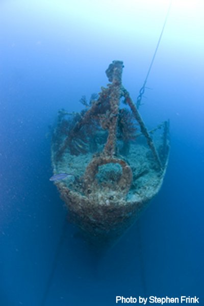
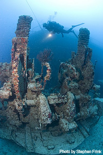
To defray the costs of cleanup, preparation, and towing, the
Key Largo Chamber of Commerce Artificial Reef Committee
will be selling medallions which will be required for divers
wishing to visit the artificial reefs off the Upper Keys.
| Two versions are available:
|
|
| Lifetime Medallion:
Purchaser's name will be engraved on the plaque $250 (only 1000 will be cast/sold) |
 |
Annual Medallion: To be purchased annually, $10 |
|
Lifetime Medallions can be ordered by calling the
Key Largo Chamber of Commerce at (305) 451-4747.
Both medallions can be ordered from the
Chamber of Commerce website.
Order link is at the bottom of page.
Más sobre Speigel Grove
185: The Black Hole
| Avg Rating: |
| Avg Depth: 65 ft. / 20m |
| Max Depth: 224 ft. / 68m |
| Skill Level: Advanced |
| Features: |
| • Caves or Caverns |
Black Hole is also known as Naples Spring even though it is 27 miles offshore of Naples in the Gulf of Mexico. Generally, the only divers to visit this site are very advanced with cavern experience. Some liveaboard charters stop at this site.
In prehistoric times Black Hole was a spring or sinkhole, but the circular opening is now 65 feet below the Gulf of Mexico's surface. The entrance to this large drowned sinkhole is close to 100 feet in diameter. From the rim, the limestone shaft plunges to depths of 224 feet, taking on an hour glass shape at 100 feet.
Sea turtles frequent the area along with large grouper and many other kinds of fish. Several sponge-covered ledges can be found near the entrance. Visibility fluctuates between 10 and 50 feet.
Latitude
Longitude
Degrees
25.842717
-082.151900
Degrees/Minutes
N 25 50.563
W 082 09.114
Degrees/Minutes/Seconds
N 25 50 34
W 082 09 07
Más sobre The Black Hole
186: Twin Caves
Más sobre Twin Caves
187: USS Massachusetts
The battleship U.S.S. Massachusetts, BB-2, was built by William Cramp & Sons in Philadelphia, Pennsylvania, and launched in 1893. She was 586 feet long, had a 69 foot beam and was commissioned on June 10, 1896.
The USS Massachusetts BB-2 was one of America's first true oceangoing battleships. More than 350 feet in length, and 70 feet wide, the 10,000 ton steel ship was equipped with 13 inch Main Guns, 8 inch batteries, torpedo tubes, gattling guns, and a host of smaller arms.
Massachusetts first saw combat during the Spanish-American war while she was part of the US naval blockade of Cuban ports. In the years following the Spanish-American War, and into World War I, the technology of the USS Massachusetts was quickly surpassed, and she was relegated to near coastal support, primarily as a training vessel.
In 1919 She was decommissioned, and in 1921, the USS Massachusetts was towed to Pensacola Florida where she was scuttled in shallow water to be used as a target for artillery batteries at Fort Pickens. She remains in the same location today, where she was dedicated as Florida's first underwater archaeological preserve on June 10th, 1993 - the 100th anniversary of her launching.


 She now rests in 21 feet of water with some of the She now rests in 21 feet of water with some of the wreckage poking through the ocean's surface, one mile off Fort Pickens jetties. The Massachusetts is still partially intact, and on calm days when a surge is not present, she makes a good shallow water dive. According to Gene Ferguson, the visibility at this site is often limited, and the current can be quite strong. The current normally flows from west to east.
Photo: The U.S.S. Massachusetts was 586 feet long and had a 63 foot beam
Más sobre USS Massachusetts
188: Florida Underwater Museum site: USS Massachusetts
The Spanish-American War-era battleship USS Massachusetts was stripped of her guns and furnishings and towed to Pensacola in 1921. The obsolete battleship was then used as a target for experimental artillery after being scuttled just outside the entrance to the bay. Today, USS Massachusetts serves as a giant artificial reef where almost every type of Gulf marine life can be observed. A virtual tour and detailed information can be found here: http://www.museumsinthesea.com/massachusetts/index.htm
Más sobre Florida Underwater Museum site: USS Massachusetts
189: USS Narcissus
| latitude: | 27°37.460' N |
| longitude: |
082°48.050' W |
The U.S.S. Narcissus Launched in New York the Narcissus was steam powered by an overhead cylinder steam engine driving a single screw propeller. The ship was capable of 14 knots per hour. At 115-tons, the Narcissus was 82-feet long, 19-feet beam, and had a draft of 9-feet. She was armed with one 20-pound muzzle loading rifle and a 12-pound smooth bore gun.
Serving the Union
The 82-foot Union tug Narcissus participated in the Battle of Mobile Bay, where Admiral David Glasgow Farragut is said to have exclaimed “Damn the torpedoes. Full speed ahead!”
The Fateful Trip - On December 7, 1864, the Narcissus struck a torpedo (mine) in Mobile Bay. She sank and was refloated and to Pensacola for repair. On January 1, 1866 (after the war), the Narcissus left Pensacola bound for New York for decommissioning and return to civilian service.

On January 3, the Narcissus ran aground 1-1/2 miles west of Egmont Key off Tampa Bay during one of the severe winter storms during a cold front moving through the area. When the cold seawater came in contact with the hot steam boiler, she exploded, killing the entire crew of 29. News of the disaster spread slowly. National newspapers made no mention of the incident until February 3, when the New York Times carried the following account on Page 8. Nothing official has been received by the Navy-yard in relation to the United States steamer Narcissus reported to have lost on Egmont Key, Florida. It is stated that the Narcissus was wrecked nearly a year ago in Tampa Bay. The United State tug Jessamine left Pensacola Fla. about the same time that the Narcissus left, and it is probable that the Jessamine is the unfortunate vessel. Nothing definite is, however, known in relation to the matter.
Authorities would later learn that the vessel lost off Egmont Key was indeed the Narcissus. Federal troops from nearby Egmont Key salvaged the ship's guns, but no signs of survivors were ever found.

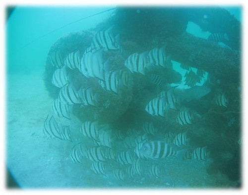

Más sobre USS Narcissus
190: Utopia Wreck
Más sobre Utopia Wreck
191: Venice Beach - Service Club Bohard Park Information
Location: 1190 Harbor Drive South, Venice, FL 34285 (941) 486-2626. Service Club Beach has been noted for its fossil finds and shark teeth. With the Venice fishing pier and Sharky's restaurant nearby, it's a great place to rejuvenate. Saw palmettos canopy over the boardwalks, which provide a path directly to the sandy beach. The beach is known for being quiet and it offers shaded areas. Parking is free and they also have sand volleyball courts, grilling and a bike rack which give all the reason to get exercise and lunch at this tiny seven-acre Venice sweet spot. Hours: Sunrise to sundown. Also features: Nature Trails, Picnic tables, some with small grills.
SEE SHARKS TEETH DIVE PLAN TO LEFT!
Más sobre Venice Beach - Service Club Bohard Park Information
192: Venice Beach Prehistoric Sharks Teeth Diving Information
Venice Beach, FL Dive Plan Report
Service Park Beach is the best site for parking and access to Venice Beach. The easiest site for your first time is either the pier or public beach which is free to park and has a large boardwalk out to the beach. It is a long walk so drink lots of water and eat a bannana before you go for extra energy. Most like to bring two dive tanks.
Venice Beach is a unique diving experience, and even though is is shallow, there are some important points to note when diving here. Make sure each buddy pair/team has a dive flag as fishermen and boaters frequent this area often. Attach any dangly equipment such as octopus and pressure gauges to yourself to avoid dragging the bottom, and becoming entangled underwater. Divers should each carry a dive knife in case of entanglement with fishing lines and nets.
Dive Flag or bouy per buddy team is mandatory and logical for safety. Boats come very close to shore and go very fast. Be very careful on asscents and come up close to the shore if possible.
Also bring:
- Trowel to pick through the rubble.
- Dive knife per diver
- Mesh bag or two for holding your goodies!
You can shore dive it fairly easily but if you would rather use a boat:
Hammerhead Charter Boat
Florida West
509 C. North Tamiami Trail
Venice, FL 34285
941-486-1400
$69 per person, includes 2 tank dive with tanks and weights
Más sobre Venice Beach Prehistoric Sharks Teeth Diving Information
193: Vixen Wreck Reef
|
Latitude |
Longitude |
| 26.5473° | -82.41322° |
| 26° 32' 50" N | 82° 24' 48" W |
| 26° 32.83 N | 82° 24.8 W |
Depth: 60' Relief: 20'
Date Reef Deployed: 2/1/97
Reef Materials: Ship Wood 57' Concrete
Reef Description: 57 Foot Long X 14 Foot Wide Wood Vessel Called Vixen
Popular artificial reefs near Vixen Wreck Reef
Depth: 60 ft. (18.29 m)
Distance: 0.12 miles (0.11 nautical)
Location: 26.548983° -82.413933°
Heading: N (356°)
Lee County
Depth: 60 ft. (18.29 m)
Distance: 0.15 miles (0.13 nautical)
Location: 26.54795° -82.415517°
Heading: NNW (331°)
Lee County
Depth: 36 ft. (10.97 m)
Distance: 8.21 miles (7.13 nautical)
Location: 26.519617° -82.2841°
Heading: SE (138°)
Lee County
Depth: 34 ft. (10.36 m)
Distance: 8.30 miles (7.21 nautical)
Location: 26.519483° -82.282533°
Heading: SE (138°)
Lee County
Depth: 57 ft. (17.37 m)
Distance: 9.07 miles (7.87 nautical)
Location: 26.41605° -82.411983°
Heading: S (180°)
Lee County
Depth: 60 ft. (18.29 m)
Distance: 9.14 miles (7.93 nautical)
Location: 26.415083° -82.411517°
Heading: S (180°)
Lee County
Depth: 45 ft. (13.72 m)
Distance: 9.65 miles (8.38 nautical)
Location: 26.682617° -82.3745°
Heading: N (0°)
Lee County
Depth: 30 ft. (9.14 m)
Distance: 9.81 miles (8.52 nautical)
Location: 26.632217° -82.286017°
Heading: N (6°)
Lee County
Depth: 24 ft. (7.32 m)
Distance: 10.56 miles (9.17 nautical)
Location: 26.558317° -82.2428°
Heading: ENE (62°)
Lee County
Depth: 45 ft. (13.72 m)
Distance: 10.59 miles (9.19 nautical)
Location: 26.41975° -82.318333°
Heading: SSE (168°)
Lee County
Más sobre Vixen Wreck Reef
194: Vortex Spring
Great Place for Checkouts. Platform at 25 feet. Great big Koi (goldfish), brim, etc.
Freshwater Eels as well. The cavern is fun and Cave has grate which you need key for.
Más sobre Vortex Spring
195: Wall Spring State Park
Wall Springs Park
3725 De Soto Blvd.
Palm Harbor, FL 34683
Phone 727.943.4653
Fax 727.943.4677
location map ![]() park diagram
park diagram ![]() gmap
gmap ![]()
Wall Springs Park's 195 acres include a historic spring once used as a spa and bathing area from the turn of the 20th century until the mid-1960s. The park includes boardwalks, nature trails, playground, a 35-foot observation tower, bike racks, drinking fountains, restrooms, parking lot, and access to the Fred Marquis Pinellas Trail. The area surrounding the spring has been improved, and a decorative sundial honoring the memory of former Pinellas County employee Karen Anne Edwards is a landmark at the park's north gate
Latitude/Longitude (Degrees): 28.106220 / -82.772360
Latitude/Longitude (Deg Min Sec): 28 6 22.39 / -82 46 20.50
Latitude/Longitude (Deg Min): 28 6.37320 / -82 46.34160
Minimum Depth: 0 metres / 0 feet
Maximum Depth: 0 metres / 0 feet

Más sobre Wall Spring State Park
196: Weeki Wachee Spring - Mermaid Show or Back Stage Dive

|
We will be accepting dive shop registration beginning April 1, 2010 for diving at Weeki Wachee Springs State Park. Only dive shops need to register. Individual diving will not be permitted. Individuals wishing to dive at our spring, must contact one of the registered dive shops for availability and pricing. 2. Surface Interval Training, 5415 Lake Howell Rd., #236, Winter Park, FL 32792, (321) 228-4862 |
Más sobre Weeki Wachee Spring - Mermaid Show or Back Stage Dive
197: Wildmans Reef
|
Latitude |
Longitude |
| 26.51962° | -82.2841° |
| 26° 31' 11" N | 82° 17' 3" W |
| 26° 31.18 N | 82° 17.05 W |
Depth: 36' Relief: 16'
Date Reef Deployed: 10/20/04
Reef Materials: Ship Concrete Sailboat 50'
Reef Description: 80 Foot Concrete Sailboat
Popular artificial reefs near Wildmans Reef
Depth: 34 ft. (10.36 m)
Distance: 0.10 miles (0.08 nautical)
Location: 26.519483° -82.282533°
Heading: ESE (115°)
Lee County
Depth: 24 ft. (7.32 m)
Distance: 3.70 miles (3.21 nautical)
Location: 26.558317° -82.2428°
Heading: N (9°)
Lee County
Depth: 26 ft. (7.92 m)
Distance: 4.09 miles (3.55 nautical)
Location: 26.560883° -82.23665°
Heading: N (9°)
Lee County
Depth: 45 ft. (13.72 m)
Distance: 7.22 miles (6.27 nautical)
Location: 26.41975° -82.318333°
Heading: S (185°)
Lee County
Depth: 30 ft. (9.14 m)
Distance: 7.78 miles (6.76 nautical)
Location: 26.632217° -82.286017°
Heading: N (360°)
Lee County
Depth: 60 ft. (18.29 m)
Distance: 8.21 miles (7.13 nautical)
Location: 26.5473° -82.413217°
Heading: NW (325°)
Lee County
Depth: 60 ft. (18.29 m)
Distance: 8.28 miles (7.19 nautical)
Location: 26.548983° -82.413933°
Heading: NNW (327°)
Lee County
Depth: 60 ft. (18.29 m)
Distance: 8.36 miles (7.26 nautical)
Location: 26.54795° -82.415517°
Heading: NW (326°)
Lee County
Depth: 57 ft. (17.37 m)
Distance: 10.67 miles (9.26 nautical)
Location: 26.41605° -82.411983°
Heading: SSW (200°)
Lee County
Depth: 60 ft. (18.29 m)
Distance: 10.69 miles (9.28 nautical)
Location: 26.415083° -82.411517°
Heading: SSW (200°)
Lee County
Más sobre Wildmans Reef
198: Zalophus
| latitude: | 27°21.019' N |
| longitude: | 082°37.989' W |
Más sobre Zalophus
199: DeLeon Springs State Park

Más sobre DeLeon Springs State Park
200: Neptune Memorial Reef
http://www.nmreef.com/
The Neptune Memorial Reef is located 3.25 miles East of Key Biscayne in open water and is free to dive. The location allows for glass bottom boat tours, snorkeling, and SCUBA diving. GPS coordinates are 25.41.412 N, 80.05.445 W. Divers of all ages and ability will find the reef a pleasure to dive and explore.
Más sobre Neptune Memorial Reef
201: Sanibel Reef 20'
20ft. depth
GPS Coordinates:
26-24.947N 82-03.161W
Started on 15-Jun-77 Concrete Rubble artificial reef.
Más sobre Sanibel Reef 20'
202: Causeway Reef-Artificial
SC9 26-22.901N 82-01.125W 6-Sep-06 Piling Cutoffs
SC10 26-22.980N 82-01.082W 11-Sep-06 Piling Cutoffs
SC11 26-23.030N 82-01.174W 13-Apr-07 Piling Cutoffs
SC12 26-22.835N 82-01.258W 30-Jul-07 Pile Caps/Pilings
SC13 26-22.836N 82-01.248W 3-Aug-07 Pile Caps, Steel Road Bed
SC14 26-22.87N 82-01.270W 8-Aug-07 Pilings
SC15 26-22.842N 82-01.236W 5-Sep-07 Guardrails
SC16 26-22.860N 82-01.169W 11-Sep-07 Road Bed
SC17 26-22.876N 82-01.208W 14-Sep-07 Road Bed
SC18 26-22.912N 82-01.250W 24-Sep-07 Guardrails, Pilings
SC19 26-22.866N 82-01.053W 9-Nov-07 Road Bed
SC20 26-22.864N 82-01.109W 13-Nov-07 Road Bed
SC21 26-22.903N 82-01.219W 14-Nov-07 Road Bed
SC22 26-22.850N 82-01.154W 19-Nov-07 Road Bed/Pilings
Más sobre Causeway Reef-Artificial
203: May Reef
Pace1 26-31.069N 82-17.014W 29-Feb-00 Concrete Tanks, Limestone
Pace2 26-31.158N 82-16.951W 15-Jun-00 Crane
Pace3 26-31.192N 82-16.884W 15-Jun-00 110'Barge
Pace4 26-31.249N 82-17.001W 15-May-01 5'Tetrahedrons
Pace5 26-31.239N 82-17.064W 21-May-01 Boxes, Risers
Pace6 26-31.249N 82-16.940W 29-May-01 Boxes, Risers
Pace7 26-31.17N 82-17.044W 21-Oct-04 50' Wildman's Reef Boat, Concrete
Pace8 26-31.096N 82-16.911W 25-Apr-06 450 Tons Limestone Rock
Pace10 26-31.212N 82-16.982W 5-May-06 300 Tons Culvert
PP1 26-40.958N 82-22.471W 31-Aug-92 Barge, Crane
PP2 26-40.824N 82-22.351W 15-Sep-89 Ship
PP3 26-40.958N 82-22.320W 15-Jun-89 Power Poles
PACE'SPLACE#199903662
POWERPOLE #198840328
HELENS #198840327
MARYS #198840329
MAY #199701536
Más sobre May Reef
204: Doc Kline Artificial Reef 30'
DK1 26-20.877N 82-05.650W 15-Jun-88 Barge
DK2 26-20.151N 82-05.355W 7-Jun-91 Culverts
DK3 26-20.224N 82-05.484W 30-Jun-92 Concrete Junction Boxes
DK4 26-20.359N 82-05.495W 30-Jun-93 Culverts
DK5 26-19.704N 82-05.543W 9-Mar-93 Concrete Junction Boxes
DK6 26-20.261N 82-05.368W 3-Jun-92 Misty Green-go
DK7 26-20.223N 82-05.105W 2-Jun-00 Piling Structure
DK8 26-20.282N 82-05.121W 30-Jun-00 Piling Structure
DK9 26-20.331N 82-05.292W 30-Jun-00 RN Culverts
DK10 26-20.355N 82-05.401W 5-Sep-00 Concrete Pilings
DK11 26-20.224N 82-05.484W 1-Jun-99 Buoy
Más sobre Doc Kline Artificial Reef 30'
205: G-H28 Artificial Reef 28'
GH02 26-20.730N 81-57.120W 15-Sep-86 Steel Dumpster
GH03 26-20.830N 81-57.070W 15-Sep-86 Steel Dumpster
GH04 26-20.830N 81-56.910W 15-Sep-86 Steel Dumpster
GH05 26-20.850N 81-57.050W 15-Sep-86 Steel Dumpster
GH1 26-20.650N 81-56.855W 15-Sep-86 Barge
GH2 26-20.878N 81-57.178W 15-Sep-86 Barge
GH3 26-20.895N 81-57.162W 15-Sep-86 ShrimpNets, Outriggers
GH4 26-20.860N 81-57.135W 15-Sep-86 CementMixerDrum
GH5 26-20.910N 81-57.452W 7-May-94 limestone rock
GH6 26-20.510N 81-57.389W 24-May-95 Culverts
GH7 26-20.743N 81-57.190W 25-Apr-97 Steel Vessel
Más sobre G-H28 Artificial Reef 28'