Sangir Island - VirtualGlobetrotting: Indonesia (ID) (sitios de interés)
Descripción del sitio
Read more...
(report offensive)
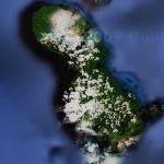
Sangir Besar, commonly called Sangir Island (with the spelling variants "Sangihe", "Sanghir" or "Sangi"), is an island in the Sangir Islands group. Its Indonesian name literally means "Great Sangir", in reference to the fact that it is the archipelago's main island. Politically, it is part of North Sulawesi province, Indonesia. The main language is the Sangir language.
It was the scene of the violent eruption of Gunung Awu volcano in March, 1856. The existing mountain was reshaped by the eruption, and flooding was extensive. The death toll was estimated to exceed two thousand, maybe as high as 6,000. While this appears to have been the most devastating eruption on record, is was not the only one - the last major eruption was in 1966, and the last significant one as recently as 2004.