Lugares de interés (POIs) del Mapa
0: Amazon-river-tour - About the Amazon River
Welcome to "About the Amazon River", the Amazon river info placemark, a collection of a lot of Amazon river info, and a part of the Google Earth Amazon river tour...
http://bbs.keyhole.com/ubb/showflat.php?Cat=0&Number=1147607
http://en.wikipedia.org/wiki/Amazon_River 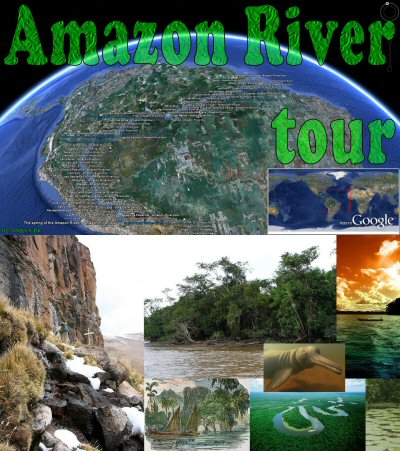
The Amazon River or River Amazon (Portuguese: Rio Amazonas; Spanish: Río Amazonas) of South America is the largest river in the world by volume, with greater total river flow than the next eight largest rivers combined, and the largest drainage basin in the world. Because of its vast dimensions it is sometimes called The River Sea. Most sources regard the Amazon as the second longest river; however, some sources disagree. The Amazon has been measured by different geographers as being anywhere between 6,259km/3,903mi and 6,712km/4,195mi long. The Nile River in Africa is reported to be anywhere from at 5,499km/3,437mi to 6,690km/4,180mi long.
The area covered by the water of the River and its tributaries more than triples over the course of a year. In an average dry season 110,000 square km of land are water-covered, while in the wet season the flooded area of the Amazon Basin rises to 350,000 square km.[citation needed] At its widest point the Amazon River can be 11 km/6.8 mi wide during the dry season, but during the rainy season when the Amazon floods the surrounding plains it can be up to 40 km/25 mi wide.
The quantity of fresh water released by the Amazon to the Atlantic Ocean is enormous: up to 300,000 m³ per second in the rainy season. The Amazon is responsible for a fifth of the total volume of fresh water entering the oceans worldwide. Offshore of the mouth of the Amazon, potable water can be drawn from the ocean while still out of sight of the coastline, and the salinity of the ocean is notably lower a hundred miles out to sea.
The Amazon estuary is over 325 km/202 mi wide. The main river (which is between approximately one and six miles wide) is navigable for large ocean steamers to Manaus, 1,500 km (more than 900 miles) upriver from the mouth. Smaller ocean vessels of 3,000 tons and 5.5 m (18 ft) draft can reach as far as Iquitos, Peru, 3,600 km (2,250 miles) from the sea. Smaller riverboats can reach 780 km (486 mi) higher as far as Achual Point. Beyond that, small boats frequently ascend to the Pongo de Manseriche, just above Achual Point.
The Amazon drains an area of some 6,915,000km² (2,722,000 mile²), or some 40 percent of South America. It gathers its waters from 5 degrees north latitude to 20 degrees south latitude. Its most remote sources are found on the inter-Andean plateau, just a short distance from the Pacific Ocean.
The Amazon has changed its course several times. In early Cenozoic times , before the uplifting of the Andes, it flowed westward.
The Upper Amazon comprises a series of major river systems in Peru (many of which originate in Ecuador) that flow north and south into the Marañón and Amazon. Among others, these include the following rivers: Morona; Pastaza; Nucuray; Urituyacu; Chambira; Tigre; Nanay; Napo; Huallaga; and Ucayali. Originating in the snow-crested Andes high above Lake Lauricocha in central Peru, the headstream of the Marañón River rises in the glaciers in what is known as the Nevado de Yarupa. Rushing through waterfalls and gorges in an area of the high jungle called the pongos, the Marañón River flows about 1,000 miles from west-central to northeast Peru before it combines with the Ucayali River, just below the provincial town of Nauta, to form the mighty Amazon River. The primary tributaries of the Marañón River are--from south to north--the Crisnejas, Chamayo, Urtcubamba, Cenepa, Santiago, Moroña, Pastaza, Huallaga, and Tiger Rivers (Cavero-Egusquiza 1941:49-51).
The most distant source of the Amazon has only recently been firmly established as a glacial stream on a snowcapped 5,597 metre (18,363 ft) peak called Nevado Mismi in the Peruvian Andes, roughly 160 km west of Lake Titicaca and 700 km S.E. of Lima. The mountain was first suggested as the source in 1971 but this was not confirmed until 2001. The waters from Nevado Mismi flow into the Quebradas Carhuasanta and Apacheta, which flow into the Río Apurímac which is a tributary of the Ucayali which later joins the Marañón to form the Amazon proper. Formally, though, the union of the Ucayali and the Marañón form the Río Amazonas, which changes its name to Solimões on the triple frontier between Peru, Colombia and Brazil, and later changes its name back to the Amazon only after it meets the Rio Negro near Manaus.
After the confluence of Río Apurímac and Ucayali, the river leaves Andean terrain and is instead surrounded by flood plain. From this point to the Marañón, some 1,600 km (1,000 mi), the forested banks are just out of water, and are inundated long before the river attains its maximum flood-line. The low river banks are interrupted by only a few hills, and the river enters the enormous Amazon Rainforest.
The river systems and flood plains in Brazil, Peru, Ecuador, Colombia and Venezuela whose waters drain into the Solimões and its tributaries are called the "Upper Amazon". From the east of the Andes, the Amazon Rainforest begins. It is the largest rainforest in the world and is of great ecological significance, as its biomass is capable of absorbing enormous amounts of carbon dioxide. Conservation of the Amazon Rainforest has been a major issue in recent years.
The rainforest is supported by the extremely wet climate of the Amazon basin. The Amazon, and its hundreds of tributaries, flow slowly across the landscape, with an extremely shallow gradient sending them towards the sea: Manaus, 1,600 km (1,000 mi) from the Atlantic, is only 44 m (144 ft) above sea level.
The biodiversity within the rainforest is extraordinary: the region is home to at least 2.5 million insect species, tens of thousands of plants, and some 2,000 birds and mammals. One fifth of all the world's species of birds can be found in the Amazon rainforest. The diversity of plant species in the Amazon basin is the highest on Earth. Some experts estimate that one square kilometre may contain over 75,000 types of trees and 150,000 species of higher plants. One square kilometre of Amazon rainforest can contain about 90,000 tons of living plants.
The breadth of the Amazon in some places is as much as 6 to 10 km (4 to 6 mi) from one bank to the other[citation needed]. At some points, for long distances, the river divides into two main streams with inland and lateral channels, all connected by a complicated system of natural canals, cutting the low, flat igapo lands, which are never more than 5 m (15 ft) above low river, into many islands. At the narrows of Óbidos, 600 km (400 mi) from the sea, the Amazon narrows, flowing in a single streambed, 1.6 km (1 mile) wide and over 60 m (200ft) deep, through which the water rushes toward the sea at the speed of 6 to 8 km/h (4 to 5 mph).
From the village of Canaria at the great bend of the Amazon to the Negro 1,000 km (600 mi) downstream, only very low land is found, resembling that at the mouth of the river. Vast areas of land in this region are submerged at high water, above which only the upper part of the trees of the sombre forests appear. Near the mouth of the Rio Negro to Serpa, nearly opposite the river Madeira, the banks of the Amazon are low, until approaching Manaus, they rise to become rolling hills. At Óbidos, a bluff 17 m (56 ft) above the river is backed by low hills. The lower Amazon seems to have once been a gulf of the Atlantic Ocean, the waters of which washed the cliffs near Óbidos.
Only about 10% of the water discharged by the Amazon enters the mighty stream downstream of Óbidos, very little of which is from the northern slope of the valley. The drainage area of the Amazon basin above Óbidos is about 5 million km² (2 million mile²), and, below, only about 1 million km² (400,000 mile²), or around 20%, exclusive of the 1.4 million km² (600,000 mile²) of the Tocantins basin.
In the lower reaches of the river, the north bank consists of a series of steep, table-topped hills extending for about 240 km (150 mi) from opposite the mouth of the Xingu as far as Monte Alegre. These hills are cut down to a kind of terrace which lies between them and the river.
Monte Alegre reaches an altitude of several hundred feet. On the south bank, above the Xingu, an almost-unbroken line of low bluffs bordering the flood-plain extends nearly to Santarem, in a series of gentle curves before they bend to the south-west, and, abutting upon the lower Tapajos, merge into the bluffs which form the terrace margin of the Tapajos river valley.
The waters of the Amazon support a diverse range of wildlife. Along with the Orinoco, the river is one of the main habitats of the Boto, also known as the Amazon River Dolphin. The largest species of river dolphin, it can grow to lengths of up to 2.6 m. Also present in large numbers are the notorious Piranha, carnivorous fish which congregate in large schools, and may attack livestock and even humans. Although many experts believe their reputation for ferocity is unwarranted, a school of piranha was apparently responsible for the deaths of up to 300 people when their boat capsized near Óbidos in 1981. However, only a few species attack humans, and many are solely fish-eaters, and do not school.
The Anaconda snake is found in shallow waters in the Amazon basin. One of the world's largest species of snake, the Anaconda spends most of its time in the water, with just its nostrils above the surface. Anacondas have been known to occasionally attack fishermen.
The river also supports thousands of species of fish, as well as crabs and turtles.
Más sobre Amazon-river-tour - About the Amazon River
1: Amazon-river-tour - The spring of the Amazon river!
The Amazon originates from a cliff at the Nevado Mismi, with a sole sign of a wooden cross. Coordinate 15° 31? 31? S, 71° 41? 27? W.
Elevation 5,597 metres (18,363 ft)
Location Peru
Range Andes
Type Stratovolcano
Nevado Mismi is a mountain peak of volcanic origin located in the Andes mountain range of Peru.
Nevado Mismi is about 160 km west of Lake Titicaca and 700 km southeast of Peru's capital city, Lima, in the Arequipa Region. It is one of the highest points of Colca Canyon. There are several glaciers on the peak.
In 2001, it was verified that the main headwater of the Amazon River has its glacial source on Nevado Mismi. An expedition of the National Geographic Society discovered that Carhuasanta stream flowing into Río Apurímac originates on the mountain's northern slopes and then runs its course through other tributaries and rivers to help form the main Amazon River. The fact that the headwaters of Río Apurímac are the source of the Amazon River was confirmed by Brazilian scientists in 2007, who pointed at Quebrada Apacheta as the most probable source of the Amazon.
http://en.wikipedia.org/wiki/Nevado_Mismi
Más sobre Amazon-river-tour - The spring of the Amazon river!
6: Amazon-river-tour - River Apurímac (start)
The Apurímac River (Spanish: Río Apurímac) ("apu"=divinity "rimac"=oracle, talker) rises from glacial meltwater of the ridge of Nevado Mismi, a 5,597-meter high mountain in the Arequipa Province in southern Peru.
The Apurímac is the source of the world's largest river system, the Amazon River. It rises in Peru's south-western cordilleras, 10 km (7 miles) from the village of Caylloma, and less than 160 km (100 miles) from the Pacific coast.
It flows generally northwest past Cuzco in narrow gorges of up to 3,000 m, twice as deep as the Grand Canyon in the USA, its course interrupted by falls and rapids. Of the six attempts so far to travel the Apurímac in its full length, only two have been successful.
After 730.70 kilometres (454.04 mi), the Apurímac joins the Mantaro River and becomes the Ene River
http://en.wikipedia.org/wiki/Apurímac_River
Más sobre Amazon-river-tour - River Apurímac (start)
23: Amazon-river-tour - Checcahuancaña
From meters 4100 to 400- (feet 13400 to 1340-) altitude. A downhill of more than 3700 meters (12000 feet) on a distance near 750 kilometers (466 miles). We have tried to place the placemarks in or close to the river, which allow you to follow the decrease in elevation as you take the Amazonas mountain river tour. Enjoy. Tour creator: Tom Kjeldsen http://ge.dooley.dk - for corrections, comments, additions feel free to mail me at googleearth(at)dooley.dk or comment in one of the forums on the internet
Más sobre Amazon-river-tour - Checcahuancaña
31: Amazon-river-tour - 15m - 49ft "Shore2Shore"
15 meters! 49 feet! from shore to shore at this point of the Amazon river
Más sobre Amazon-river-tour - 15m - 49ft "Shore2Shore"
70: Amazon-river-tour - 50m - 164ft "Shore2Shore"
50 meters! 164 feet! from shore to shore at this point of the Amazon river
Más sobre Amazon-river-tour - 50m - 164ft "Shore2Shore"
103: Amazon-river-tour - River Mantaro (tributary)
Más sobre Amazon-river-tour - River Mantaro (tributary)
104: Amazon-river-tour - River Ene (start)
The Ene River (Spanish: Río Ene) is a Peruvian river on the eastern slopes of the South American Andes.
The Ene is formed at the confluence of the Mantaro River and the Apurímac River, circa 400 m above sea level, where the three Peruvian Regions Junín, Cusco, and Ayacucho meet.
The river flows in a northwesterly direction at a total length of 180.6 km.
http://en.wikipedia.org/wiki/Ene_River
Más sobre Amazon-river-tour - River Ene (start)
106: Amazon-river-tour - San Gabriel (villa Esmeralda)
Más sobre Amazon-river-tour - San Gabriel (villa Esmeralda)
118: Amazon-river-tour - River Perené (tributary)
The Perené River (Spanish: Río Perené) is a Peruvian river on the eastern slopes of the South American Andes.
It is formed the confluence of the Chanchamayo River and the Paucartambo rivers, 15 km above the community of Perené, at 650 m above sea level.
The river flows in a south-easterly direction; its length is 165 km.
The Perené joins the Ene River, 10 km below the community of Puerto Ocopa, at 400 m above sea level, and is called the Tambo River from then on.
http://en.wikipedia.org/wiki/Perené_River
Más sobre Amazon-river-tour - River Perené (tributary)
119: Amazon-river-tour - River Tambo (start)
The Tambo River is a Peruvian river on the eastern slopes of the South American Andes.
The Río Tambo is part of the headwaters of the Amazon River whose origin is the Apúrimac River at Nevado Mismi and which becomes Ene River before its waters form the Tambo River. The Tambo River is formed at the town of Puerto Prado, 400 m above sea level. The river flows 70 km in an easterly direction southeast of Gran Pajonal and then turns north, its total length being 159 km.
The Tambo River joins the Urubamba River, at the town of Atalaya, 287 m above sea level, and is called the Ucayali River from then on.
http://en.wikipedia.org/wiki/Tambo_River
Más sobre Amazon-river-tour - River Tambo (start)
122: Amazon-river-tour - 250m - 822ft "Shore2Shore"
250 meters! 822 feet! from shore to shore at this point of the Amazon river
Más sobre Amazon-river-tour - 250m - 822ft "Shore2Shore"
132: Amazon-river-tour - River Urubamba (tributary)
The Urubamba River (Rio Urumamba) is a river in Peru. A partially navigable headwater of the Amazon River, it rises in the Andes to the south-east of Cuzco near the Puno Region border, where it is called the Vilcanota River (Rio Vilcanota). In the Sacred Valley, between Písac and Ollantaytambo, it is also called the Wilcamayu (sacred river). It flows north-north-west for 724 kilometers before coalescing with the lower Apurímac River to form the Ucayali River.
The Urubamba is divided into Upper Urubamba and Lower Urubamba, the dividing feature being the Pongo de Mainique, an infamous whitewater canyon.
John Walter Gregory, the British geologist, drowned in the river on June 2, 1932 while on a geological expedition to the Andes.
http://en.wikipedia.org/wiki/Urubamba_River
Más sobre Amazon-river-tour - River Urubamba (tributary)
133: Amazon-river-tour - River Ucayali (start)
The Ucayali River, which rises about 110 km (70 miles) north of Lake Titicaca, is a branch of the Amazon River near the Madeira River.
The Río Ucayali, together with Apurímac River, Ene River, and Tambo River, is today considered the main headwater of the Amazon River, totalling a length of 2,669.9 km from the source of the Apurímac at Nevado Mismi to the confluence of the Ucayali and Marañón Rivers:
* Apurímac River (total length): 730.7 km
* Ene River (total length): 180.6 km
* Tambo River (total length): 158.5 km
* Ucayali River (confluence with Tambo River to confluence with the Marañón): 1,600.1 km
The Ucayali was first called San Miguel, then Ucayali, Ucayare, Poro, Apu-Poro, Cocama and Rio de Cuzco. Peru has fitted out many costly and ably-conducted expeditions to explore it. One of them (1867) claimed to have reached within 380 km (240 miles) of Lima, and the little steamer "Napo" forced its way up the violent currents for 124 km (77 miles) above the junction with the Pachitea River as far as the Tambo River, 1240 km (770 miles) from the confluence of the Ucayali with the Amazon. The "Napo" then succeeded in ascending the Urubamba branch of the Ucayali 56 km (35 miles) above its union with the Tambo, to a point 320 km (200 miles) north of Cuzco.
The remainder of the Urubamba, as shown by Bosquet in 1806 and Castelnau in 1846, is interrupted by cascades, reefs and numberless other obstacles to navigation. Torres, who explored the Alto Ucayali for the Peruvian government, gives it a length of 186 miles, counting from the mouth of the Pachitea to the junction of the Tambo and Urubamba. Its width varies from 400-1200 m (1300 to 4000 feet), due to the great number of islands. The current runs from 5-6 km/h (3 to 4 miles an hour), and a channel from 20-50 m (60 to 150 feet) wide can always be found with a minimum depth of 1.5 m (5 feet). There are five bad passes, due to the accumulation of trees and rafts of timber. Sometimes enormous rocks have fallen from the mountains and spread over the river-bed causing huge whirlpools.
The river gives its name to the Ucayali Region of Peru.
http://en.wikipedia.org/wiki/Ucayali_River
Más sobre Amazon-river-tour - River Ucayali (start)
137: Amazon-river-tour - 500m - 1641ft "Shore2Shore"
500 meters! 1641 feet! from shore to shore at this point of the Amazon river
Más sobre Amazon-river-tour - 500m - 1641ft "Shore2Shore"
161: Amazon-river-tour - 750m - 2461ft "Shore2Shore"
750 meters! 2461 feet! from shore to shore at this point of the Amazon river
Más sobre Amazon-river-tour - 750m - 2461ft "Shore2Shore"
167: Amazon-river-tour - River Pachitea (tributary)
Más sobre Amazon-river-tour - River Pachitea (tributary)
182: Amazon-river-tour - River Aguaytia (tributary)
Más sobre Amazon-river-tour - River Aguaytia (tributary)
223: Amazon-river-tour - San Antonio de Acuracay
Más sobre Amazon-river-tour - San Antonio de Acuracay
241: Amazon-river-tour - River Marañón (tributary)
The Marañón River (Spanish: Río Marañón) rises about 160 km to the northeast of Lima, Peru, flows through a deeply-eroded Andean valley in a northwesterly direction, along the eastern base of the Cordillera of the Andes, as far as 5 degrees 36' southern latitude; then it makes a great bend to the northeast, and cuts through the inland Andes, until at the Pongo de Manseriche it flows through the plains. After its confluence with Río Ucayali, the Marañón is given the name of the Amazon River.
http://en.wikipedia.org/wiki/Marañón_River
Más sobre Amazon-river-tour - River Marañón (tributary)
244: Amazon-river-tour - San Rafael De Tapirillo
Más sobre Amazon-river-tour - San Rafael De Tapirillo
254: Amazon-river-tour - River Napo (tributary)
The Napo is a tributary to the Amazon River that rises in Ecuador on the flanks of the volcanoes of Antisana, Sincholagua and Cotopaxi.
Before it reaches the plains it receives a great number of small streams from impenetrable, saturated and much broken mountainous districts, where the dense and varied vegetation seems to fight for every piece of ground. From the north it is joined by the river Coca, having its sources in the gorges of Cayambe (volcano) on the equator, and also a powerful river, the Aguarico, having its headwaters between Cayambe and the Colombian frontier.
From the west it receives a secondary tributary, the Curaray, from the Andean slopes, between Cotopaxi and the volcano of Tungurahua. From its Coca branch to the mouth of the Curaray the Napo is full of snags and shelving sandbanks, and throws out numerous canos among jungle-tangled islands, which in the wet season are flooded, giving the river an immense width. From the Coca to the Amazon it runs through a forested plain where not a hill is visible from the river - its uniformly level banks being only interrupted by swamps and lagoons.
From the Amazon the Napo is navigable for river craft up to its Curaray branch, a distance of about 216 miles (350 km), and perhaps a bit further; thence, by painful canoe navigation, its upper waters may be ascended as far as Santa Rosa, the usual point of embarkation for any venturesome traveller who descends from the Quito tableland. The Coca river may be penetrated as far up as its middle course, where it is jammed between two mountain walls, in a deep canyon, along which it dashes over high falls and numerous reefs. This is the stream made famous by the expedition of Gonzalo Pizarro.
http://en.wikipedia.org/wiki/Napo_River
Más sobre Amazon-river-tour - River Napo (tributary)
269: Amazon-river-tour - 1,2km - 0,75mi "Shore2Shore"
1,2 kilometers! 0,75 miles! from shore to shore at this point of the Amazon river
Más sobre Amazon-river-tour - 1,2km - 0,75mi "Shore2Shore"
290: Amazon-river-tour - River Solimões (start)
Formally, though, the union of the Ucayali and the Marañón form the Río Amazonas, which changes its name to Solimões on the triple frontier between Peru, Colombia and Brazil
Más sobre Amazon-river-tour - River Solimões (start)
292: Amazon-river-tour - River Javary (tributary)
The Javary River, the boundary between Brazil and Peru, is a Amazon River tributary river. It is supposed to be navigable by canoe for 900 miles above its mouth to its sources among the Ucayali highlands, but only 260 were found suitable for steam navigation. The Brazilian Boundary Commission ascended it in 1866 to the junction of the Shino with its Jaquirana branch. The country it traverses in its extremely sinuous course is very level, similar in character to that of the Jurua.
Más sobre Amazon-river-tour - River Javary (tributary)
306: Amazon-river-tour - River Putumayo (tributary)
The Içá or Putumayo River is one of the tributaries of the Amazon River, west of and parallel to the Yapura. It forms part of Colombia's border with Ecuador, as well as most of the frontier with Peru. Known as the Putumayo in the former three nations, it is called the Içá when it crosses into Brazil.
In the late 19th century, the Içá was navigated by the French explorer Jules Crevaux (1847-1882). He ascended it in a steamer drawing 6 feet (1.8 m) of water, and running day and night. He reached Cuemby, 800 miles (1,300 km) above its mouth, without finding a single rapid. Cuemby is only 200 miles (320 km) from the Pacific Ocean, in a straight line, passing through the town of Pasto in southern Colombia. Creveaux discovered the river sediments to be free of rock to the base of the Andes; the river banks were of argillaceous earth and the bottom of fine sand.
Today the river is a major transport route. Almost the entire length of the river is navigated by boats.
Cattle farming, along with the rubber trade, is also a major industry on the banks of the Içá. Rubber and balatá (a substance very much like gutta-percha, to the point where it is often called gutta-balatá) from the Içá area are shipped to Manaus, Brazil.
http://en.wikipedia.org/wiki/Putumayo_River
Más sobre Amazon-river-tour - River Putumayo (tributary)
321: Amazon-river-tour - River Yapura (tributary)
The Japurá River or Caquetá River also called the zhepoorä´ in Latin is a river of c.1,750 mi (2,815 km) long (some sources say 2,414 km) rising as the Caquetá River in the Andes in the Southwest of Colombia. It flows southeast into Brazil, where it is called the Japurá. The Japura enters the Amazon River through a network of channels. It is navigable by small boats in Brazil.
The river is home to a wide variety of fish and reptiles, including enormous catfish weighing up to 200 lb (91 kg). and measuring up to six feet in length, electric eels, piranhas, turtles, and caimans. It also serves as a principal means of transportation, being plied by tiny dugout canoes, larger ones, motorboats, and riverboats known locally as "lanchas." These lanchas carry a multitude of cargoes, sometimes being chartered, sometimes even being traveling general stores. The presence of guerrillas and soldiers often severely limits river traffic.
Much of the jungle through which the eastern Caquetá originally flowed has been cleared for pasture, crops of rice, corn, "yuca" (manioc), and sugar cane, and in the past two decades, particularly coca crops.
http://en.wikipedia.org/wiki/Japurá_River
Más sobre Amazon-river-tour - River Yapura (tributary)
324: Amazon-river-tour - 2km - 1,24mi "Shore2Shore"
2 kilometers! 1,24 miles! from shore to shore at this point of the Amazon river
Más sobre Amazon-river-tour - 2km - 1,24mi "Shore2Shore"
348: Amazon-river-tour - River Purus (tributary)
The Purus is a river in South America. Its drainage basin is 63,166 km². The mean discharge is 8,400 m³/s.
It enters the Amazon River west of the Madeira River, which it parallels as far south as the falls of the latter stream. It runs through a continuous forest at the bottom of the great depression lying between the Madeira River, which skirts the edge of the Brazilian sandstone plateau, and the Ucayali which hugs the base of the Andes.
One of its marked features is the five parallel furos which from the north-west at almost regular intervals the Amazon sends to the Purus; the most south-westerly one being about 150 miles (240 km) above the mouth of the latter river. They cut a great area of very low-lying country into five islands. Farther down the Purfis to the right three smaller furos also connect it with the Amazon.
William Chandless found its elevation above sea-level to be only 107 feet (33 m) 590 miles (950 km) from its mouth. It is one of the most crooked streams in the world, and its length in a straight line is less than half that by its curves. It is practically only a drainage ditch for the half-submerged, lake-flooded district it traverses.
Its width is very uniform for 1000 miles (1600 km) up, and for 800 miles (1300 km) its depth is never less than 45 feet (15 m).
It is navigable by steamers for 1648 miles (2650 km) as far as the little stream, the Curumaha, but only by light-draft craft. Chandless ascended it 1866 miles (3,000 km). At 1792 miles (2,880 km) it forks into two small streams. Occasionally a cliff touches the river, but in general the lands are subject to yearly inundations throughout its course, the river rising at times above 50 feet (15 m), the numerous lakes to the right and left serving as reservoirs.
Its main tributary, the Aquiry or Acre River, enters from the right about 1104 miles (1777 km) from the Amazon. Its sources are near those of the Mayutata. It is navigable for a period of about five months of the year, when the Purus valley is inundated; and, for the remaining seven months, only canoes can ascend it sufficiently high to communicate overland with the settlements in the great india-rubber districts of the Mayutata and lower Beni; thus these regions are forced to seek a canoe outlet for their rich products by the very dangerous, costly and laborious route of the falls of the Madeira River.
http://en.wikipedia.org/wiki/Purus
Más sobre Amazon-river-tour - River Purus (tributary)
358: Amazon-river-tour - River Negro (tributary)
Rio Negro (Portuguese: Rio Negro, Spanish: Río Negro, English: Black River) is the largest left tributary of the Amazon and the largest blackwater river in the world. It has its sources along the watershed between the Orinoco and the Amazon basins, and also connects with the Orinoco by way of the Casiquiare canal. In Colombia, where the sources are located, it is called the Guainía River. Its main affluent is the Vaupés, which disputes with the headwaters of the Guaviare branch of the Orinoco, the drainage of the eastern slope of the Andes of Colombia. The Rio Negro flows into the Rio Solimões to form the Amazon River below Manaus, Brazil.
Rio Negro is navigable for 450 miles (720 km) above its mouth for 4 feet (1 m) of water in the dry season, but it has many sandbanks and minor difficulties.
In the wet season, it floods the country far and wide, sometimes to a breadth of 20 miles (32 km), for long distances, and for 400 miles (640 km) up. During this time, from April until October, it is a succession of lagoons, full of long islands and intricate channels as far as Santa Isabel do Rio Negro. The foothills of the Andes begin just before reaching the Vaupés River. At this point, the Negro narrows and is filled with many large rocks over which it violently flows in cataracts, rapids and whirlpools. Despite the impediments, canoes and motor launches ascend past São Gabriel da Cachoeira to the Andes. The mouth of the Rio Negro at the "Meeting of Waters": the dark Rio Negro meeting the silty Amazon River. The mouth of the Rio Negro at the "Meeting of Waters": the dark Rio Negro meeting the silty Amazon River.
While the name Rio Negro means Black River, its waters aren't exactly black; they are similar in color to strong tea. The dark color comes from humic acid from incomplete breakdown of phenol-containing vegetation from sandy clearings. The river's name arises from the fact that it looks black from afar.
Much has been written on the productivity of the Rio Negro and other blackwater rivers. The older idea that these are "hunger rivers" is giving way, with new research, to the recognition that the Rio Negro, for example, supports a large fishing industry and has numerous turtle beaches. If the Negro was empty of Indians during the 17th century, introduced exotic diseases and warfare are more likely causes than low river productivity.
http://en.wikipedia.org/wiki/Rio_Negro_(Amazon)
Más sobre Amazon-river-tour - River Negro (tributary)
359: Amazon-river-tour - River Amazon
Formally, though, the union of the Ucayali and the Marañón form the Río Amazonas, which changes its name to Solimões on the triple frontier between Peru, Colombia and Brazil, and later changes its name back to the Amazon only after it meets the Rio Negro near Manaus.
Más sobre Amazon-river-tour - River Amazon
362: Amazon-river-tour - Porto Fluvial do Careiro da Várzea
Más sobre Amazon-river-tour - Porto Fluvial do Careiro da Várzea
366: Amazon-river-tour - River Madeira (tributary)
The Madeira River is a major waterway in South America, approximately 3,380 km (2,100 miles) long. Madeira is the longest tributary of Amazon.
The mean inter-annual precipitations on the great basins vary from 750 to 3000 mm, the entire upper Madeira basin receiving 1705 mm/yr. The greatest extremes of rainfall are between 490 mm and more than 7000 mm. At its head, the Madeira on its own is still one of the largest rivers of the world, with a mean inter-annual discharge of 17,000 m3/s, i.e. 536 km³/yr, approximately half the discharge of the Congo River. The mean inter-annual contribution of the Bolivian Andes is 4170 m³/s, i.e. 132 km³/yr, representing 25% of the discharge of the entire upper Madeira basin.
Between Guajará-Mirim and the falls, the Madeira receives the drainage of the north-eastern slopes of the Andes from Santa Cruz de la Sierra to Cuzco, the whole of the south-western slope of Brazilian Mato Grosso and the northern slope of the Chiquitos sierras. In total, the catchment area is 850,000 km²[1], almost equal in area to France and Spain combined. The waters flow into the Madeira from many large rivers, the principal of which, (from east to west), are the Guaporé or Itenez, the Baures and Blanco, the Itonama or San Miguel, the Mamoré, Beni, and Mayutata or Madre de Dios, all of which are reinforced by numerous secondary but powerful affluents.
All of the upper branches of the river Madeira find their way to the falls across the open, almost level Mojos and Beni plains, 90,000 km2 (35,000 square miles) of which are yearly flooded to an average depth of about 3 feet (0.91 m) for a period of from three to four months.
From the falls, the Madeira flows northward forming the border between Bolivia and Brazil for approximately 100 km (60 miles). Below the confluence of the Rio Abunã, the Madeira meanders north-eastward through the Rondônia and Amazonas states of north west Brazil to its junction with the Amazon. At its mouth is Ilha Tupinambaranas, an extensive marshy region formed by the Madeira’s distributaries.
It rises more than 15 m (50 ft) during the rainy season, and ocean vessels may ascend it to the Falls of San Antonio, near Pôrto Velho, Brazil, 1070 km (663 miles) above its mouth; but in the dry months, from June to November, it is only navigable for the same distance for craft drawing about 2 m (from 5 to 6 feet) of water. The Madeira-Mamoré Railroad runs in a 365 km (227 mile) loop around the unnavigable section to Guajará-Mirim on the Mamoré River.
A subspecies of Boto (Amazon River Dolphin) is known to inhabit the Madeira river system.
http://en.wikipedia.org/wiki/Madeira_river
Más sobre Amazon-river-tour - River Madeira (tributary)
376: Amazon-river-tour - 3,3km - 2,05mi "Shore2Shore"
3,3 kilometers! 2,05 miles! from shore to shore at this point of the Amazon river
Más sobre Amazon-river-tour - 3,3km - 2,05mi "Shore2Shore"
400: Amazon-river-tour - River Tapajós (tributary)
The Tapajós, a Brazilian river running through a humid and hot valley, pours into the Amazon River 500 miles above Pará and is about 1200 miles long.
It rises on the lofty Brazilian plateau near Diamantino in 14 degrees 25' south latitude. Near this place a number of streams unite to form the river Arinos, which at latitude 10 degrees 25' joins the Juruena to form the Alto Tapajós, so called as far down as the Rio Manoel, which enters it from the east.
Thence to Santarém the stream is known as the Tapajós. The lower Arinos, the Alto Tapajós and the Tapajós to the last rapid, the Maranhão Grande, are a continuous series of formidable cataracts and rapids; but from the Maranhão Grande to its mouth, about 188 miles, the river can be navigated by large vessels.
For its last 100 miles it is from 4 to 9 miles wide and much of it very deep. The valley of the Tapajós is bordered on both sides by bluffs. They are from 300 to 400 feet high along the lower river; but a few miles above Santarém, they retire from the eastern side and do not approach the Amazon flood-plain until some miles below Santarém.
South American pole of inaccessibility is located close to the sources of Tapajós's tributaries, near town Utiariti
The Tapajós is named after the Tapajós Indians, a tribe of Native Americans from Santarém.
Más sobre Amazon-river-tour - River Tapajós (tributary)
408: Amazon-river-tour - 8km - 5mi "Shore2Shore"
8 kilometers! 5 miles! from shore to shore at this point of the Amazon river
Más sobre Amazon-river-tour - 8km - 5mi "Shore2Shore"
412: Amazon-river-tour - River Xingu (tributary)
Más sobre Amazon-river-tour - River Xingu (tributary)
414: Amazon-river-tour - River Jari (tributary)
The Jari River, is a northern tributary of the Amazon river on the border between the states of Pará and Amapá in northeastern Brazil. It is in the most downstream regions of the Amazon Basin and borders the Guiana Highlands and the Guianas and French Guiana to the northwest.
Más sobre Amazon-river-tour - River Jari (tributary)
420: Amazon-river-tour - River Tocantins (tributary)
Más sobre Amazon-river-tour - River Tocantins (tributary)