Lugares de interés (POIs) del Mapa
0: Depart Port Jackson in the Tom Thumb II 25 March 1796
A voyage to Norfolk Island interrupted our further proceedings, until March 1796. Mr Bass and myself then went again in Tom Thumb, to explore a large river, said to fall into the sea some miles to the south of Botany Bay, and of which there was no indication in captain Cook's chart.
We sailed out of Port Jackson early in the morning of March 25, and stood a little off to sea to be ready for the sea breeze.
Más sobre Depart Port Jackson in the Tom Thumb II 25 March 17961: Unexpected Arrival off Wollongong 25 March 1796
On coming in with the land in the evening, instead of being near Cape Solander, we found ourselves under the cliffs near Hat Hill, six or seven leagues to the southward, whither the boat had been drifted by a strong current.
(Editor's note: Hat Hill is Mount Kembla)
Más sobre Unexpected Arrival off Wollongong 25 March 17962: Tom Thumb Swamped 26 March 1796
Not being able to land, and the sea breeze coming in early next morning from the northward, we steered for two small islets, six or seven miles further on, in order to get shelter; but being in want of water, and seeing a place on the way where, though the boat could not land, a cask might be obtained by swimming, the attempt was made, and Mr Bass went on shore. Whilst getting off the cask, a surf arose further out than usual, carried the boat before it to the beach, and left us there with our arms, ammunition, clothes and provisions thoroughly drenched and partly spoiled. The boat was emptied and launched again immediately; but it was late in the afternoon before every thing was rafted off, and we proceeded to the islets.
(Editor's note: it is difficult to precisely determine from Flinder's notes on which beach the boat was swamped - but it does state they were 6 or 7 miles from Flinders and Tom Thumb Islets - which places them off Towradgi or Fairy Meadow beach)
Más sobre Tom Thumb Swamped 26 March 17963: Overnight at Red Point 26-27 March 1796
It was not possible to land there; and we went on to two larger isles lying near a projecting point of the main, which has four hillocks upon it presenting the form of a double saddle, and proved to be captain Cook's Red Point. The isles were inaccessible as the others; and it being dark, we were constrained to pass a second night in Tom Thumb, and dropped our stone anchor in 7 fathoms, under the lee of the point.
(Editor's note: Red Point, as named by Captain Cook, is now known as Hill 60 at Port Kembla. The smaller of the islands off Red Point was named by Flinders "Martins Island" in honour of their young servant lad.)
Más sobre Overnight at Red Point 26-27 March 17964: Meeting Aborigines at Lake Illawarra 27 March 1796
The sea breeze, on the 27th, still opposed our return; and learning from two Indians that no water could be procured at Red Point, we accepted their offer of piloting us to a river which, they said, lay a few miles further southward, and where not only fresh water was abundant, but also fish and wild ducks. These men were natives of Botany Bay, whence it was that we understood a little of their language, whilst that of some others was altogether unintelligible. Their river proved to be nothing more than a small stream, which descended from a lagoon under Hat Hill, and forced a passage for itself through the beach; so that we entered it with difficulty even in Tom Thumb. Our two conductors then quitted the boat to walk along the sandy shore abreast, with eight or ten strange natives in company.
---
The number of people had increased to near twenty, and others were still coming, so that it was necessary to use all possible expedition in getting out of their reach. But a new employment arose upon our hands: we had clipped the hair and beards of the two Botany Bay natives at Red Point; and they were showing themselves to the others, and persuading them to follow their example. Whilst, therefore, the powder was drying, I began with a large pair of scissors to execute my new office upon the eldest of four or five chins presented to me; and as great nicety was not required, the shearing of a dozen of them did not occupy me long. Some of the more timid were alarmed at a formidable instrument coming so near to their noses, and would scarcely be persuaded by their shaven friends, to allow the operation to be finished. But when their chins were held up a second time, their fear of the instrument--the wild stare of their eyes--and the smile which they forced, formed a compound upon the rough savage countenance, not unworthy the pencil of a Hogarth. I was almost tempted to try what effect a little snip would produce; but our situation was too critical to admit of such experiments.
Más sobre Meeting Aborigines at Lake Illawarra 27 March 17965: Overnight near Flinders Islet 27-28 March 1796
Our examination of the country was confined, by circumstances, to a general view. This part is called Alowrie, by the natives, and is very low and sandy near the sides of the rivulet. About four miles up it, to the north-west, is the lagoon; and behind, stands a semicircular range of hills, of which the highest is Hat Hill. The water in the lagoon was distinctly seen, and appeared to be several miles in circumference. The land round it is probably fertile, and the slopes of the back hills had certainly that appearance. The natives were in nothing, except language, different from those at Port Jackson; but their dogs, which are of the same species, seemed to be more numerous and familiar.
Soon after dark the sea breeze was succeeded by a calm; and at ten o'clock we rowed out of the rivulet, repassed Red Point, and at one in the morning came to an anchor in 5 fathoms, close to the northernmost of the two first rocky islets.
(Editor's note: The Island they anchored by is now known as Flinders Islet, and the other is Tom Thumb Islet.)
Más sobre Overnight near Flinders Islet 27-28 March 17966: Sleeping on the Beach 28-29 March 1796
In the afternoon of the 28th, we got on shore under the high land to the north of Hat Hill and were able to cook provisions and take some repose without disturbance. The sandy beach was our bed; and after much fatigue, and passing three nights of cramp in Tom Thumb, it was to us a bed of down.
The shore in this part is mostly high and cliffy; and under the cliffs were lying black lumps, apparently of slaty stone, rounded by attrition. These were not particularly noticed, but Mr. Clarke, in his disastrous journey along the coast, afterwards made fires of them; and on a subsequent examination, Mr. Bass found a stratum of coal to run through the whole of these cliffs.
(Editor's note: based on the description I assume the beach must have been one around Wombarra or Coalcliff.)
Más sobre Sleeping on the Beach 28-29 March 17967: Anchorage near Cliffs 29 March 1796
March 29. By rowing hard we got four leagues nearer home; and at night dropped our stone under another range of cliffs, more regular but less high than those near Hat Hill.
(Editor's note: these cliffs are the line of cliff faces along the Royal National Park, north of Otford)
Más sobre Anchorage near Cliffs 29 March 17968: Storm & Emergency Discovery of Wottomolla 29 March 1796
At ten o'clock, the wind, which had been unsettled and driving electric clouds in all directions, burst out in a gale at south, and obliged us to get up the anchor immediately, and run before it. In a few minutes the waves began to break; and the extreme danger to which this exposed our little bark, was increased by the darkness of the night, and the uncertainty of finding any place of shelter. The shade of the cliffs over our heads, and the noise of the surfs breaking at their feet, were the directions by which our course was steered parallel to the coast.
Mr Bass kept the sheet of the sail in his hand, drawing in a few inches occasionally, when he saw a particularly heavy sea following. I was steering with an oar, and it required the utmost exertion and care to prevent broaching to; a single wrong movement, or a moment's inattention, would have sent us to the bottom. The task of the boy was to bale out the water which, in spite of every care, the sea threw in upon us.
After running near an hour in this critical manner, some high breakers were distinguished ahead; and behind them there appeared no shade of cliffs. It was necessary to determine, on the instant, what was to be done, for our bark could not live ten minutes longer. On coming to what appeared to be the extremity of the breakers, the boat's head was brought to the wind in a favourable moment, the mast and sail taken down, and the oars got out. Pulling then towards the reef during the intervals of the heaviest seas, we found it to terminate in a point; and in three minutes were in smooth water under its lee. A white appearance, further back, kept us a short time in suspense; but a nearer approach showed it to be the beach of a well-sheltered cove, in which we anchored for the rest of the night. So sudden a change, from extreme danger to comparatively perfect safety, excited reflections which kept us some time awake: we thought Providential Cove a well-adapted name for this place; but by the natives, as we afterwards learned, it is called Watta-Mowlee.
Más sobre Storm & Emergency Discovery of Wottomolla 29 March 17969: Arrive Port Hacking 30 March 1796
Between three and four miles to the northward of this cove, we found the river, or rather port, which was the original place of our destination; and it having been a pilot named Hacking, from whom the first information of it had been received, it was named after him: by the natives it is called Deeban.
Más sobre Arrive Port Hacking 30 March 179610: Explore Port Hacking 1-2 Apr 1796
April 1st, was employed in the examination of the port. It is something more than one mile wide in the entrance; but soon contracts to half that space, and becomes shallow. Neither have the three arms, into which it afterwards branches out, any deep channel into them; although, within the second branch, there are from 3 to 8 fathoms. Finding there was no part accessible to a ship, beyond two miles from the entrance, nor any prospect of increasing our small stock of provisions, Port Hacking was quitted early in the morning of April 2.
The shores of the port are mostly rocky, particularly on the north side; but there is no want of grass or wood; and without doubt there are many culturable spots on the sides of the streams which descend, apparently from the inland mountains, into the uppermost branch. Two natives came down to us in a friendly manner, and seemed not to be unacquainted with Europeans. Their language differed somewhat from the Port Jackson dialect; but with the assistance of signs, we were able to make ourselves understood.
Más sobre Explore Port Hacking 1-2 Apr 179611: Return to Port Jackson 2 Apr 1796
After sounding the entrance of Port Hacking in going out, and finding 3½ fathoms water, we steered N.E. by E for Cape Solander; and the same evening Tom Thumb was secured alongside the Reliance in Port Jackson.
Más sobre Return to Port Jackson 2 Apr 179612: Depart Port Jackon in the Norfolk 7 Oct 1798
In September following, His Excellency Governor Hunter had the goodness to give me the Norfolk, a colonial sloop of twenty-five tons, with authority to penetrate behind Furneaux's Islands; and should a strait be found, to pass through it and return by the south end of Van Diemen's Land; making such examinations and surveys on the way as circumstances might permit. Twelve weeks were allowed for the performance of this service, and provisions for that time were put on board; the rest of the equipment was completed by the friendly care of Captain Waterhouse of the Reliance.
I had the happiness to associate my friend Bass in this new expedition, and to form an excellent crew of eight volunteers from the king's ships; but a time keeper, that essential instrument to accuracy in nautical surveys, it was still impossible to obtain.
My report of the seals at Furneaux's Islands had induced Messrs. Bishop and Simpson, the commander and supracargo of the snow Nautilus, to prepare their vessel for a sealing speculation to that quarter; and on Oct. 7, we sailed out of Port Jackson together.
Más sobre Depart Port Jackon in the Norfolk 7 Oct 179813: Mount Dromedary & Montague Island 8 Oct 1798
The wind being fair, we passed Hat Hill at four in the afternoon, and next morning, made Mount Dromedary. I took this opportunity of passing between Montague Isle and the main; but the depth of water being uncertain, the Nautilus was desired by signal not to follow. There was no bottom with 13, and afterwards with 20 fathoms, at a mile distance from the island; and the passage seemed perfectly free from danger, and is five or six miles wide. Mount Dromedary, from which the island lies E by N ½ N., is the highest land upon this part of the coast; its elevation being, I think, not less than 3000 feet. The top is about three miles long, and the south end is somewhat the most elevated part; it is covered with wood, even there, but still more so down the sides; the shore under it is mostly a white, sandy beach.
Más sobre Mount Dromedary & Montague Island 8 Oct 179814: Two-fold Bay 9-14 Oct 1798
At noon the centre of the mountain bore N.N.W. four leagues; but the haziness of the weather prevented an observation being taken for the latitude, as it had before done when passing in the Francis*. We then hauled further off the coast, with the Nautilus in company, and being near the latitude of Cape Howe, at ten o'clock, lay to until daylight, for the purpose of obtaining a good departure; but on the 9th, the wind had veered to south-west, and the weather having a bad appearance, we bore up for Two-fold Bay. The course after passing Green Cape, was N. 16° W. seven miles to Haycock Point, and N. 44° W. three or four miles from thence to the south point of entrance to the bay; the shore being all along bold, and for the most part rocky. From the south point, which may be known by its reddish appearance and having a steep rock lying off it, we steered for Snug Cove, on the north-west side of the bay; and there anchored in 3½ fathoms, sandy bottom, at something more than a cable's length from the small beach, and the same distance from the two points which bound the cove. In this situation, the outer red point was hidden by Snug-cove Head; and further out, in 5 fathoms, where the Nautilus anchored, the head and point were in a line.
In order to make some profit of this foul wind, Mr Bass landed early next morning to examine the country, whilst I went with Mr Simpson to commence a survey of Two-fold Bay. In the way from Snug Cove, through the wood, to the long northern beach, where I proposed to measure a base line, our attention was suddenly called by the screams of three women, who took up their children and ran off in great consternation. Soon afterward a man made his appearance. He was of a middle age, unarmed, except with a whaddie, or wooden scimitar, and came up to us seemingly with careless confidence. We made much of him, and gave him some biscuit; and he in return presented us with a piece of gristly fat, probably of whale. This I tasted; but watching an opportunity to spit it out when he should not be looking, I perceived him doing precisely the same thing with our biscuit, whose taste was probably no more agreeable to him, than his whale was to me. Walking onward with us to the long beach, our new acquaintance picked up from the grass a long wooden spear, pointed with bone; but this he hid a little further on, making signs that he should take it on his return. The commencement of our trigonometrical operations was seen by him with indifference, if not contempt; and he quitted us, apparently satisfied that, from people who could thus occupy themselves seriously, there was nothing to be apprehended.
Más sobre Two-fold Bay 9-14 Oct 179815: Kent's Group 17 Oct 1798
The wind veered round by the south until it fixed itself at east; and when the day broke, on the 17th, the signal was made to the Nautilus, and we bore away S.W. by W. until noon. The latitude was then 39° 11' south, and we judged ourselves to be nearly in the meridian of the Sisters; the weather was tolerably fine, and had been so all the morning, yet no land was any where to be seen; and I therefore concluded, that none could lie in or near the meridian of these islands, and be in the latitude of 39°.
The course steered at noon was west; but in half an hour it was altered for high irregular land which came in sight to the south-westward, and proved to be the largest of the two clusters which I had discovered when in the Francis, and named Kent's Groups. We sounded in 30 fathoms, but lost the lead, the sole deep-sea line with which we had been furnished, proving to be totally rotten. After running twenty miles, assisted by a flood tide, we came up with the group at four o'clock, and steered through the channel by which the principal islands are separated. It is about three miles long, and a full mile in width; is free from danger, and so deep, that our hand line could not reach the bottom. There are two sandy coves on the east, and one on the west side of the channel, where small vessels might find shelter, if there were any inducement to visit these steep, barren, granitic masses of rock. Above the cliffs we could occasionally perceive a brown-looking vegetation of brush wood, and here and there a few starved gum trees; but there was neither bird nor quadruped to enliven the dreary scene.* The principal island of the small, western group, opened at S. 68° W., on clearing the channel; and we then hauled the wind to the southward, for Furneaux's Islands, that the Nautilus might no longer be detained from her sealing business.
Más sobre Kent's Group 17 Oct 179816: Furneaux Group 18 Oct 1798
The wind blew fresh from the eastward all night, with hazy weather. At daylight, Oct. 18, a large piece of hilly land bore N. 48° to 64° E., four leagues; and soon afterward, Mount Chappell, a smooth round hill which had been seen from Preservation Island, was set at S. 78° E., distant seven or eight leagues, and was as conspicuous on this side as when seen from the eastward. Our latitude at noon was 40° 22', and Mount Chappell bore N. 71° E. seven or eight miles, which would place it to the north of its position before determined. Between us and the mount were two small, low islands, and to the northward the hilly land first seen was visible under the sun.
Finding the wind hang obstinately in the eastern quarter, we had tacked to the north in order to keep under the lee of the islands. This course brought us, in the evening, within two miles of the hilly northern land, the same which had been discovered in the Francis, and of whose connection with the great island of Furneaux I was doubtful; nor could it yet be determined. The shores of the south-western part are rocky; and the land rises, by a steep ascent, to hills of an elevation equal to that of Mount Chappell. These hills are slightly covered with grass and small brush wood, but the general appearance was that of great sterility.
About four miles to the south of this land we had passed a rocky islet, and observed a circular reef which seemed to connect the two together. The stormy appearance of the night induced me to stretch in, under this reef; and finding there was shelter from the east winds, we came to an anchor in 5 fathoms, coarse sand: the Nautilus followed; but not liking the place, captain Bishop preferred keeping the sea. On sounding round the sloop, I found the bottom every where foul, and that there were no means of escape in case of a shift of wind; therefore, after killing a few seals upon the granitic rocks, we weighed the anchor, ran two leagues to the southward, and then hauled the wind under storm sails for the night.
Más sobre Furneaux Group 18 Oct 179817: Chappell Isles 19 Oct 1798
Oct. 19, the wind was at north-east; and we bore away to pass between Mount Chappell and the low islands lying to the westward. The passage is about two miles wide, and the water much discoloured; but 10 fathoms of line did not reach the bottom. A similar appearance in the water had been observed several leagues to the westward of the low islands, where there was 23 to 25 fathoms, on a bottom of sand and broken shells.
This small group, to which the name of Chappell Isles is affixed in the chart, consists of three, or perhaps four islands, for the mount seemed to stand detached from the land on the east side of the passage. The basis of the whole is probably of granite, and they seemed nothing superior in fertility to the worst of Furneaux's Islands; but in a distant view, a slight covering of small herbage upon their sloping, even surfaces, gave them a prepossessing appearance. Mount Chappell is five or six hundred feet above the water, a very conspicuous object until, by the clearing away of the haze the high mountains of the great island behind it became visible: their white, towering peaks, bathed in the late showers, reflected the gleaming sunshine with great splendour, and presented a spectacle so magnificent, that the circular, gently sloping Mount Chappell no longer attracted attention.
Más sobre Chappell Isles 19 Oct 179818: Swan Islands 31 Oct 1798
Oct 20, the wind was at north-west, and blew a gale, accompanied with rain, which continued for several days. This weather very much impeded our progress with the Nautilus in Armstrong's Channel, but Captain Bishop at length moored in Kent's Bay, the most secure place to be found within reach of the sealing points. The greater part of Kent's Bay is occupied by shoals; but along the shore of Sloping Point there is a deep channel running northward, which leads into the western head of the bay; and there, behind a reef of dry rocks, several ships may lie in 4 or 5 fathoms, sheltered from all winds. The Nautilus's tents were pitched upon the borders of a run of fresh water, about one mile north of the anchorage; and a garden, which Captain Bishop made there, produced some tolerable vegetables.
We had no prospect of advancing along the north coast of Van Diemen's Land whilst the strong western winds continued to blow; and therefore, whilst Mr Bass explored some of the islands, I occupied myself in sounding different parts of Armstrong's Channel, and in making some other additions to my former survey. At length, on Oct. 31., the gale moderated to a light breeze, and we stretched over, with the flood tide, towards the Swan Isles.
Soon after three o'clock, we anchored in a small sandy bay, at the south-east end of the largest Swan Isle, in 4 fathoms; being well sheltered from north and western winds, but entirely open to any that might arise from the opposite quarters. The furthest extreme of the opposite coast then bore S. 36° E. three leagues; but the nearest part, in the direction of S. by W., was little more than three miles distant.
I landed with Mr Bass; and leaving him to pursue his researches, went round to the north side of the island, to take angles...
Más sobre Swan Islands 31 Oct 179819: Cape Portland 1 Nov 1798
Nov 1. Having an unfavourable wind, I waited the flood tide, and then proceeded westward, along that part of Van Diemen's land to which the name of CAPE PORTLAND was given, in honour of His Grace the then secretary of state for the colonies. From the eastern extremity, the coast trends about N. 62° W. six leagues, and terminates in a point, off which lie some small rocky islets. The shore consists of long, sandy beaches, separated by low and stony points, which project very little beyond the coastline. The country for two or three miles behind the shore is low and sandy; but it then ascends in gradations of gently rising hills, and being covered with verdure, interspersed with clumps of wood and single trees of a fair growth, it had a very pleasing appearance. At the back of these hills, the bare and rugged tops of a ridge of distant mountains appeared here and there, and formed a striking contrast with the verdure of the front scene.
Más sobre Cape Portland 1 Nov 179820: Isle Waterhouse 1 Nov 1798
Soon after four o'clock, the ebb appeared to be making; and the anchor was dropped in 11 fathoms, sandy bottom, about one mile west of Cape Portland. The shore on this side of the cape trends south, in rocky heads and beaches, and afterwards curves westward, forming an extensive bay, which terminates in a point. To this the name of Point Waterhouse was given, in honour of the commander of the Reliance, and an island, whose top is level and moderately high, lying off the point, was named ISLE WATERHOUSE.
The bottom of the large bay is sandy, and the hills of Cape Portland there retiring further back, permitted a view of the inland mountains, of which there was a high and extensive ridge. Mountains like these are usually the parents of rivers; and the direction of the ebb tide, which came from between S.W. by S. and S.W. by W. at the rate of two-and-a-half miles an hour, gave hopes of finding some considerable inlet in the bay, and increased our anxiety for a fair breeze.
Más sobre Isle Waterhouse 1 Nov 179821: Discover Port Dalrymple 3 Nov - 3 Dec 1798
Some shoals, not quite covered, we left on the starbord hand; keeping a straight course for the entrance of a basin or bay, at which the inlet seemed to terminate. This course took us over some strong ripplings of tide, on none of which, however, there was less than 5 fathoms; and so soon as they were passed, 13 fathoms did not reach the bottom. After advancing three miles, we approached a low, green island, lying nearly in mid-channel; and being uncertain which was the deepest side, I took the most direct, which lay to the west. From 8 fathoms, the next cast of the lead was 3½, and immediately the sloop was aground. Fortunately, the bottom was soft, and the strong flood dragged her over the bank without injury. The water deepened again as quick; and when the channel on the east side of Green Island was open, there was no bottom at 13 fathoms.
We could not but remark the contrast between the shores of this inlet, covered with grass and wood down to the water's edge, and the rocky sterile banks observed in sailing up Port Jackson: it spoke favourably for the country, and added to the satisfaction we felt in having made the discovery. There was, however, little time for meditation: the tide drove the sloop rapidly onward to the basin; and the evening coming on, I pushed between some dry rocks and a point on the western side, and anchored in 2 fathoms, on a bottom of sand and mud.
There appeared to be three arms, or rivers, discharging themselves into this extensive basin. That which came from the westward., had its embouchure close to the sloop; and Mr. Bass went off in the boat to look up it. His attention was, however, soon called to another pursuit: a number of black swans were swimming before him, and judging from former experience in Western Port, that several of them were unable to fly, he gave chase with the boat. On his return at dusk, he rejoiced us with the sight of four, and with a promise that we should not be in want of fresh provisions in this port.
---
The harbour, which we entered with so much pleasure on Nov. 3, and finally quitted with still more on Dec. 3, was named PORT DALRYMPLE, by His Excellency governor Hunter, as a mark of respect to Alexander Dalrymple, Esq., the late hydrographer to the Admiralty.
Más sobre Discover Port Dalrymple 3 Nov - 3 Dec 179822: Discover Three-Hummock Island 8 Dec 1798
During the night and next day, Dec. 7, the wind was variable, with alternate calms. The latitude at noon was 40° 28', and the sugarloaf hill bore W. by S. ten miles. On the 8th a breeze sprung up from the south-westward, and threatened a gale from that boisterous quarter. We were in 40° 23' at noon, and trying to work up to the land of the three hummocks, to prevent losing ground; and at six in the evening, got to an anchor in a quarter less 4 fathoms, in a small sandy bight under the northern hummock, being sheltered from N. 2° E., round by the west to S. 30° E. Circular Head was still visible, bearing S. 35° E.; and the difference of longitude made from Port Dalrymple was calculated at 1¾°, subject to future revision.
Mr. Bass and myself landed immediately to examine the country and the coast, and to see what food could be procured; for the long detention by foul winds had obliged me to make a reduction in the provisions, lest the object of our voyage and return to Port Jackson should not be accomplished in the twelve weeks for which we were victualled. At dusk, we returned on board, having had little success as to any of the objects proposed; but with the knowledge of a fact, from which an interesting deduction was drawn: the tide had been running from the eastward all the afternoon, and contrary to expectation, we found it to be near low water by the shore; the flood, therefore, came from the west, and not from the eastward, as at Furneaux's Isles. This we considered to be a strong proof, not only of the real existence of a passage betwixt this land and New South Wales, but also that the entrance into the Southern Indian Ocean could not be far distant.
---
From the north-east point of the three-hummock land, the shore trended W. 1° N. three miles; then S. 39° W. four miles, to a rocky point, forming the south-west extremity of what was then ascertained to be THREE-HUMMOCK ISLAND. The channel which separates it from the land to the west, is, at least, two miles in width, and is deep; so that it was difficult to conjecture how the Indians were able to get over to the island. It was almost certain that they had no canoes at Port Dalrymple, nor any means of reaching islands lying not more than two cables length from the shore; and it therefore seemed improbable that they should possess canoes here. The small size of Three-hummock Island rendered the idea of fixed inhabitants inadmissible; and whichever way it was considered, the presence of men there was a problem difficult to be resolved.
Más sobre Discover Three-Hummock Island 8 Dec 179823: Trefoil Island & Cape Grim 10 Dec 1798
Besides these islands and rocks, we passed another cliffy island four or five miles to the south of Steep-head, and to which I gave the name of Trefoil Island, its form appearing to be nearly that of a clover leaf; there were, also, several others of less importance, mostly lying near the barren land. The steep south end of this land was set over the north end of Trefoil at N. 65° E.; and being almost assured of its separation from Van Diemen's Land, I added it, under the name of Barren Island, to the rest of this cluster; and in honour of His Excellency, the governor of New South Wales, I gave to the whole the title of HUNTER'S ISLES.
The north-west cape of Van Diemen's Land, or island, as it might now be termed, is a steep, black head, which, from its appearance, I call CAPE GRIM. It lies nearly due south, four miles, from the centre of Trefoil, in latitude 40° 44'; the longitude will be 144° 43° east, according to the position of Albatross Island made in the Investigator. There are two rocks close to Cape Grim, of the same description with itself. On the north side of the cape, the shore is a low, sandy beach, and trends north-eastward, three or four miles; but whether there be a sufficient depth for ships to pass between it and Barren Island, has not, I believe, been yet ascertained. To the south of the cape, the black cliffs extend seven or eight miles, when the shore falls back, eastward, to a sandy bay, of which little could be perceived.
Más sobre Trefoil Island & Cape Grim 10 Dec 179824: Sight Mount Zeehan 11 Dec 1798
The two last appear to have been the smaller mountains seen by TASMAN to the north-east, on his discovering this land Nov. 24, 1642; and I have therefore named the first Mount Heemskerk, and the latter Mount Zeehan, after his two ships. The back ridge of woody hills does not terminate here; but it retreats further inland, and as far as could be perceived through the haze, rises in height to the southward. The extreme of the coast, which bore S. S. E., forms the southern point of a sandy, and rather deep bight, where I thought it probable there might be some small opening; but as the wind blew strong directly into it, there was too much danger in bearing away for its examination.
At three o'clock, we passed the southern point of the bight, at the distance of four miles; and the coast then again trended S. S. E., waving in rocky bights and projections. The land here rises by a gentle ascent for two or three miles from the shore; its appearance was smooth and uniform; but it was destitute of wood, and almost of other vegetation: the back mountains were obscured by the haze.
Más sobre Sight Mount Zeehan 11 Dec 179825: Point St. Vincent (Port Davy) 12 Dec 1798
At ten o'clock, a projection which merited the name of Rocky Point bore S. 74° E., five miles; and here the direction of the coast was changed to east, for near seven miles, when it formed a bight by again trending south-eastward. The shore round the bight is high, and at the back were several bare peaks which, from their whiteness, might have been thought to be covered with snow; but their greatest elevation of perhaps 1200 feet, combined with the height of the thermometer at 62°, did not admit the supposition. These peaks are probably what Tasman named De Witt's Isles, from his distance having been too far off to distinguish the connecting land, and I therefore called the highest of them, lying in 43° 9½' south, Mount De Witt.
It afterwards appeared, that these smaller hills stood upon the extremity of a point; and in honour of the noble admiral with whose victory we had become acquainted, it was named POINT ST. VINCENT.
The western breeze died away in the evening, and the sloop was drifted in by the swell, and perhaps by a tide, towards an opening round Point St. Vincent. This opening is indicated in the small chart which accompanies the voyage of M. Marion, but does not appear to have been seen by any other navigator.
Más sobre Point St. Vincent (Port Davy) 12 Dec 179826: Off South-West Cape 13 Dec 1789
It remained nearly calm all night; and on the 13th, at daybreak, I was much surprised to find our situation near ten miles to the southward, instead of being in the same place. This circumstance, and a breeze which arose at north, precluded me from examining the opening as I had intended; for a width of three or four miles at the entrance, and the form of the mountains behind, made it probable that a considerable river discharged itself there; and the offset during the night strengthened the supposition. We were then steering for the South-west Cape, and at nine I set Mount De Witt over it at N. 22° W., our distance from the cape being then about three miles.
Más sobre Off South-West Cape 13 Dec 178927: Off South Cape 13 Dec 1798
The wind died away at six o'clock, when the Cape was one mile distant; but thick clouds were gathering in the south and west, and strong gusts with heavy rain presently succeeded. Fortunately, the squalls came from the westward, so that we were enabled to get further from those stupendous cliffs; had they come from the south, the consequences might have been fatal to the Norfolk.
The first steep head, to the eastward of the South Cape, opened round it at E. 7° N., (allowing 4° east variation,) and a second from the first, at E. 16° N., their distances asunder being each about five miles. It is the middlemost of these three heads which is called South Cape by captain Cook, as appears from the relative situations of his Peaked Hill and of Swilly rock; but he had not the opportunity of seeing the heads opening one from the other, as we had in the Norfolk.
Más sobre Off South Cape 13 Dec 179828: Exploring D'Entrecasteauxs Channel 14-17 Dec 1798
Dec. 14, at four in the morning, our situation was far to leeward; and having no prospect of fetching into the channel, we bore away for Boreel's Isles, which were seen bearing N. 65° E. two leagues. Three of these produce some vegetation, and that of the largest had been partially burnt not long before. The two easternmost, called the Friars by captain Furneaux, are bare pyramidal rocks, and, except where they had been made white by the gannets, are of a black, weather-beaten colour: a patch of breakers lies one mile to the north-east from them.
Fluted Cape opened round Tasman's Head at N. 18° E. We passed these steep projections at a mile distance; and not being able to fetch into Adventure Bay, did the same by Cape Frederick Henry.* At noon, this cape bore S. 13° W. eight miles, and Fluted Cape was behind it in the same bearing. I proposed to enter the Derwent River; but on making a stretch toward Betsey's Island,** it appeared that the Henshaw's Bay of Hayes, instead of being a shallow bight, was a deep opening; and as the north-west wind blew out of the Derwent, we stretched on, seven miles above the island, and came to an anchor in 10 fathoms, sandy ground. This opening is the North Bay of D'Entrecasteaux; but I was totally ignorant, at that time, of its having ever been entered.
Dec. 15, the wind being at north-west, we passed a sloping island (Isle St. Aignan of D'Extrecasteaux), and steered north-eastward, to explore the inlet. After running three-and-half miles, with soundings from 13 no bottom, to 5 fathoms, we anchored under a small island, which lies S. 75° W., one mile and a half, from Point Renard, the uppermost station of the French boats. This small spot received the descriptive name of Isle of Caves, and lies in the passage from North Bay to a large extent of water which appeared to the eastward, and which the French boats did not explore.
From the Isle of Caves we ran six miles, E. S. E. up the new bay, for Smooth Island. The width of the entrance, from Point Renard to Green Head, is two miles, the soundings are from 6 to 16 fathoms, and there are no dangers. Smooth Island, behind which we anchored in 4 fathoms, and where I again landed to take bearings, is three quarters of a mile long, and covered with grass and a few small trees. It had been visited by the natives, as had the Isle of Caves; but from the eggs of gulls found upon both, I judge they do not go often.
Dec. 16, we anchored two miles to the south-east of Smooth Island, in 6 fathoms, near a point of the main where a round hill afforded me a good view of this extensive bay. The country there is stony and barren, though covered with wood and much frequented by kangaroos. In the evening, the appearance of a southern gale induced me to shift our berth to the north side of the point; between which, and an islet lying half a mile from it, the depth was 5 to 7 fathoms.
On the 17th, we landed upon the islet, and killed some out of the many gulls by which it is frequented. A small arm of the bay extending north-eastward, where we hoped to obtain fresh water, was the object of our examination in the afternoon. There was a little stream falling in at the head, but rocks prevented it from being accessible to boats, or to a raft; and a walk of perhaps a mile to the eastward, afforded nothing but the sight of a stony country, and of a few miserable huts. Our greyhound started a kangaroo, but it was lost in the wood; and there were no birds to shoot.
Más sobre Exploring D'Entrecasteauxs Channel 14-17 Dec 179829: Discover Norfolk Bay 18 Dec 1798
Dec. 18, the wind still blowing fresh from the westward, we worked up to Smooth Island; and then stretched over to the south side of the bay. The soundings were generally 9 fathoms, on mud and sand, to within a mile of the shore; and at half a mile, where the anchor was dropped, the depth was 4 fathoms.
We landed at a steep, but not high point near the sloop, where I took some bearings, and observed the meridian altitude of the moon in an artificial horizon, which gave the latitude 43° 1½'; Mr. Bass, in the mean time, walked a little distance inland, but saw nothing of particular interest. Some further bearings were taken next morning, from a head lying to the west; after which the anchor was weighed, and we steered northward along the west side of the bay, with soundings from 8 to 4 fathoms. In the evening, we had worked back into North Bay, and come to an anchor under the north-east end of Sloping Island.
The great eastern bay now quitted had never been entered till this time; and as it is proved not to be Frederik Hendrik's, I have named it NORFOLK BAY. It is about eight miles long, north and south, and three to five miles broad from east to west. The largest fleet may find shelter here, with anchorage on a good bottom of 4 to 9 fathoms deep. We saw but one small stream of fresh water, and that was of difficult access; but it is scarcely probable that, amongst the many coves all around the bay, water convenient for ships should not be found. The country near the shore is rocky; but as the kangaroo seemed to be abundant, there are probably many grassy plains further inland. Wood abounds every where, except at Green Head, which is mostly covered with grass. Of the four islands in the bay, Smooth and Gull Islands were found superior in fertility to the main land: the first contains about forty acres of tolerable pasturage.
Más sobre Discover Norfolk Bay 18 Dec 179830: Arrive Entrance to Derwent River 21 Dec 1798
Dec. 21, we proceeded round for the Derwent. On clearing North Bay, I went off in the boat to Betsey's Island, leaving Mr. Bass to conduct the sloop. This island is high, and accessible only towards its north end; its length is one mile, and mean breadth about half that quantity; the soil is fertile, and nourishes a luxuriant vegetation of grass and wood; and though the natives visit it occasionally, none of their traces were recent. On rejoining the sloop, I found she had passed between the island and two flat rocks near the main, with from 5 to 9 fathoms water; in which depths the gigantic sea-weed grows up to the surface. At eight clock we anchored in 9 fathoms, off Cape Direction, at the entrance of the river.
Más sobre Arrive Entrance to Derwent River 21 Dec 179831: Arrive Risdon Cove 23 Dec 1798
Dec. 22, a base was measured and bearings taken for a survey of the entrance, which proved to be near three miles wide. On the 23rd, the wind being fair, we ran upwards between shores which were sometimes steep, but generally of a gradual ascent, and well clothed with grass and wood. At nine miles from the entrance lies Sullivan Cove, on the west side, where a settlement has since been established by colonel Collins;* and here the width of the river is suddenly contracted, from one mile and a half to less than three-quarters of a mile, but the depth is not diminished. Four miles higher up we found Risdon Cove, and anchored there in 4 fathoms, with the intention of filling our empty water casks at the Risdon River of Mr. Hayes; but finding it to be a little creek which even our boat could not enter, I determined to seek a more convenient watering place higher up the Derwent.
Más sobre Arrive Risdon Cove 23 Dec 179832: Herdsman's Cove 25 Dec 1798
In the afternoon of the 25th, we got the sloop, with much difficulty, five or six miles further up the river, to an inlet which I called Herdsman's Cove, from the pastoral appearance of the surrounding country. Two streams fall into it; and up the principal one, in the north-east corner, I went two miles with the boat. The water was there found to be fresh, and the depth sufficient to allow of its being reached by the sloop; but the banks being steep and channel narrow, I was deterred from watering in this place, by the fear of detention from foul winds.
The width of the Derwent abreast of Herdsman's Cove is half a mile; but except a very narrow channel close to the eastern shore, it is too shallow even for boats. The intention of proceeding further with the sloop was therefore abandoned; but so soon as the rainy, blowing weather permitted, which was not until the 28th, I accompanied Mr. Bass in a boat excursion up the river. Three miles above Herdsman's Cove the banks open out to a mile in width; the river, from running north-westward, turns to the south-west; and the deep channel makes a short cut across to the convex bank, leaving the mud to collect in the opposite elbow. A great deal of long, aquatic grass growing upon these mud flats, seemed to have attracted the black swans, for the number collected there was not estimated at less than five hundred.
Más sobre Herdsman's Cove 25 Dec 179833: Exploring the Derwent 28-29 Dec 1798
The intention of proceeding further with the sloop was therefore abandoned; but so soon as the rainy, blowing weather permitted, which was not until the 28th, I accompanied Mr. Bass in a boat excursion up the river. Three miles above Herdsman's Cove the banks open out to a mile in width; the river, from running north-westward, turns to the south-west; and the deep channel makes a short cut across to the convex bank, leaving the mud to collect in the opposite elbow. A great deal of long, aquatic grass growing upon these mud flats, seemed to have attracted the black swans, for the number collected there was not estimated at less than five hundred.
The width of the Derwent is contracted in the south-west reach to little more than a quarter of a mile, and we had not rowed far up it before the water became perfectly fresh. The land on both sides rises to hills of moderate elevation, and the rather steep acclivities being well clothed with verdure, they had an agreeable appearance. Our attention was suddenly called from contemplating the country, by the sound of a human voice coming from the hills. There were three people; and as they would not comply with our signs to come down, we landed and went up to them, taking with us a black swan. Two women ran off, but a man, who had two or three spears in his hand, stayed to receive us, and accepted the swan with rapture. He seemed entirely ignorant of muskets, nor did any thing excite his attention or desire except the swan and the red kerchiefs about our necks; he knew, however, that we came from the sloop, and where it was lying. A little knowledge of the Port Jackson, and of the South-Sea-Island languages was of no use in making ourselves understood by this man; but the quickness with which he comprehended our signs spoke in favour of his intelligence. His appearance much resembled that of the inhabitants of New South Wales; he had also marks raised upon the skin, and his face was blackened and hair ruddled as is sometimes practised by them. The hair was either close cropped, or naturally short; but it had not the appearance of being woolly. He acceded to our proposition of going to his hut; but finding from his devious route and frequent stoppages, that he sought to tire our patience, we left him delighted with the certain possession of his swan, and returned to the boat. This was the sole opportunity we had of communicating with any of the natives of Van Diemen's Land.
Más sobre Exploring the Derwent 28-29 Dec 179834: Exit Derwent River into D'Entrecasteaux's Channel 1-2 Jan 1799
1799.
The last day of December and the first of January were occupied in beating down to the entrance of the river.
Jan. 2. The wind blew strong from the south-east, with heavy rain; and finding no advantage could be made by beating in Storm Bay, we ran into D'Entrecasteaux's Channel, passed the large North-west Port, and anchored in Pruen Cove, in 4 fathoms. We landed, so soon as the rain cleared away, and found a small creek in which the water was fresh at a few hundred yards above where it falls into the cove. A tree had been felled on the bank, probably in 1793 or 4 by Mr. Hayes, who called this stream Amelia's River; but it would be very difficult to fill casks here, except when long continued rains should bring the fresh water to the entrance of the creek. The valley through which it comes from the westward, seemed to be of a rich, though damp soil.
Más sobre Exit Derwent River into D'Entrecasteaux's Channel 1-2 Jan 179935: Crossing Storm Bay 3 Jan 1799
On Jan. 3, having a breeze at north-west, we got under way at daylight; and after repassing the northern entrance of D'Entrecasteaux's Channel, steered across Storm Bay
Cape Pillar opened round Cape Raoul at E. 5° N., and the distance run from one to the other was nine miles. These two high, columnar capes are the extreme points of the land which captain Furneaux took to be Maria's Island. Between them, the shore falls back about four miles, and forms a small bay at the head, where there appeared to be shelter against all winds except those from the southward; and perhaps from those also, for the water seemed to reach behind the inner western point. At five clock we passed Tasman's small, cliffy Island and Cape Pillar, and Maria's Island came in sight at N. 6° E. We then hauled up to keep close in with the shore to the northward; but the wind came in such violent puffs down those steep cliffs, that the necessity of steering further off frustrated my intention: the outer Hippolite Rock bore N. 56° W. three miles, at dusk.
Más sobre Crossing Storm Bay 3 Jan 179936: Maria and Schouten Islands 4 Jan 1799
At daylight, Maria's Island appeared to be divided into two, Schouten's Island was visible.
The wind shifted to north at ten o'clock, and we tacked towards Maria's Island. At noon, the north-east extreme, a cock's-comb-like head, was distant four or five miles; but the islet lying off it, in Mr. Cox's chart, was not visible, nor yet the isthmus which connects the two parts of the island.
We had squally weather in the afternoon, with the wind at north-west; and being unable to get near Maria's Island before the evening, bore away northward, having then a fresh breeze at W. S. W. Schouten's Island was passed within two miles at ten o'clock, and at eleven, a piece of land called Vanderlin's Island by Tasman, but which has since been found to be the southern extremity of a peninsula. We then steered north, to keep in with the coast; but the wind drawing forward in the morning of the 5th, the sloop was drifted off, by noon, to four or five leagues. The land then abreast rose in ranges of irregular, well-wooded hills; and behind them were two peaks and a flat-topped piece of land, seemingly not many leagues from the shore. The southernmost of the two peaks is the most elevated, and appears to be the high round mountain seen by Tasman on Dec 4 and 5, 1642; I have, therefore, called it Tasman's Peak. It is the northernmost part seen by him on this side of Van Diemen's Land, as Mount Heemskerk was on the west coast: the flat-topped mountain is that which colonel Paterson afterwards named Benlomen. To the southward, the land was visible at a great distance; and if Schouten's Island and the cape of the peninsula near it can possibly be seen so far as twenty leagues from the deck, it must have been them.
Más sobre Maria and Schouten Islands 4 Jan 179937: Explore Babel Island 6-8 Jan 1799
Jan. 6, in latitude 40° 45½' no land was in sight; but on the 7th, when in 40° 24¾', the high land of Cape Barren was visible through a thick haze, bearing S. 76° W. five or six miles. The wind being then nearly at east, we steered to pass between Cape Barren and the great northern island, intending to explore the west side of the latter in our way. At five o'clock breakers were seen two miles to the north, though no bottom could be found at 17 fathoms; at six, however, we fell suddenly into 3 fathoms; but hoping to find a sufficient depth for the sloop round the island which lies in the opening, stood on till the soundings diminished to nine feet, and breakers were seen all round ahead, from beam to beam. It was then near sun-set, and the breeze right aft; but whilst I was considering what could be done for our safety, the wind shifted suddenly, as if by an act of Providence, to the opposite quarter, and enabled us to steer back, out of this dangerous place, with all sail. At nine o'clock the wind returned to the south-eastward, having just lasted long enough to take us out of danger; at eleven we had 20 fathoms; and in two hours more steered N. by W., for the Babel Isles, with a fresh and fair wind.
Jan 8, at six o'clock, Mr. Bass went on shore to the small, south~ eastern islet; whence he brought a boat load of seals and gannets. Besides these, the islet is inhabited by geese, shags, penguins, gulls, and sooty petrels; each occupying its separate district, and using its own language. It was the confusion of noises amongst these various animals which induced me to give the name of Babel Isles to this small cluster.
Más sobre Explore Babel Island 6-8 Jan 179938: Arrive Port Jackson in the Norfolk 11 Jan 1799
To make certain of clearing Cape Howe, the eastern course was prolonged until day-light of the 10th; we then bore away, and at noon were in latitude 37° 5'. On the 11th, the observation gave 34° 30'; and the gale still continuing, we anchored within the heads of Port Jackson at ten o'clock the same evening, having exceeded, by no more than eleven days, the time which had been fixed for our return.
To the strait which had been the great object of research, and whose discovery was now completed, governor Hunter gave, at my recommendation, the name of BASS' STRAIT. This was no more than a just tribute to my worthy friend and companion, for the extreme dangers and fatigues he had undergone in first entering it in the whale boat, and to the correct judgment he had formed from various indications, of the existence of a wide opening between Van Diemen's Land and New South Wales.
Más sobre Arrive Port Jackson in the Norfolk 11 Jan 179939: Sail from Spithead 18 July 1801
On July 18 we sailed from Spithead; and in the afternoon of the 20th, having a light breeze from the eastward, with fine weather, our departure was taken from the Start, bearing N. 18° W. five or six leagues. On the following day we fell in with vice-admiral Sir Andrew Mitchell, with a detachment of four three-decked ships from the grand fleet cruising before Brest. It was gratifying to learn from the admiral, that although he had not dropped an anchor for seventeen weeks, there was not a scorbutic man on board; nor any in the sick list, except from slight hurts.
Más sobre Sail from Spithead 18 July 180140: Resupply at Madeira 1-7 Aug 1801
The north-east winds usually prevail at Madeira in the summer season, and sometimes blow very strong. To reach Funchal Read, ships are accustomed to sail between the east end of Madeira and the Dezertas, before the wind. They are not very desirous of passing close to Brazen Head, where they would be becalmed, but keep off a mile or two, in the skirt of the north-east wind, until they are off the town, or even off Punta de Cruz, where they generally find a breeze from the south-west, which takes them to the anchorage. This south-west wind is the sea breeze of Funchal; and during the time we lay in the road, it usually set in at eight or nine o'clock in the morning, and prevailed as far as three or four miles in the offing, till sunset. A variable breeze comes off the land in the night; at which time it is recommended to ships to pass close to Brazen Head and tow into the road.
We found his Majesty's ship Argo lying here; and I waited upon captain James Bowen, immediately that the ship was secured. Lieutenant Flinders was sent, at the same time, to present my respects to the Portuguese governor, and to ask his Excellency's permission to purchase the necessaries of which we stood in need; as also for the scientific gentlemen to make such an examination of the natural productions of the island, as our short stay would allow. The first request was granted by the governor in polite terms, and accompanied with offers of assistance; but an answer to the second was deferred until he should see me.
Más sobre Resupply at Madeira 1-7 Aug 180141: Resupply at Cape of Good Hope 15 Oct - 4 Nov 1801
At one o'clock we hauled round the rocks which lie off the Cape Point, and steered into False Bay. Near these rocks were two whales; and one or more of what seamen call thrashers were engaged in a furious combat with them, at a less distance than half a mile from the ship. The sinewy strength of the thrasher must be very great; for besides raising his tail high out of the water to beat the adversary, he occasionally threw the whole of his vast body several feet above the surface, apparently to fall upon him with greater force. Their struggles covered the sea with foam for many fathoms round.
At three o'clock we got sight of the squadron lying in Simon's Bay. It consisted of His Majesty's ships Lancaster, Jupiter, Diomede, Imperieuse, Hindoostan, Rattlesnake, and Euphrosyne, under the command of vice-admiral sir Roger Curtis, Bart. The master of the Lancaster came on board to pilot the ship to a proper berth, and I went on shore to wait upon the vice-admiral. On showing my orders, and presenting an account of the supplies and the work requisite to put the Investigator in the same state as on leaving England, I found that the naval magazines could furnish only some part, and that many articles, especially biscuit, were not to be obtained; but with great consideration for the service on which I was sent out, the commander in chief ordered every request to be granted either in the articles specified, or by substitution; and a thorough caulking, both within and without side of the ship, being the work most essential to be done, a gang of caulkers, collected from the squadron, was sent on board on the following morning.
Más sobre Resupply at Cape of Good Hope 15 Oct - 4 Nov 180142: Arrive Australia at Cape Leeuwin 6 Dec 1801
At two in the afternoon, the wind being north-westward, we hauled up to make the south-western point of Leeuwin's Land, and bent the cables. At seven, land was seen right ahead, bearing N. 14° E., at the supposed distance of ten leagues; and on sounding there was 85 fathoms, coral sand. We stood for it until eleven at night, and then veered to the south-west, in 65 fathoms, same bottom.
The examination of Nuyts' and of Leeuwin's Lands was not prescribed in my instructions to be made at this time; but the difference of sailing along the coast at a distance, or in keeping near it and making a running survey, was likely to be so little that I judged it advisable to do all that circumstances would allow whilst the opportunity offered; and I had the pleasure to find this slight deviation approved at the Admiralty.
Más sobre Arrive Australia at Cape Leeuwin 6 Dec 180143: Arrive King George's Sound 8 Dec 1801
The wind blew fresh at this time, and a current of more than one mile an hour ran with us, so that, by carrying all sail, I hoped to get sight of King George's Sound before dark. At seven we passed close on the south side of the Eclipse Isles; but Bald Head at the entrance of the sound had so different an appearance from what I had been led to expect, being a slope in this point of view, that the steep east end of Break-sea Island was at first taken for it. The error was fortunately perceived in time; and at eight o'clock we hauled up round the head, with the wind at west, and made a stretch into the sound. It was then dark; but the night being fine, I did not hesitate to work up by the guidance of captain Vancouver's chart; and having reached nearly into a line between Seal Island and the first beach round Bald Head, we anchored at eleven o'clock in 8 fathoms, sandy bottom.
Más sobre Arrive King George's Sound 8 Dec 180144: Arrive Doubtful Islands 6 Jan 1802
At four o'clock we had passed the Point Hood of Vancouver; and seeing a channel of nearly a mile in width between it and the two outer of his Doubtful Islands, steered through it with soundings from 20 to 24 fathoms. I then hauled up south-westward, along the inner island and point, and sent away the master to sound between them; it being my intention to anchor, if a sufficient depth should be found for the ship to escape in case the wind came to blow from the eastward: it was then light at south-east-by-south. Mr. Thistle found the opening to be very narrow, and no more than 2 fathoms in the shoalest part; we therefore stood out, repassing within a small black islet, upon which were some seals. At eight, tacked to the southward and weathered the Doubtful Islands.
On the north side of the isles and of Point Hood the shore falls back five or six miles to the west-south-west before it curves northward, and affords good shelter against all winds which do not blow strong from between north-east and east. At the time we stood out of the bay the ship was three miles within the outermost islands, and not more than a cable's length from the shore of Point Hood, and we had 7½ fathoms, sandy bottom. The point and islands are steep and rocky, but the western shores of this great bay are mostly sandy beaches. On the north-western and north sides there are some masses of tolerably high land which appeared to be granitic; and for distinction in the survey they are called West, Middle, and East Mount Barren.
Más sobre Arrive Doubtful Islands 6 Jan 180245: Archipelago of the Recherche 9 Jan 1802
Before sunset the westernmost isle of D'Entrecasteaux's Archipel de la Recherche was in sight to the eastward, and at half-past seven our distance from it was about six miles. The French admiral had mostly skirted round the archipelago, a sufficient reason for me to attempt passing through the middle, if the weather did not make the experiment too dangerous. It was fine at this time, and the breeze moderate at south-south-west; and I therefore took measures to be in with the western group as early on the following morning as possible, to have the whole day for getting through.
The chart alone can give any adequate idea of this labyrinth of islands and rocks, or of our track amongst them until half past five in the evening. We were then abreast of the Ile du Mondrain, and the view from the mast head was almost as crowded as before; but with this difference, that the islands were smaller, and the low rocks and patches of breakers more numerous. Seeing no probability of reaching a space of clear water in which to stand off and on during the night, and no prospect of shelter under any of the islands, I found myself under the necessity of adopting a hazardous measure; and with the concurrence of the master's opinion, we steered directly before the wind for the main coast, where the appearance of some beaches, behind other islands, gave a hope of finding anchorage. At seven in the evening we entered a small sandy bay; and finding it sheltered everywhere except to the south-westward, in which direction there were many islands and rocks in the offing to break off the sea, the anchor was dropped in 7 fathoms, sandy bottom. The master sounded round the ship, but nothing was found to injure the cables; and except the water being shallow in the north-west corner of the bay, there was no danger to be apprehended, unless from strong south-west winds. The critical circumstance under which this place was discovered induced me to give it the name of LUCKY BAY.
Más sobre Archipelago of the Recherche 9 Jan 180246: Explore Middle (Goose) Island 15 Jan 1802
The botanists landed in the morning upon Middle Island; for I had determined to stop a day or two, as well for their accommodation as to improve my chart of the archipelago. I went to the northern island, which is one mile long and near half a mile in breadth, and found it to be covered with tufts of wiry grass intermixed with a few shrubs. Some of the little, blue penguins, like those of Bass Strait, harboured under the bushes; and amongst the grass and upon the shores were a number of the bernacle geese, of which we killed nine, mostly with sticks; and sixteen more were procured in the course of the day.
After taking bearings from the uppermost of the small elevations of GOOSE ISLAND, as it was now named, I ascended the high north-western hill of Middle Island, which afforded a more extensive view. The furthest visible part of the main land was a projecting cape, with a broad-topped hill upon it bearing N. 58° E., six or seven leagues. This projection not having been seen by D'Entrecasteaux, was named after the late admiral Sir Thomas Pasley, under whom I had the honour of entering the naval service. The shore betwixt Cape Pasley and Cape Arid is low and sandy, and falls back in a large bight, nearly similar to what is formed on the west side of Cape Arid. Behind that cape was a high bank of sand, which stretched from one bight nearly to the other, and had the appearance of having been the sea shore not very long since.
Más sobre Explore Middle (Goose) Island 15 Jan 180247: Great Australian Bight 17-27 Jan 1802
The length of these cliffs, from their second commencement, is thirty-three leagues; and that of the level bank, from near Cape Pasley where it was first seen from the sea, is no less than one hundred and forty-five leagues. The height of this extraordinary bank is nearly the same throughout, being no where less, by estimation, than four hundred, nor any where more than six hundred feet. In the first twenty leagues the ragged tops of some inland mountains were visible over it; but during the remainder of its long course the bank was the limit of our view.
---
After steering east-north-east, east, and east-south-east, and having seen the beach all round the head of the Great Bight, we hauled up parallel to the new direction of the coast, at the distance of six miles; and at five o'clock were abreast of the furthest part seen by the French admiral when he quitted the examination. The coast is a sandy beach in front; but the land rises gradually from thence, and at three or four miles back is of moderate elevation, but still sandy and barren. According to the chart of Nuyts, an extensive reef lay a little beyond this part.
Más sobre Great Australian Bight 17-27 Jan 180248: Discover Nyut's Reefs 28 Jan 1802
The breakers lie five or six miles from the land, and did not appear to have any connection with it, nor with two other sets of small reefs which came in sight to the east and east-south-east, soon afterward. At two o'clock our situation was betwixt these last reefs. The southernmost patches are two or three miles in length, and there are large rocks upon them, standing above water; the northern patches extend eight miles along the coast, from which they are distant three miles, and on the eastern parts there are also some rocks above water, but there were none upon the western reef first seen. It may be doubted whether the western reef were known to Nuyts, but there can be no doubt concerning these last; and I call the whole NUYTS' REEFS.
The aspect of the shore to the northward was nearly the same as that seen the preceding afternoon, but behind the second reefs it began to assume a more rocky appearance. A high cliffy cape is formed a little further eastward; it has a pyramidal rock near it, and the coast there takes a direction somewhat on the north side of east. This remarkable projection, being within a few leagues of the furthest part of the main coast discovered by the Dutch, I have called CAPE NUYTS: its latitude is 32° 2' south, and longitude 132° 18' east.
Más sobre Discover Nyut's Reefs 28 Jan 180249: Shelter in Fowler's Bay 28-29 Jan 1802
The bay in which we anchored on the evening of January 28, at the extremity of the before known south coast of Terra Australis, was named FOWLER'S BAY, after my first lieutenant; and the low, cliffy point which shelters it from southern winds and, not improbably, is the furthest point (marked B) in the Dutch chart, was called POINT FOWLER. The botanical gentlemen landed early on the following morning [FRIDAY 29 JANUARY 1802] to examine the productions of the country, and I went on shore to take observations and bearings, and to search for fresh water.
The cliffs and rocks of Point Fowler are calcareous, and connected with the main land by a low, sandy isthmus of half a mile broad. Many traces of inhabitants were found, and amongst others, some decayed spears; but no huts were seen, nor anything to indicate that men had been here lately. Upon the beach were the foot marks of dogs, and some of the emu or cassowary. I found in a hole of the low cliffs one of those large nests which have before been mentioned, but it contained nothing, and had been long abandoned.
No fresh water was discovered round the shores of the bay, nor was there any wood large enough for fuel nearer than the brow of a hill two or three miles off. Two teal were shot on the beach, whence it seemed probable that some lake or pond of fresh water was not far distant; a sea-pie and a gull were also shot, and a few small fish caught alongside. These constituted everything like refreshment obtained here, and the botanists found the scantiness of plants equal to that of the other productions; so that there was no inducement to remain longer.
Más sobre Shelter in Fowler's Bay 28-29 Jan 180250: Isles of St. Francis 2 Feb 1802
The island is nearly three miles long, north-west and south-east, and is moderately high and cliffy at the ends; the middle part is a sandy isthmus, not more than half a mile broad, but the breadth of the higher ends is from one-and-half to two miles. This island is the central one of a group; for besides the four small isles to the north-east, there are two close to the west end, and two others, something larger, lying off to the southward. I call these the ISLES OF ST. FRANCIS; in the persuasion that the central one is that named St. Francis by Nuyts. Independently of the eight isles and a rock, surrounding this Isle St. Francis, I set from the north-east point three other islands. The first, named Lacy's Isle, bore N. 28° E., seven miles; and two miles from it to the north-west there is an islet and a separate rock above water surrounded with breakers, the same near which we had tacked at half-past four on the preceding evening. The second was called Evans' Isle, and bore N. 49° E. eleven miles, and the third to which the name of Franklin was given, bore N. 81° E. sixteen miles. All these are much inferior in magnitude to the central island of St. Francis.
For several days before anchoring here we had observed large flocks of sooty petrels; and I found the surface of the island, where it was sandy and produced small shrubs, to be full of their burrows. Penguins, similar to those of Furneaux's Islands, had their burrows nearer to the water-side. A small species of kangaroo, was also found, and at some preceding season the island had been frequented by geese; but at this time, the vegetation being almost burnt up, they seemed to have quitted it from want of food. The heat was, indeed, such as to make walking a great fatigue; and this was augmented by frequently sinking into the bird holes and falling upon the sand. The thermometer stood at 98° in the shade, whilst it was at 78° on board the ship.
Más sobre Isles of St. Francis 2 Feb 180251: Pass Streaky Bay 5 Feb 1802
No land was yet visible ahead; and there being much refuse from the shore, as well as seaweed floating about, some hopes of finding a river were entertained. At half-past two, however, low, sandy land was seen from the mast head, nearly all round, the depth had diminished from 19 to 7 fathoms, and the water was much discoloured in streaks at less than a mile from the ship. Smokes Were rising in three different places; but as the wind was unfavourable, and there was no prospect of any opening sufficiently large to admit the Investigator, I gave up the further examination of this place, and called it STREAKY BAY.
Más sobre Pass Streaky Bay 5 Feb 180252: Discover Smoky Bay 6 Feb 1802
On the north side of Point Brown the shore formed a large open bay, into which we hauled up as much as the wind would permit, passing near to a reef of rocks and breakers, two miles to the north-north-east of Franklin's Isles. At half-past two the water had shoaled to 5 fathoms; and not being able to distinguish any inlet, we then bore away westward along the land. The number of smokes rising from the shores of this wide, open place induced me to give it the name of SMOKY BAY.
Más sobre Discover Smoky Bay 6 Feb 180253: Discover Anxious Bay 11 Feb 1802
The weather was squally with rain, but our situation made it necessary to carry all possible sail; and we had the satisfaction, at daylight [THURSDAY 11 FEBRUARY 1802], to find the ship had gained considerably. It then blew a strong breeze at south-west-by-south, and we stretched in under Waldegrave's Isles; and finding the water become smooth, the anchor was let go in 7 fathoms, on a bottom of calcareous sand, at half a mile from the north-east end of the inner and largest island. We were here sheltered from the present wind, but exposed from west-by-south to north-north-west; the master was therefore immediately sent to sound the opening of one mile wide between the island and the main, by which alone we could hope to escape, should the wind shift to the north-westward and blow strong; but the opening proved to be full of rocks and breakers.
The press of sail carried in the night had so much stretched the rigging that it required to be set up, fore and aft. Whilst this was doing on board, the naturalists landed upon the island; where I also went to take bearings with a theodolite, and observations for the latitude and longitude. The island is about two miles long, and connected by rocks with the small outer isle; and they extend four or five miles from a projecting part of the main, in a west direction. These islands form the southern boundary, as Cape Radstock does the north point of a great open bay, which, from the night we passed in it, obtained the name of ANXIOUS BAY.
Más sobre Discover Anxious Bay 11 Feb 180254: Explore The Investigators Group 13 Feb 1802
In the morning we were surprised to see breaking water about one mile from the ship, and as much from the shore. It was not far from the place where the last tack had been made in the evening, and the master found no more than six feet water close to it; so that we were fortunate in having escaped. The botanical gentlemen landed early; and I followed them to make the usual observations for the survey.
From my first station, at the north-east end of the island, the largest of the Top-gallant Isles bore S. 67° E., four or five miles. It is of little extent, but high and cliffy; and there are three rocks on its south side resembling ships under sail, from which circumstance this small cluster obtained its present name. To the south-west I distinguished several small islands, of which the northernmost and largest is remarkable from two high and sharp-pointed peaks upon it, lying in latitude 33° 57' and longitude 134° 13'. This cluster, as it appeared to be, received the name of Pearson's Isles; but it is possible that what seemed at a distance to be divided into several may form two or three larger islands, or even be one connected land. Another island, about one mile long and of moderate height, was discovered bearing S. 72° W., about four leagues. It was surrounded with high breakers, as was a smaller isle near it; and the two were called Ward's Isles. These three small clusters, with Waldegrave's Isles, and this larger island, which was named Flinders', after the second lieutenant, form a group distinct from Nuyts' Archipelago; and I gave it the name of the INVESTIGATOR'S GROUP.
The form of Flinders' Island is nearly a square, of which each side is from three to five miles in length. Bights are formed in the four sides; but that to the north seems alone to afford good anchorage. In its composition this island is nearly the same as that of Waldegrave's largest isle; but between the granitic basis and the calcareous top there is a stratum of sand stone, in some places twenty feet thick. The vegetation differed from that of other islands before visited, in that the lower lands were covered with large bushes; and there was very little either of the white, velvety shrub (atriplex) or of the tufted, wiry grass. A small species of kangaroo, not bigger than a cat, was rather numerous. I shot five of them, and some others were killed by the botanists and their attendants, and found to be in tolerably good condition. We were now beginning to want a supply of water, and the northern part of the island was sought over carefully for it; but the nearest approach to success was in finding dried-up swamps in which the growing plants were tinged red, as if the water had been brackish. No other trees than a few small casuarinas, at a distance from the anchorage, were seen upon the island; but wood for fuel might with some difficulty be picked out from the larger bushes growing near the shore. The beaches were frequented by seals of the hair kind. A family of them consisting of a male, four or five females, and as many cubs was lying asleep at every two or three hundred yards. Their security was such that I approached several of these families very closely; and retired without disturbing their domestic tranquillity or being perceived by them.
Más sobre Explore The Investigators Group 13 Feb 180255: Discover Coffin's Bay 16 Feb 1802
At daylight, Point Drummond was seven miles distant to the north-by-east. The shore, after falling back four or five miles from it, trended northward; but there was other land further out, and we steered for the opening between them, passing a rocky islet five miles from Point Drummond and nearly as much from the eastern shore. At eight o'clock we found ourselves in a bay whose width, from the outer western point of entrance, named Point Sir Isaac, to the shore on the east side, was near three leagues. It extended also far into the south-south-east but the depth diminished, in less than half an hour, to 4 fathoms, although the head of the bay was still six or seven miles distant. We were then two miles from the eastern shore, with Point Sir Isaac bearing N. 67° W.; and hoping to find deeper water in that direction, hauled to the westward; but coming into 3 fathoms, were obliged to tack, and the wind veering round from the sea, we worked to windward in the entrance of the bay.
The situation of Point Sir Isaac is 34° 27' south, and from observations of the moon with stars on each side, in 135° 13' east; but by the time-keepers corrected, which I prefer, the longitude is 135° 10' east. The basis of the point seemed to be granitic, with an upper stratum of calcareous rock, much similar to the neighbouring isles of the Investigator's Group. Its elevation is inconsiderable, and the surface is sandy and barren, as is all the land near it on the same side. The large piece of water which it shelters from western winds I named COFFIN'S BAY, in compliment to the present vice-admiral Sir Isaac Coffin, Bart.; who, when resident commissioner at Sheerness, had taken so zealous a part in the outfit of the Investigator. Coffin's Bay extends four or five leagues to the south-eastward from Point Sir Isaac; but I do not think that any stream more considerable than perhaps a small rill from the back land falls into it, since sandy cliffs and beach were seen nearly all round. On the east side of the entrance the shore rises quickly from the beach to hills of considerable height, well covered with wood. The highest of these hills I call Mount Greenly; its elevation is between six and eight hundred feet, and it stands very near the water-side.
Más sobre Discover Coffin's Bay 16 Feb 180256: Whidbey's Isles & Avoid Bay 17 Feb 1802
In the evening the wind veered to the southward; and at sunset we passed Point Sir Isaac at the distance of half a mile. Our course was then directed to the south-west, towards two high pieces of land which appeared in the offing, and obtained the name of Greenly's Isles. The ship was hove to at midnight; but on seeing the islands to leeward at two in the morning [WEDNESDAY 17 FEBRUARY 1802], we filled; and at three, tacked towards the main land. At daylight a rocky point which lies ten or eleven miles to the south-south-west of Point Sir Isaac, and is called Point Whidbey, was distant two miles; and the peak upon the southernmost of Greenly's Isles bore S. 66° W., four or five leagues. At S. 18° E., seven or eight miles from Point Whidbey, lies an island one mile in length, the middlemost and largest of seven, which I named WHIDBEY'S ISLES, after my worthy friend the former master-attendant at Sheerness. The basis of these isles appeared to be granitic, but the more elevated are covered with a thick crust of calcareous rock; and in the middlemost this upper stratum is perforated, admitting the light through the island.
The two easternmost of Whidbey's Isles are close to a low projection of the main land which was named Point Avoid. It lies eleven or twelve miles to the east-south-east of Point Whidbey; and the shore between them forms so deep a bight that the peninsula between it and Coffin's Bay seems to be there not more than two or three miles broad. At the head of this bight is a low, rocky island, and there are rocks and breakers on each side of the entrance; on which account, and from its being exposed to the dangerous southern winds, I named it AVOID BAY.
Más sobre Whidbey's Isles & Avoid Bay 17 Feb 180257: Sleaford Bay 20 Feb 1802
At daylight of the 20th the hill on the east side of the bight bore N. 68° E. five or six miles, and an island, named Isle Williams, was seen to lie two miles from it to the south-east. We steered north-west soon afterward, up the bight; but in an hour were able to see the land all round, and that this place, which, I called SLEAFORD BAY, was dangerous with the wind at south-east, as it was then blowing.
---
A tide from the north-eastward, apparently the ebb, ran more than one mile an hour; which was the more remarkable from no set of tide, worthy to be noticed, having hitherto been observed upon this coast. No land could be seen in the direction from whence it came; and these circumstances, with the trending of the coast to the north, did not fail to excite many conjectures. Large rivers, deep inlets, inland seas, and passages into the Gulph of Carpentaria, were terms frequently used in our conversations of this evening; and the prospect of making an interesting discovery seemed to have infused new life and vigour into every man in the ship.
Más sobre Sleaford Bay 20 Feb 180258: Thistle Island 21 Feb 1802
Early in the morning I went on shore to the eastern land, anxious to ascertain its connexion with or separation from the main. There were seals upon the beach, and further on, numberless traces of the kangaroo. Signs of extinguished fire existed everywhere; but they bespoke a conflagration of the woods, of remote date, rather than the habitual presence of men, and might have arisen from lightning, or from the friction of two trees in a strong wind. Upon the whole I satisfied myself of the insularity of this land; and gave to it, shortly after, the name of THISTLE'S ISLAND, from the master who accompanied me. In our way up the hills, to take a commanding station for the survey, a speckled, yellow snake lay asleep before us. By pressing the butt-end of a musket upon his neck I kept him down whilst Mr. Thistle, with a sail needle and twine, sewed up his mouth; and he was taken on board alive for the naturalist to examine; but two others of the same species had already been killed, and one of them was seven feet nine inches in length. We were proceeding onward with our prize when a white eagle, with fierce aspect and outspread wing, was seen bounding towards us; but stopping short at twenty yards off, he flew up into a tree. Another bird of the same kind discovered himself by making a motion to pounce down upon us as we passed underneath; and it seemed evident that they took us for kangaroos, having probably never seen an upright animal in the island of any other species. These birds sit watching in the trees, and should a kangaroo come out to feed in the day-time, it is seized and torn to pieces by these voracious creatures. This accounted for why so few kangaroos were seen, when traces of them were met with at every step; and for their keeping so much under thick bushes that it was impossible to shoot them. Their size was superior to any of those found upon the more western islands, but much inferior to the forest kangaroo of the continent.
Más sobre Thistle Island 21 Feb 180259: Cape Catastrophe (8 Men Lost) 22 Feb 1802
At dusk in the evening the cutter was seen under sail, returning from the main land; but not arriving in half an hour, and the sight of it having been lost rather suddenly, a light was shown and lieutenant Fowler went in a boat, with a lanthorn, to see what might have happened. Two hours passed without receiving any tidings. A gun was then fired, and Mr. Fowler returned soon afterward, but alone. Near the situation where the cutter had been last seen he met with so strong a rippling of tide that he himself narrowly escaped being upset; and there was reason to fear that it had actually happened to Mr. Thistle. Had there been daylight, it is probable that some or all of the people might have been picked up; but it was too dark to see anything, and no answer could be heard to the hallooing or to the firing of muskets. The tide was setting to the southward and ran an hour and a half after the missing boat had been last seen, so that it would be carried to seaward in the first instance; and no more than two out of the eight people being at all expert in swimming, it was much to be feared that most of them would be lost.
---
At daybreak I got the ship under way and steered across Thorny Passage, over to the main land, in the direction where the cutter had been seen; keeping an officer at the masthead, with a glass, to look out for her. There were many strong ripplings, and some uncommonly smooth places where a boat, which was sent to sound, had 12 fathoms. We passed to the northward of all these; and seeing a small cove with a sandy beach, steered in and anchored in 10 fathoms, sandy bottom; the main land extending from north-half-west, round by the west and south to east-south-east, and the open space being partly sheltered by the northern islands of the passage.
[SOUTH COAST. CAPE CATASTROPHE.]
A boat was despatched in search of the lost cutter, and presently returned towing in the wreck, bottom upward; it was stove in every part, having to all appearance been dashed against the rocks. One of the oars was afterwards found, but nothing could be seen of our unfortunate shipmates. The boat was again sent away in search; and a midshipman was stationed upon a headland, without-side of the cove, to observe everything which might drift past with the tide. Mr. Brown and a party landed to walk along the shore to the northward, whilst I proceeded to the southern extremity of the mainland, which was now named Cape Catastrophe. On landing at the head of the cove I found several footmarks of our people, made on the preceding afternoon when looking for water; and in my way up the valley I prosecuted the same research, but ineffectually, although there were many huts and other signs that natives had resided there lately.
From the heights near the extremity of Cape Catastrophe I examined with a glass the islands lying off, and all the neighbouring shores, for any appearance of our people, but in vain; I therefore took a set of angles for the survey and returned on board; and on comparing notes with the different parties, it appeared that no further information had been obtained of our unfortunate companions.
---
The reader will pardon me the observation that Mr. Thistle was truly a valuable man, as a seaman, an officer, and a good member of society. I had known him, and we had mostly served together, from the year 1794. He had been with Mr. Bass in his perilous expedition in the whale-boat, and with me in the voyage round Van Diemen's Land, and in the succeeding expedition to Glass-house and Hervey's Bays. From his merit and prudent conduct he was promoted from before the mast to be a midshipman, and afterwards a master in his Majesty's service. His zeal for discovery had induced him to join the Investigator when at Spithead and ready to sail, although he had returned to England only three weeks before, after an absence of six years. Besides performing assiduously the duties of his situation, Mr. Thistle had made himself well acquainted with the practice of nautical astronomy, and began to be very useful in the surveying department. His loss was severely felt by me; and he was lamented by all on board, more especially by his mess-mates, who knew more intimately the goodness and stability of his disposition.
Mr. William Taylor, the midshipman of the boat, was a young officer who promised fair to become an ornament to the service, as he was to society by the amiability of his manners and temper. The six seamen had all volunteered for the voyage. They were active and useful young men; and in a small and incomplete ship's company, which had so many duties to perform, this diminution of our force was heavily felt.
Más sobre Cape Catastrophe (8 Men Lost) 22 Feb 180260: Cape Donington 25 Feb 1802
Before quitting Memory Cove a boat was sent to haul a seine upon the beach, which was done with such success that every man had two meals of fish and some to spare for salting. In the morning [THURSDAY 25 FEBRUARY 1802] we sailed for the new discovered inlet, and at two o'clock passed round the projection which had been set at N. 18° W. from Thistle's Island. It formed the south side of the entrance to the new opening, and is named CAPE DONINGTON. Our soundings in passing it were from 7 to 9 fathoms, and in steering south-westward we left an island four miles long, named Boston Island, on the starboard hand, and passed two islets on the other side, called Bicker Isles, which lie off Surfleet Point. On the depth of water diminishing to 5 fathoms we tacked, and presently came to an anchor on the west side of this point in 4½ fathoms, soft grey sand. We were then three miles within the entrance, and the nearest shore was a beach half a mile distant, lying under a hill which had been seen from Thistle's Island. This is a ridge of moderately high land about two miles long, but when seen to the north or south it assumes a conical form. I named it Stamford Hill; and there being a good deal of wood scattered over it, a hope was given of procuring water by digging at the foot. A boat was sent to make the experiment this evening, at the back of the beach; but the water which flowed into the pit was quite salt; and notwithstanding the many natives huts about, no fresh water could be found.
Boston Island at the entrance of the port being also woody and of some elevation, the boat was sent next morning [FRIDAY 26 FEBRUARY 1802] to search there for water; and in the mean time I landed with the botanists, and ascended Stamford Hill to ascertain the nature of this inlet and take angles. The port was seen to terminate seven or eight miles to the west-south-west; but there was a piece of water beyond it, apparently a lake or mere, from which we, might hope to obtain a supply, if no more convenient watering place could be found. Betwixt Cape Donington at the entrance, and Surfleet Point, was a large cove with a sandy beach at the head, capable of sheltering a fleet of ships, if the depth should be sufficient, as it appeared to be, to receive them; this was named Spalding Cove. Wood was not wanting there, but no stream of water could be distinguished. On the north side of the port, higher up, was a projecting piece of land, with an island lying off it nearly one mile in length. This island, which was named Grantham Island, contracts the width of that part to one mile and three-quarters; whereas above and below it the width is from two to three miles.
Más sobre Cape Donington 25 Feb 180261: Explore Port Lincoln 25 Feb - 6 Mar 1802
The port which formed the most interesting part of these discoveries I named PORT LINCOLN, in honour of my native province; and having gained a general knowledge of it and finished the bearings, we descended the hill and got on board at ten o'clock. The boat had returned from Boston Island, unsuccessful in her search for water; and we therefore proceeded upward, steering different courses to find the greatest depth. Soon after one o'clock we anchored in 4 fathoms, soft bottom, one mile from the beach at the furthest head of the port, and something less from the southern shore.
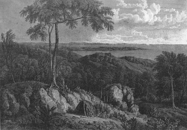 Entrance of Port Lincoln, taken from behind Memory Cove
 Fresh water being at this time the most pressing of our wants, I set off the same afternoon, with a party, to examine the lake or mere discovered from Stamford Hill. The way to it was over low land covered with loose pieces of calcareous rock; the soil was moist in some places, and, though generally barren, was overspread with grass and shrubs, interspersed with a few clumps of small trees. After walking two miles we reached the lake, but to our mortification the water was brackish and not drinkable; the distance, besides, from Port Lincoln was too great to roll casks over a stony road. This piece of water was named Sleaford Mere. It is one mile broad, and appeared to be three or four in length. The shore was a whitish, hardened clay, covered at this time with a thin crust, in which salt was a component part. The sun being too near the horizon to admit of going round the mere, our way was bent towards the ship; and finding a moist place within a hundred yards of the head of the port, I caused a hole to be dug there. A stratum of whitish clay was found at three feet below the surface, and on penetrating this, water drained in, which was perfectly sweet though discoloured; and we had the satisfaction to return on board with the certainty of being able to procure water, although it would probably require some time to fill all our empty casks.
Más sobre Explore Port Lincoln 25 Feb - 6 Mar 180262: Examine Sir Joseph Banks' Group 7 March 1802
I landed again in the morning with the botanical gentlemen, taking Arnold's watch and the necessary instruments for ascertaining the latitude and longitude. Twelve other isles of the group were counted, and three rocks above water; and it is possible that some others may exist to the eastward, beyond the boundary of my horizon, for it was not extensive. The largest island seen is four or five miles long, and is low and sandy, except at the north-east and south ends; it was called Reevesby Island, and names were applied in the chart to each of the other isles composing this group. The main coast extended northward from Point Bolingbroke, but the furthest part visible from the top of Kirkby Island was not more than four or five leagues distant.
Más sobre Examine Sir Joseph Banks' Group 7 March 180263: Explore Spencer's Gulph 9-14 March 1802
Our prospect of a channel or strait, cutting off some considerable portion of Terra Australis, was lost, for it now appeared that the ship was entered into a gulph; but the width of the opening round Point Lowly left us a consolatory hope that it would terminate in a river of some importance. In steering for the point we came into 4 fathoms, but on hauling to the eastward found 8, although a dry sand-bank was seen in that direction. The depth afterwards diminished to 6, on which the course for Point Lowly was resumed; and we passed it at the distance of a mile and a half, in 9 fathoms water. Here the gulph was found to take a river-like form, but the eastern half of it was occupied by a dry, sandy spit and shoal water. We continued to steer upwards, before the wind; but as the width contracted rapidly, and there was much shoal water, it was under very easy sail, and with an anchor ready to be let go. At four o'clock, in attempting to steer close over to the western side, we came suddenly into 2½ fathoms; the ship was instantly veered to the eastward, and on the water deepening to 7, we let go the anchor and veered out a whole cable; for the wind blew a fresh gale right up the gulph, and between S. 4° W. and 30° E. there was no shelter from the land. At sunset a second anchor was dropped under foot.
---
Although the continuation of the main coast was not to be distinguished beyond the cape, yet there was land in sight at the distance of seven or eight leagues, from about south to S. 18½° W. Whether this land were an island or a part of the continent, and the wide opening to the eastward a strait or a new inlet, was uncertain; but in either case, the investigation of the gulph was terminated; and in honour of the respectable nobleman who presided at the Board of Admiralty when the voyage was planned and ship put into commission, I named it SPENCER'S GULPH. The cliffy-pointed cape which forms the east side of the entrance, and lies in 35° 18' south and 136° 55' east, was named CAPE SPENCER; and the three isles lying off it, with their rocks, Althorp Isles.
Más sobre Explore Spencer's Gulph 9-14 March 180264: Point Riley 15 March 1802
On the morning of the 15th the wind had shifted to south-east; and the great bank then trending south-westward, we followed it with variable soundings between 3 and 10 fathoms. At ten o'clock the water had deepened to 15; and being then nearer to the west than to the east side of the gulph, and the wind having come more ahead, we tacked to the east-south-east; but in fifty minutes were obliged to steer westward again, having fallen into 3 fathoms on the edge of the bank. This is the narrowest part of the gulph below Point Lowly, the two shores being scarcely more than twenty miles asunder; and of this space, the great eastern bank, if the part where we last had 3 fathoms be connected with it, occupies about eleven, and the shallow water of the west side one or two miles. The soundings we had in stretching westward across the deep channel were, from the shoal, 3, 5, 7, 10, 12, 12, 12, 10, 9, 8, 7, 6, 7, 6, 5 fathoms, at nearly equal distances asunder, and the last at six miles from the western land.
After sounding across the channel we stood back, lying up south-east, and reached within five miles of the eastern shore, where the anchor was dropped in 4½ fathoms; Barn Hill bearing N. 69° E., and a cliffy projection, named Point Riley after the gentleman of that name in the Admiralty, S. 14° W., two or three leagues. This point was the furthest visible part of the eastern shore; and so low and uniform had the coast been from the head of the gulph, that this was the first mark I had found upon it for the survey. The great eastern bank, which we had already followed about sixty miles, seemed to terminate at Point Riley; and from thence southward the gulph greatly enlarges its breadth. The situation of the point is about 33° 53' south and 137° 30' E.
Más sobre Point Riley 15 March 180265: Hardwicke Bay 19 March 1802
The howling of dogs was heard during the night, and at daylight [FRIDAY 19 MARCH 1802] the shore was found to be distant two or three miles, and was woody, rising land, but not of much elevation. A remarkable point, which I named Corny Point, bearing S 73° W. three miles, was the furthest land visible to the westward; its latitude, from meridian observations of Jupiter and the moon, is 34° 52' South, and longitude from the time-keepers 137° 6½' east. Between this point and Point Pearce, twenty-eight miles to the north-north-east, is a large bay, well sheltered from all southern winds, and none others seem to blow with much strength here. The land trends eastward about seven leagues, from Corny Point to the head of the bay; but what the depth of water may be there, or whether any fresh stream fall into it, I am not able to state; the land, however, was better wooded, and had a more fertile appearance than any before seen in the neighbourhood. I called this HARDWICKE BAY, in honour of the noble earl of that title.
Más sobre Hardwicke Bay 19 March 180266: Discover & Explore Kangaroo Island 21-24 March 1802
At ten o'clock we were close under the land; and finding the water tolerably smooth, had shortened sail with the intention of anchoring near a small, sandy beach; but the situation proving to be too much exposed, we steered eastward along the shore under two close-reefed topsails and fore-sail, the wind blowing strong in squalls from the south-west. The furthest land seen ahead at noon was a projecting point, lower than the other cliffs; it bore E. 7° S., four leagues, and and lies in 35° 33' south and 137° 41' east. It was named Point Marsden, in compliment to the second secretary of the Admiralty; and beyond it the coast was found to trend southward into a large bay containing three coves, any one of which promised good shelter from the gale. This was called NEPEAN BAY. in compliment to the first secretary (now Sir Evan Nepean, Bart.), and we hauled up for it; but the strength of the wind was such that a headland forming the east side of the bay was fetched with difficulty. At six in the evening we came to anchor in 9 fathoms, sandy bottom, within a mile of the shore; the east extreme bearing S. 76° E., and the land near Point Marsden, on the west side of Nepean Bay, N. 61° W., six leagues. A piece of high land, seemingly unconnected, bore from N. 45° to 78° E.; but no land could be distinguished to the northward.
Neither smokes nor other marks of inhabitants had as yet been perceived upon the southern land, although we had passed along seventy miles of its coast. It was too late to go on shore this evening; but every glass in the ship was pointed there, to see what could be discovered. Several black lumps, like rocks, were pretended to have been seen in motion by some of the young gentlemen, which caused the force of their imaginations to be much admired; next morning [MONDAY 22 MARCH 1802], however, on going toward the shore, a number of dark-brown kangaroos were seen feeding upon a grass-plat by the side of the wood and our landing gave them no disturbance. I had with me a double-barrelled gun, fitted with a bayonet, and the gentlemen my companions had muskets. It would be difficult to guess how many kangaroos were seen; but I killed ten, and the rest of the party made up the number to thirty-one, taken on board in the course of the day; the least of them weighing sixty-nine, and the largest one hundred and twenty-five pounds. These kangaroos had much resemblance to the large species found in the forest lands of New South Wales, except that their colour was darker, and they were not wholly destitute of fat.
After this butchery, for the poor animals suffered themselves to be shot in the eyes with small shot, and in some cases to be knocked on the head with sticks, I scrambled with difficulty through the brushwood, and over fallen trees, to reach the higher land with the surveying instruments; but the thickness and height of the wood prevented anything else from being distinguished. There was little doubt, however, that this extensive piece of land was separated from the continent; for the extraordinary tameness of the kangaroos and the presence of seals upon the shore concurred with the absence of all traces of men to show that it was not inhabited.
The whole ship's company was employed this afternoon in skinning and cleaning the kangaroos; and a delightful regale they afforded, after four months' privation from almost any fresh provisions. Half a hundred weight of heads, forequarters and tails were stewed down into soup for dinner on this and the succeeding days; and as much steaks given, moreover, to both officers and men as they could consume by day and by night. In gratitude for so seasonable a supply I named this southern land KANGAROO ISLAND.
Más sobre Discover & Explore Kangaroo Island 21-24 March 180267: Discovery of St Vincent's Gulf 30 March 1802
Early in the morning I went in a boat, accompanied by the naturalist, to examine more closely the head of the gulph. We carried from 4 to 3 fathoms water four miles above the ship, when it shoaled to fifteen and eight feet, which brought us to mud flats, nearly dry; but by means of a small channel amongst them we got within half a mile of the shore, and walked to it upon a bank of mud and sand.
In honour of the noble admiral who presided at the Board of Admiralty when I sailed from England, and had continued to the voyage that countenance and protection of which Earl Spencer had set the example, I named this new inlet the GULPH OF ST. VINCENT. To the peninsula which separates it from Spencer's Gulph I have affixed the name of YORKE'S PENINSULA, in honour of the Right Honourable Charles Philip Yorke, who followed the steps of his above-mentioned predecessors at the Admiralty.
Más sobre Discovery of St Vincent's Gulf 30 March 180268: Troubridge Shoal 1 Apr 1802
During the night the wind veered round to east, and at three in the morning to north-east; and a fire being seen on the eastern shore, the fore top sail was laid to the mast. At daybreak we made sail west for the land of the peninsula; and at half-past nine it was less than five miles distant, being very low and sandy. The northern extreme then in sight appeared to be the same land set in the evening at S. 3° E.; the other extreme was not far from Troubridge Hill, on the west side of the entrance to the gulph; and near it was an extensive bank, part of it dry, which I called Troubridge Shoal.
Más sobre Troubridge Shoal 1 Apr 180269: Second Exploration of Kangaroo Island 2-7 Apr 1802
Having now made myself acquainted with the shores of the continent up to Cape Jervis, it remained to pursue the discovery further eastward; but I wished to ascertain previously whether any error had crept into the time-keepers' rates since leaving Kangaroo Island, and also to procure there a few more fresh meals for my ship's company. Our course was in consequence directed for the island, which was visible from aloft; but the winds being very feeble, we did not pass Kangaroo Head until eleven at night. I purposed to have run up into the eastern cove of Nepean Bay, but finding the water to shoal from 12 to 7 fathoms, did not think it safe to go further in the dark, and therefore dropped the anchor about three-quarters of a mile from the shore, and two miles to the south-west-by-west of our former anchorage.
FRIDAY 2 APRIL 1802
Early on the following morning a party was sent to shoot kangaroos, another to cut wood, and the naturalists went to pursue their researches. The observations taken by lieutenant Flinders, compared with those of March 24th, showed the timekeepers to have erred 2' 10" of longitude to the west in the nine days we had been absent; and they had not, consequently, lost quite so much upon a medium as the Port Lincoln rates supposed. This small error, which principally affected the Gulph of St. Vincent, has been corrected in the longitudes there specified and in the chart by an equal proportion.
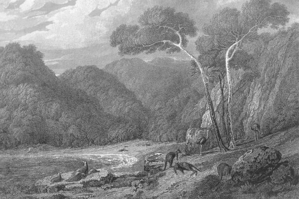 View on the north side of Kangaroo Island
 The kangaroos were found to be less numerous than at the first anchoring place, and they had become shy, so that very few were killed. Those few being brought off, with a boat load of wood, we got under way at daylight next morning to prosecute the examination of the coast beyond Cape Jervis; but the timekeepers had stopped, from having been neglected to be wound up on the preceding day. We therefore came to an anchor again; and as some time would be required to fix new rates, the ship was moored so soon as the flood tide made. I landed immediately, to commence the necessary observations, and a party was established on shore, abreast of the ship, to cut more wood for the holds. Lieutenant Fowler was sent in the launch to the eastward, with a shooting party and such of the scientific gentlemen as chose to accompany him; and there being skins wanted for the service of the rigging, he was directed to kill some seals.
Más sobre Second Exploration of Kangaroo Island 2-7 Apr 180270: Meeting Capt. Baudin at Encounter Bay 8 Apr 1802
Before two in the afternoon we stretched eastward again, and at four a white rock was reported from aloft to be seen ahead. On approaching nearer it proved to be a ship standing towards us, and we cleared for action, in case of being attacked. The stranger was a heavy-looking ship, without any top-gallant masts up; and our colours being hoisted, she showed a French ensign, and afterwards an English jack forward, as we did a white flag. At half-past five, the land being then five miles distant to the north-eastward, I hove to, and learned, as the stranger passed to leeward with a free wind, that it was the French national ship Le Géographe, under the command of captain NICOLAS BAUDIN. We veered round as Le Géographe was passing, so as to keep our broadside to her, lest the flag of truce should be a deception; and having come to the wind on the other tack, a boat was hoisted out, and I went on board the French ship, which had also hove to.
As I did not understand French, Mr. Brown, the naturalist, went with me in the boat. We were received by an officer who pointed out the commander, and by him were conducted into the cabin. I requested captain Baudin to show me his passport from the Admiralty; and when it was found and I had perused it, offered mine from the French marine minister, but he put it back without inspection. He then informed me that he had spent some time in examining the south and east parts of Van Diemen's Land, where his geographical engineer, with the largest boat and a boat's crew, had been left, and probably lost. In Bass Strait captain Baudin had encountered a heavy gale, the same we had experienced in a less degree on March 21 in the Investigator's Strait. He was then separated from his consort, Le Naturaliste; but having since had fair winds and fine weather, he had explored the South Coast from Western Port to the place of our meeting without finding any river, inlet or other shelter which afforded anchorage. I inquired concerning a large island said to lie in the western entrance of Bass Strait; but he had not seen it, and seemed to doubt much of its existence.
Más sobre Meeting Capt. Baudin at Encounter Bay 8 Apr 180271: Cape Jaffa 12 Apr 1802
From Encounter Bay to this slight projection the coast is little else than a bank of sand, with a few hummocks on the top, partially covered with small vegetation; nor could anything in the interior country be distinguished above the bank. The shore runs waving between east-south-east and south-south-east; but to form what is called Cape Bernouilli it trends south, and then curves back south-eastward into a bight. The land then becomes better clothed with bushes and small trees; and it also differs from the more northern part in that some little risings of back land were visible.
Our soundings were more shallow along this part of the coast than before. The depth in passing Cape Bernouilli was from 8 to 12 fathoms; and on tacking out of the southern bight, at half past five in the evening, it was no more than 6, at three miles from the shore. We then saw land extending as far out as S. 29° W., which was the south head of the bight, and appears to be the Cape Jaffa of the French; but I do not find that they have given any name to the bight or bay, although much more deserving than some other sinuosities in the coast on which that honour is conferred.
Más sobre Cape Jaffa 12 Apr 180272: Cape Bridgewater 19 Apr 1802
A constant succession of rainy squalls prevented us from knowing how the land lay for some time, nor could an observation for the latitude be obtained; but at half-past noon our anxiety was relieved by distinguishing the furthest extreme, a bold, cliffy, cape, bearing S. 72½° E., broad on the lee bow.
[SOUTH COAST. OFF CAPE BRIDGEWATER.]
This high projection was the Cape Bridgewater of captain Grant. A hill upon it slopes to the edge of the cliffs in which the cape is begirt toward the sea; and on the land side it descends so low that the connection of the hill with the main could not be clearly discerned. To the northward, and nearly in a line with the first, are two other hills almost equal to it in elevation. As we passed Cape Bridgewater, a second cliffy head opened at S. 73½° E., and a further round the last at N. 83° E. These are the Capes Nelson and Sir W. Grant, though differing considerably in relative position from what they are laid down in captain Grant's chart.
Más sobre Cape Bridgewater 19 Apr 180273: Explore King Island 21 Apr 1802
We were now entered into Bass' Strait; and the subsiding of the sea made me suspect that the large island, concerning which I had made inquiry of captain Baudin, was to windward. The south part of this island was discovered by Mr. Reid in a sealing expedition from Port Jackson; and before quitting New South Wales in 1799, I had received an account of its lying to the north-west of Hunter's Isles. It afterwards appeared that the northern part was seen in January 1801 by Mr. John Black, commander of the brig Harbinger, who gave to it the name of KING'S ISLAND. Of this I was ignorant at the time; but since it was so very dangerous to explore the main coast with the present south-west wind, I was desirous of ascertaining the position of this island before going to Port Jackson, more especially as it had escaped the observation of Captain Baudin.
Más sobre Explore King Island 21 Apr 180274: Arrival at Port Phillip 27 Apr 1802
This, however, was not Western Port, as we found next morning [TUESDAY 27 APRIL 1802]; and I congratulated myself on having made a new and useful discovery; but here again I was in error. This place, as I afterwards learned at Port Jackson, had been discovered ten weeks before by lieutenant John Murray, who had succeeded captain Grant in the command of the Lady Nelson. He had given it the name of PORT PHILLIP, and to the rocky point on the east side of the entrance that of Point Nepean.
Our situation was found in the morning to be near two miles from the south shore, and the extreme towards Point Nepean bore N. 83° W., two leagues. About three miles to the north-by-west were some dry rocks, with bushes on them, surrounded with mud flats; and they appeared to form a part of the same shoal from which we had three times tacked in 2½ and 3 fathoms. The mud bank where the ship had grounded is distinct from the middle shoal; but I am not certain that it is so from the south shore, from which it is one mile distant. The Bluff Mount (named Arthur's Seat by Mr. Murray, from a supposed resemblance to the hill of that name near Edinburgh) bore S. 76° E.; but from thence the shore trended northward so far that the land at the head of the port could not be seen even from aloft. Before proceeding any higher with the ship I wished to gain some knowledge of the form and extent of this great piece of water; and Arthur's Seat being more than a thousand feet high and near the water-side, presented a favourable station for that purpose.
Más sobre Arrival at Port Phillip 27 Apr 180275: Resupply at Port Jackson 9 May 1802
I tried to beat up for the port in the night, being sufficiently well acquainted to have run up in the dark, had the wind permitted; but we were still to leeward in the morning [SUNDAY 9 MAY 1802], and Mr. Westall made a good sketch of the entrance. At one o'clock, we gained the heads, a pilot came on board, and soon after three the Investigator was anchored in Sydney Cove.
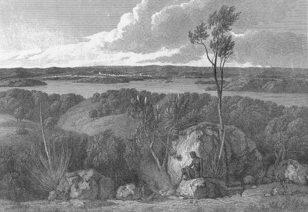 View of Port Jackson, taken from the South Head
 There was not a single individual on board who was not upon deck working the ship into harbour; and it may be averred that the officers and crew were, generally speaking, in better health than on the day we sailed from Spithead, and not in less good spirits. I have said nothing of the regulations observed after we made Cape Leeuwin; they were little different from those adopted in the commencement of the voyage, and of which a strict attention to cleanliness and a free circulation of air in the messing and sleeping-places formed the most essential parts. Several of the inhabitants of Port Jackson expressed themselves never to have been so strongly reminded of England as by the fresh colour of many amongst the Investigator's ship's company.
Más sobre Resupply at Port Jackson 9 May 180276: Depart Port Jackson 22 July 1802
Lieutenant John Murray, commander of the brig Lady Nelson, having received orders to put himself under my command, I gave him a small code of signals, and directed him, in case of separation, to repair to Hervey's Bay; which he was to enter by a passage said to have been found by the south-sea whalers, between Sandy Cape and Break-sea Spit. In the morning of July 22, we sailed out of Port Jackson together; and the breeze being fair and fresh, ran rapidly to the northward, keeping at a little distance from the coast.
At eleven o'clock, the south head of Broken Bay bore W. by N. three leagues; and Mr. Westall then made a sketch of the entrance, with that of the Hawkesbury River, which falls into it (Atlas, Plate XVIII, View 2). The colonists have called this place Broken Bay, but it is not what was so named by captain Cook; for he says it lies in latitude 33° 42' (Hawkesworth III. 103), whereas the southernmost point of entrance is not further than 33° 34' south. There is, in captain Cook's latitude, a very small opening, and the hills behind it answer to his description of "some broken land that seemed to form a bay," when seen at four leagues, the distance he was off; but in reality, there is nothing more than a shallow lagoon in that place. In consequence of this difference in position, Cape Three-points has been sought three or four leagues to the north of Broken Bay; whereas it is the north head of the entrance into the bay itself which was so named, and it corresponds both in situation and appearance.
Más sobre Depart Port Jackson 22 July 180277: Cape Byron & Mt. Warning 25 July 1802
Cape Byron is a small steep head, projecting about two miles from the low land, and in coming along the coast makes like an island; its latitude is 28° 38', and longitude 153° 37', or 7' east of the situation assigned to it by captain Cook. There are three rocks on its north side; and in the direction of N. 57° W., eight or nine leagues from it, is the peaked top of a mass of mountains, named by its discoverer Mount Warning; whose elevation is about 3300 feet, and exceeds that of Mount Dromedary, or any other land I have seen upon this East Coast. To Mr. Westall's sketch of this remarkable peak (Atlas, Plate XVIII. View 3.) it may be added, that the surrounding hills were well covered with wood, whose foliage announced a soil more fertile than usual so near the sea side.
The sun was near setting at the time Cape Byron bore west, three or four miles; and the coast from thence to Point Look-out having been seen by captain Cook, we steered off in order to avoid falling in with the reefs of Point Danger in the night. At eleven, hauled more in for the land; and at eight next day [MONDAY 26 JULY 1802], Mount Warning was set at S. 25° W., twenty leagues.
Más sobre Cape Byron & Mt. Warning 25 July 180278: Hervey Bay 28 July 1802
At one o'clock we steered northward, close to the edge of Break-sea Spit, searching for a passage through it into Hervey's Bay. There were many small winding channels amongst the breakers, and a larger being perceived at three, the boat was sent to make an examination; in the mean time, the wind having shifted to north-west and become very light, we dropped the stream anchor two miles from the Spit, in 11 fathoms, fine grey sand. The channel where the boat was sounding, and out of which a tide came of more than one mile an hour, bore W. by N.½ N., and Sandy Cape S. 24° to 41° W., about three leagues.
Soon after sunset the master returned, and reported the channel to be nearly a mile and a half wide, and that it went quite through to the bay; but it did not generally contain more than fourteen feet water, and was therefore impassable for the Investigator. The bottom of this, and of the former small channel, as also the shoaler banks of the Spit, were of coral, mixed with coral sand.
Más sobre Hervey Bay 28 July 180279: Bustard Bay 2 Aug 1802
There was no remarkable projection till we came to the south head of Bustard Bay; and the night being then at hand, we ran in and anchored on a sandy bottom, in 4½ fathoms, nearly in the same spot where the Endeavour had lain thirty-two years before.
The rocky south head of Bustard Bay, from the survey between the preceding and following noons, should lie in 24° 9' south, and the time keepers placed it in 151° 52' east; or 5' south and 10' east of captain Cook's situation; nor did the form of the Bay correspond to his chart.* The variation observed a few miles from the anchorage, was 8° 20' east, with the ship's head N. W. by N., or 6° 52' reduced to the meridian; nearly as had been found in the morning, when it was 6° 56' corrected. This is a full degree less than it was on the east side of Sandy Cape, and captain Cook's observations show a still greater diminution.
A low island was seen from the mast head, bearing north at the supposed distance of six leagues, of which captain Cook does not make any mention;* and the furthest visible part of the main land was a conspicuous hill, named Mount Larcom, in compliment to captain Larcom of the navy. It bore W. ½° N., ten or eleven leagues; but the coast line between it and the north head of Bustard Bay, seemed to be much broken.
Más sobre Bustard Bay 2 Aug 180280: Port Curtis 5 Aug 1802
The opening was not so much as a mile in width, but from the extent of water within, it was conjectured to have a communication with the bight on the south side of Gatcombe Head; and this being an object worthy of examination, the sails were furled and the boats hoisted out. The naturalist and his companions landed at the west side of the entrance, where some Indians had assembled to look at the ship; but they retired on the approach of our gentlemen, and afterwards taking the advantage of a hillock, began to throw stones at the party; nor would they desist until two or three muskets were fired over their heads, when they disappeared. There were seven bark canoes lying on the shore, and near them hung upon a tree some parts of a turtle; and scoop nets, such as those of Hervey's Bay, were also seen.
I proceeded up the opening in a boat, and lieutenant Murray got under way to follow with the brig; but the tide ran up so rapidly, over a bottom which was rocky and very irregular in depth, that he anchored almost immediately, and came to the middle islet where I was taking angles. We then went over to the west shore, and ascended a hill called in the chart, Hill View; from whence it was evident, that this water did certainly communicate with the bight round Gatcombe Head, and by an opening much more considerable than that in which the vessels were anchored; the port was also seen to extend far to the westward, and I was induced to form a regular plan for its examination. The northern entrance being too full of rocks and shoals for the Lady Nelson to pass, although drawing no more than six feet when the keels were hoisted up, Mr. Murray was desired to go round to the southern opening; and about sunset he got under way.
---
As much time having been employed in the examination of this port as the various objects I had in view could permit, we prepared to quit it on the following morning. This part of the East Coast had been passed in the night by captain Cook; so that both the openings escaped his notice, and the discovery of the port fell to our lot. In honour of admiral Sir Roger Curtis, who had commanded at the Cape of Good Hope and been so attentive to our wants, I gave to it the name of PORT CURTIS; and the island which protects it from the sea, and in fact forms the port, was called Facing Island. It is a slip of rather low land, eight miles in length, and from two to half a mile in breadth, having Gatcombe Head for its southern extremity.
Más sobre Port Curtis 5 Aug 180281: Keppel Bay 9 Aug 1802
In following the low and rather sandy shore, northward to Cape Capricorn, we passed within a rocky islet and another composed of rock and sand, four miles south-east of the cape, the soundings being there from 8 to 9 fathoms; and at ten o'clock hauled round for Cape Keppel, which lies from Cape Capricorn N. 80° W., ten miles. The shore is low, with some small inlets in it, and sand banks with shoal water run off more than two miles; at six miles out there is a hummocky island and four rocks, one of which was at first taken for a ship. We passed within these, as captain Cook had before done; and at half past two in the afternoon anchored in Keppel Bay, in 6 fathoms soft bottom, three-quarters of a mile from a head on the east side of the entrance.
My object in stopping at this bay was to explore two openings marked in it by captain Cook, which it was possible might be the entrances of rivers leading into the interior. So soon as the ship was secured, a boat was sent to haul the seine, and I landed with a party of the gentlemen to inspect the bay from an eminence called Sea Hill. There were four places where the water penetrated into the land, but none of these openings were large; that on the west side, in which were two islands, was the most considerable, and the hills near it were sufficiently elevated to afford an extensive view; whereas in most other parts, the shores were low and covered with mangroves. These considerations induced me to begin the proposed examination by the western arm; and early next morning [TUESDAY 10 AUGUST 1802] I embarked in the Lady Nelson, intending to employ her and my whale boat in exploring the bay and inlets, whilst the botanists made their excursions in the neighbourhood of the ship.
Más sobre Keppel Bay 9 Aug 180282: Port Bowen 20 Aug 1802
Instead of a bight in the coast, we found this to be a port of some extent; which had not only escaped the observation of captain Cook, but from the shift of wind, was very near being missed by us also. I named it PORT BOWEN, in compliment to captain James Bowen of the navy; and to the hilly projection on the south side of the entrance (see the sketch), I gave the appellation of Cape Clinton, after colonel Clinton of the 85th, who commanded the land, as captain Bowen did the sea forces at Madeira, when we stopped at that island
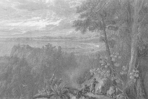 View of Port Bowen, from behind the Watering Gully
 A boat was despatched with the scientific gentlemen to the north side, where the hills rise abruptly and have a romantic appearance; another went to the same place to haul the seine at a small beach in front of a gully between the hills, where there was a prospect of obtaining fresh water; and a third boat was sent to Entrance Island with the carpenters to cut pine logs for various purposes, but principally to make a main sliding keel for the Lady Nelson. Our little consort sailed indifferently at the best; but since the main keel had been carried away at Facing Island, it was as unsafe to trust her on a lee shore, even in moderate weather. On landing at Entrance Island, to take angles and inspect the form of the port, I saw an arm extending behind Cape Clinton to the southward, which had the appearance of a river; a still broader arm ran westward, until it was lost behind the land; and between Entrance Island and Cape Clinton was a space three miles wide, where nothing appeared to obstruct the free passage of a ship into both arms. Finding the port to be worthy of examination, and learning that the seine had been successful and that good water was to be procured, I left orders with lieutenant Fowler to employ the people in getting off pine logs and watering the ship; and early next morning [SUNDAY 22 AUGUST 1802], set off in my whale boat upon an excursion round the port.
Más sobre Port Bowen 20 Aug 180283: Shoalwater Bay 27 Aug 1802
On weighing the kedge anchor to go further up the passage, it came up broken near the crown, having in all probability hooked a rock. The Lady Nelson went one mile ahead, a boat was kept sounding close to the ship, and in this manner we drifted up with the flood tide, till half past eight; when another kedge anchor was dropped in 7 fathoms, a short mile from the land on each side, and two from the inner end of the opening. Lieutenant Fowler was immediately sent away in the whale boat, to search for the lost cutter; and in the mean time we weighed with the afternoon's flood, to get through the passage. On approaching a low, triangular island on the eastern shore, the depth diminished quick, and an anchor was let go; but in swinging to it, the ship caught upon a bank of sand and shells where there was no more than twelve feet water. In half an hour the tide floated her off; and the whale boat having returned, but without any information of the cutter, it was kept ahead; and before dark we anchored in 5 fathoms, at the entrance of Shoalwater Bay.
The opening through which we had come was named Strong-tide Passage. It is six miles long, and from one to two broad; but half the width is taken up by shoals and rocks, which extend out from each shore and sometimes lie near the mid-channel; and the rapid tides scarcely leave to a ship the choice of her course. The bottom is rocky in the outer entrance, but in the upper part seems more generally to consist of sand and shells. By the swinging of the ship, it was high water ten hours after the moon's passage, and the rise was thirteen feet by the lead; but at the top of the springs it is probably two or three feet greater; and the rate at which the tides then run, will not be less than five miles an hour. It will be perceived, that I do not recommend any ship to enter Shoal-water Bay by this passage.
Más sobre Shoalwater Bay 27 Aug 180284: Thirsty Sound 4 Sept 1802
At noon September 4, when the botanical gentlemen returned from their excursion to Pine Mount, we made sail out of Shoal-water Bay with a breeze from the eastward. In steering north-west amongst the small islands, the soundings were between 9 and 14 fathoms; and nearly the same afterwards, in keeping at three or four miles from the coast. I intended to go into Thirsty Sound; but not reaching it before dark, the anchor was dropped in 8 fathoms, sandy bottom, when the top of Pier Head bore west, three miles. In the morning [SUNDAY 5 SEPTEMBER 1802] we ran into the Sound, and anchored in 6 fathoms, with the points of entrance bearing N. 16° and S. 67° E., one mile. The carpenters had for some time been employed in making a sliding keel for the Lady Nelson, from the pine logs cut in Port Bowen; and being now finished, it was sent on board.
The botanists landed upon the east shore, preferring the main land for their pursuits; and the launch was sent to haul the seine on that side, at a beach a little way up the Sound. I went to the top of Pier Head and took bearings of the Northumberland Islands, as also of the points and hills of the coast to the east and west; the most essential of them to the connexion of the survey, were as under:
Más sobre Thirsty Sound 4 Sept 180285: Percy Isles 28 Sept 1802
On quitting Broad Sound, we steered for the north-easternmost of the Northumberland Islands., which I intended to visit in the way to Torres' Strait. These are no otherwise marked by captain Cook, than as a single piece of land seen indistinctly, of three leagues in extent; but I had already descried from Mount Westall and Pier Head a cluster of islands, forming a distinct portion of this archipelago; and in honour of the noble house to which Northumberland gives the title of duke, I named them Percy Isles.
---
We got under way again in the morning [WEDNESDAY 29 SEPTEMBER 1802]; but the wind being light and unfavourable, and the tide adverse, I went off in the whale boat, accompanied by Messrs. Brown and Westall, to examine the passage between the rocky islets and No. 2, directing lieutenant Fowler to follow with the ship when the signal should be made. We first landed at the islets, where the same kind of pine as seen at Port Bowen and other places, was abundant; and leaving the two gentlemen there, I sounded the passage, which was a mile and a half wide, with a sandy bottom of 8 to 13 fathoms deep, and sheltered from all eastern winds. The signal was then made to the ship; and so soon as she was brought to anchor, I went to examine a little cove, or basin, into which the height of the surrounding hills gave expectation of finding a run of fresh water. The entrance is little more than wide enough for the oars of a rowing boat, the basin, within side, is mostly dry at low water, and the borders are over-run with the tiresome mangrove; but when the tide is in, it is one of the prettiest little places imaginable. In searching round the skirts, between the mangroves and feet of the hills, a torrent-worn gully was found with several holes of water; and one in particular, near the edge of the mangroves, where, by cutting a rolling way for the casks, the holds of the two vessels might be filled; and at a beach without side of the entrance to the basin, several hauls of the seine were made with good success.
Más sobre Percy Isles 28 Sept 180286: Exploring the Reefs 9 Oct 1802
In the morning we steered E. N. E., with a light air from the southward; the brig was ahead, and at half past nine, made the signal for immediate danger; upon which the stream anchor was dropped in 16 fathoms. The tide ran one mile and a half to the E. N. E, and this leading me to expect some opening in that direction, I sent the master to sound past the brig; and on his finding deeper water we followed, drifting with the tide. At eleven he made the signal for being on a shoal, and we came to, in 35 fathoms, broken coral and sand; being surrounded by reefs, except to the westward from whence we had come. On the outside were high breakers, not more than three or four miles distant; these terminated at E. by S., and between them and other reefs further on, there seemed a possibility of finding an outlet; but no access to it could be had, except by a winding circuit amongst the great mass of banks to the southward, which it was not advisable to make upon such an uncertainty. I therefore determined to remain at the present anchorage till low water, when the reefs would be dry, and the channels between them, if any such there were, would be visible: and should nothing better then present itself, to steer north-westward, as close within the line of the high breakers as possible, until an opening should be found.
The latitude observed to the north and south, at this fifth anchorage amongst the reefs, was 20° 53' 15"; longitude by time keeper, 151° 5' east. In the afternoon, I went upon the reef with a party of the gentlemen; and the water being very clear round the edges, a new creation, as it was to us, but imitative of the old, was there presented to our view. We had wheat sheaves, mushrooms, stags horns, cabbage leaves, and a variety of other forms, glowing under water with vivid tints of every shade betwixt green, purple, brown, and white; equalling in beauty and excelling in grandeur the most favourite parterre of the curious florist. These were different species of coral and fungus, growing, as it were, out of the solid rock, and each had its peculiar form and shade of colouring; but whilst contemplating the richness of the scene, we could not long forget with what destruction it was pregnant.
Different corals in a dead state, concreted into a solid mass of a dull-white colour, composed the stone of the reef. The negro heads were lumps which stood higher than the rest; and being generally dry, were blackened by the weather; but even in these, the forms of the different corals, and some shells were distinguishable. The edges of the reef, but particularly on the outside where the sea broke, were the highest parts; within, there were pools and holes containing live corals, sponges, and sea eggs and cucumbers;* and many enormous cockles (chama gigas) were scattered upon different parts of the reef. At low water, this cockle seems most commonly to lie half open; but frequently closes with much noise; and the water within the shells then spouts up in a stream, three or four feet high: it was from this noise and the spouting of the water, that we discovered them, for in other respects they were scarcely to be distinguished from the coral rock. A number of these cockles were taken on board the ship, and stewed in the coppers; but they were too rank to be agreeable food, and were eaten by few. One of them weighed 47½ lbs. as taken up, and contained 3lbs. 2 oz. of meat; but this size is much inferior to what was found by captains Cook and Bligh, upon the reefs of the coast further northward, or to several in the British Museum; and I have since seen single shells more than four times the weight of the above shells and fish taken together.
Más sobre Exploring the Reefs 9 Oct 180287: Cumberland Islands 14 Oct 1802
At daylight the breeze was still from the north-westward, and our course was pursued to the south and south-west, close round the inner end of the reefs, till they trended west and we could no longer keep in with them. The Pine Peak of the northern Percy Isles, and several of the Cumberland Islands were then in sight
Más sobre Cumberland Islands 14 Oct 180288: The Lady Nelson Departs 18 Oct 1802
Our latitude here, by an observation of the moon, was 20° 10' south; and now hoping we should not meet with any more interruption from the reefs, I resolved to send the brig back to Port Jackson. The Lady Nelson sailed so ill, and had become so leewardly since the loss of the main, and part of the after keel, that she not only caused us delay, but ran great risk of being lost; and instead of saving the crew of the Investigator, in case of accident, which was one of the principal objects of her attendance, it was too probable we might be called upon to render her that assistance. A good vessel of the same size I should have considered the greatest acquisition in Torres' Strait and the Gulph of Carpentaria; but circumstanced as was the Lady Nelson, and in want of anchors and cables which could not be spared without endangering our own safety, she was become, and would be more so every day, a burthen rather than an assistant to me. Lieutenant Murray was not much acquainted with the kind of service in which we were engaged; but the zeal he had shown to make himself and his vessel of use to the voyage, made me sorry to deprive him of the advantage of continuing with us; and increased my regret at the necessity of parting from our little consort.
The stores and provisions already supplied to the brig, were returned; and Mr. Murray spared us his old launch, to replace, in some sort, the cutter we had lost in Strong-tide Passage. Nanbarre, one of the two natives, having expressed a wish to go back to Port Jackson, was sent to the Lady Nelson in the morning [MONDAY 18 OCTOBER 1802], with two seamen exchanged for the same number of that vessel's crew; and Mr. Denis Lacy, who had been lent, returned back to the Investigator. I wrote to His Excellency governor King, an account of our proceedings and discoveries upon the East Coast; and requested a new boat might be built against our return to Port Jackson, and that the brig should be repaired and equipped ready to accompany me in the following year.
At nine o'clock we got under way, and showed our colours to bid farewell to the Lady Nelson; she steered southward for the Cumberland Islands, whilst our course was directed north-east, close to the wind. The brig was not out of sight when more reefs were discovered, extending from east to N. N. W.; and in pursuance of my plan to avoid small openings, we bore away to run along their inner side. At noon, the latitude was 19° 58' 20", and longitude by time keeper, 149° 37' east. Reefs extended from E. ½ N. to S. ½ E., at the distance of one to three miles; and there were separate patches somewhat further, bearing W. by N. ½ N. and N. N. E. Between the first and last bearing was an opening of a good appearance, and we hauled up for it; but the water having shoaled to 12 fathoms, though no breakers were seen ahead, we kept away again; and from that time till evening, passed a variety of reefs, hauling up between them to look into the openings, and bearing away when repulsed. None of these banks were dry, nor was there much breaking water upon them; which made it probable that they were far within the outer line of the barrier.
Más sobre The Lady Nelson Departs 18 Oct 180289: Flinders Passage through the Reef 20 Oct 1802
At noon, the latitude from observations to the north and south was 19° 8' 15", and longitude by time keeper, 147° 59' east. No land was in sight, and the high breakers were lost in the eastern quarter; but we had detached reefs in the N. E., the N. E. by N., and W. N. W., distant from two to five miles. Towards the north there was six points of clear water, and I steered onward till near three o'clock; when, besides two new reefs already passed, one on each side, we had five others: two in the E. by N. at the distances of one and five miles. one E. S. E. four miles, another N. W. by W. six miles, and a fifth N. W. by N. three miles. Whether to steer onward amongst these, and trust to finding shelter for the night, or to run south-westward towards the land, and get within all the reefs before night came on, was an important, but difficult point to decide. The reefs in sight were small, and could not afford shelter against the sea which was breaking high upon them; but these breakers excited a hope that we might, even then, be near an opening in the barrier; and although caution inclined to steering back towards the land, this prospect of an outlet determined me to proceed, at least until four o'clock, at the chance of finding either larger reefs for shelter, or a clear sea. We were successful. At four, the depth was 43 fathoms, and no reefs in sight; and at six, a heavy swell from the eastward and a depth of 66 fathoms were strong assurances that we had at length gained the open sea.
---
It has been said, that the width of the opening by which we got out to sea, is uncertain; it is undoubtedly four, and possibly more leagues, but there are many small, unconnected banks in it. To a ship desiring access to any part of the coast, south of Endeavour River, I should certainly recommend her to enter the inclosed sea by the way of Break-sea Spit, if able to choose her own route; but the question is, whether a ship driven by stress of weather, or by accident, to seek the coast, might steer for the opening with a fair prospect of passing through in safety? I certainly think she might; with the precaution of not attempting the passage late in the day. The marks to be given for it, are, the latitude 18° 52', longitude 148° 2', variation 6° east with the ship's head north or south, and the soundings. When right off the opening, bottom will be found at from 70 to 40 fathoms before any reefs come in sight; whereas, if breakers be seen and no soundings can be obtained, it may be certainly concluded that the ship is not in the fair way for this opening, and probably, that no large opening exists in that part of the barrier. On getting soundings and afterwards making the reefs near the situation above given, a ship should push through the first opening of two miles wide that presents itself, and steer south-westward amongst the inner reefs for the land; and it will not be many hours, perhaps minutes, before she will find smooth water and anchoring ground. The commander who proposes to make the experiment, must not, however, be one who throws his ship's head round in a hurry, so soon as breakers are announced from aloft; if he do not feel his nerves strong enough to thread the needle, as it is called, amongst the reefs, whilst he directs the steerage from the mast head, I would strongly recommend him not to approach this part of New South Wales.
Más sobre Flinders Passage through the Reef 20 Oct 180290: Murray Island 29 Oct 1802
Finding by the latitude that we had been set considerably to the north, and were out of the parallel of Murray's Islands, I tacked to the S. S. W.; and at two o'clock, the largest island was seen bearing S. 38° W. about five leagues. Soon afterward, a reef came in sight to the south-east, extending in patches toward the islands; and presently another was distinguished to the westward, from the mast head, which took nearly a parallel direction, the passage between them being about four miles wide. We steered along the lee side of the eastern reef, at the distance of a mile, with soundings from 29 to 24 fathoms, coral sand, until four o'clock; the reef then trended more southward, and we edged away for the islands, of which Mr. Westall sketched the appearance (Atlas Plate XVIII. View 10). At half past five, the largest island bore S. 36° E. to 28° W., one mile and a half; and there being more reefs coming in sight to the westward, the anchor was immediately let go in 20 fathoms, coarse sand and shells. The north and east sides of the island are surrounded by a reef, which may probably include the two smaller isles on its southwest side; but it is totally unconnected with the reefs to the north-east. These appear to be a northern continuation of the vast bank, on the outside of which the Pandora sailed as far as 11½° south, and in the chart of captain Edwards' track, published by Mr. Dalrymple, it is marked as surrounding the islands; whereas it is at least four miles distant from the reef which probably does surround them.
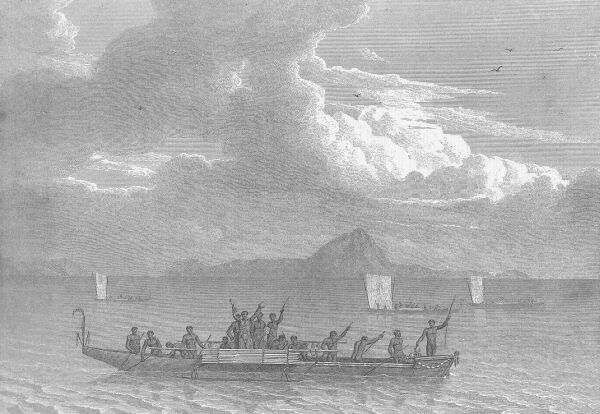 View of Murray's Islands, with the natives offering to barter
 A number of poles standing up in various places, more especially between the islands, appeared at a distance like the masts of canoes, and made me apprehend that the inhabitants of the Strait had collected a fleet here; but on approaching nearer, the poles were found to be upon the reefs, and were probably set up for some purpose connected with fishing. We had scarcely anchored when between forty and fifty Indians came off, in three canoes. They would not come along-side of the ship, but lay off at a little distance, holding up cocoa nuts, joints of bamboo filled with water, plantains, bows and arrows, and vociferating tooree! tooree! and mammoosee! A barter soon commenced, and was carried on in this manner: a hatchet, or other piece of iron (tooree) being held up, they offered a bunch of green plantains, a bow and quiver of arrows, or what they judged would be received in exchange; signs of acceptance being made, the Indian leaped overboard with his barter, and handed it to a man who went down the side to him; and receiving his hatchet, swam back to the canoe. Some delivered their articles without any distrust of the exchange, but this was not always the case. Their eagerness to get tooree was great, and at first, any thing of that same metal was received; but afterwards, if a nail were held up to an Indian, he shook his head, striking the edge of his right hand upon the left arm, in the attitude of chopping; and he was well enough understood.
Más sobre Murray Island 29 Oct 180291: Prince of Wales' Islands 31 Oct 1802
At two o'clock, when we passed on the north side of the double isle, it was seen to be surrounded with a coral reef, and there were rocks on its west and south sides. We then hauled tip S. W. by S. for some rocky islets lying, as I supposed, off Cape York; but finding no shelter there, bore away round the north end of an island, of which Mr. Westall took a view (Atlas, Plate XVIII. View 12), and anchored in 7 fathoms, gravel and shells, one mile and a half from the land, and two or three cables length from a shoal to the southward, which became dry at low water. Our latitude here was 10° 30' from bearings, and longitude by time-keeper 142(? illegible in book) 18½' east; but I was altogether at a loss to know what islands these were, under which we had anchored. Supposing the flat-topped island to have been the easternmost York Isle, the land we had in sight to the southward should have been Cape York; but no such isles as those around us were laid down by captain Cook, to the north of that cape. On consulting the sketch made by captain Bligh in the Bounty's launch (Voyage to the South Seas, p. 220), it appeared that the first land was not the easternmost isle, but one much nearer to Cape York; and that our anchorage was under the southern group of the Prince of Wales' Islands, the longitude of which, by captain Cook, is 1° 12' west of what I make it.* The north-eastern isle of this group, under which we more immediately lay, is that named Wednesday Island by captain Bligh; to the other isles he gave no name; but the one westward of the ship seems to have been the Hammond's Island of captain Edwards, when passing here with the Pandora's boats. So soon as the weather cleared a little, the subjoined bearings were taken.
Más sobre Prince of Wales' Islands 31 Oct 180292: Batavia (Wenlock) River 6 Nov 1802
In the morning we had a breeze off the land; and the fear of the north-west monsoon preventing me from taking time to beat up, we passed Batavia River at the distance of six miles, with soundings from 5 to 8 fathoms. Several flocks of ducks were seen coming from the westward, where they had probably been to pass the night upon some island not inhabited. Our latitude at noon, from double altitudes, was 11° 56', and longitude by time keeper 141° 50'; the clump of trees near the entrance of Batavia River bore E. 1° S., the furthest extreme of the land, S. 11° W., and the nearest part was distant four miles.
On approaching the entrance, a canoe, or something like one, passed and repassed from the north to the south side, the rower using both hands to the paddle like the natives of Murray's Islands. We had a good deal of difficulty to get in, on account of the shoals; the channel amongst them being narrow and winding, and not more than nine to twelve feet deep. On the north side was a party of natives, and Bongaree went on shore to them, naked and unarmed; but although provided with spears, they retreated from him, and all our endeavours to bring about an interview were unsuccessful. It was not safe for the gentlemen to botanise in presence of these suspicious people; and therefore we rowed a mile higher up, to a green looking point on the same side, and landed about noon. The depth thus far, was 2 fathoms; and I could see two-and-half miles further up the inlet to the E. S. E., where it turned more southward, round a woody point; and from the strength of the tide, probably extended some miles into the country.
Más sobre Batavia (Wenlock) River 6 Nov 180293: Coen (Pennefather) River 7 Nov 1802
This small opening appears to be the Coen River of the Dutch chart; but the entrance is too small and shallow to admit any thing larger than boats: its latitude is 12° 13' south, and longitude 141° 47' east; and the variation of the compass, observed with the ship's head in the magnetic meridian, was 4° 36' east. The tide was running from south-west, at ten in in the morning, and on entering the inlet it was found to be setting in with considerable strength; at two in the afternoon the flood was still running; and admitting that it would be high water an hour afterwards, as seemed probable, the time would be five hours and a half after the moon passed the lower meridian; or an hour later than it had appeared to be at the Prince of Wales' Islands.
Más sobre Coen (Pennefather) River 7 Nov 180294: Caron (Flinders?) River 12 Nov 1802
In the afternoon our course along shore was more westward; and this, with the increasing shallowness of the water, made me apprehend that the Gulph would be found to terminate nearly as represented in the old charts, and disappoint the hopes formed of a strait or passage leading out at some other part of Terra Australis. At four o'clock, after running more than an hour in 3½ fathoms, or less than 3 at low water, our distance from the shore was five miles; and a small opening then bore S. 14° E, which seems to be the Caron River, marked at the south-east extremity of the Gulph in the Dutch chart; but whatever it might have been in Tasman's time, no navigator would now think of attempting to enter it with a ship: the latitude is 17° 26', and longitude 140° 52' east. From four till seven our course was W. by S., close to the wind, the depth being mostly 3 fathoms, and the land barely within sight from the mast head. We then stood off; and the water being smooth, anchored on muddy ground, in 4½ fathoms, which became 3½ at low water. The flood tide here set S. S. W., till midnight; and the ebb N. by E., till we got under way in the morning.
Editor's Note: there is considerable confusion as to which actual inlet along this coast is being referred to as The Caron - it may NOT be the entrance to the Flinders River as placemarked. Technically the Flinders River was discovered and named in 1840 by John Lort Stokes in the 3rd voyage of The Beagle.
Más sobre Caron (Flinders?) River 12 Nov 180295: Sweers Island 16 Nov 1802
The hill proved to be a mass of calcareous rock, whose surface was cut and honeycombed as if it had been exposed to the washing of a surf. It was the highest land we had seen in Carpentaria, after having followed one hundred and seventy-five leagues of coast; nor was any land to be distinguished from the top of the hill which had an equal degree of elevation; yet it did not much exceed the height of the ship's mast head! The land round it proved to be an island of five miles long; separated from other land to the west by a channel of nearly two miles in width. The wide opening between this land and the low coast to the southward, I take to have been what is called Maatsuyker's River in the old chart; and that the island, which Tasman, or whoever made the examination, did not distinguish well from being too far off, is the projecting point marked on the west side of that river. Maatsuyker was one of the counsellors at Batavia, who signed Tasman's instructions in 1644; but as there is no river here, his name, as it stands applied in the old chart, cannot remain. I would have followed in the intention of doing him honour, by transferring his name to the island, but Maatsuyker's Isles already exist on the south coast of Van Diemen's Land; I therefore adopt the name of Sweers, another member of the same Batavia council; and call the island at the entrance of the supposed river, Sweers' Island. The hill obtained the name of Inspection Hill; and after taking bearings from it, I rowed into the channel which separates Sweers' Island from the western land; and finding the shelter to be good, the bottom soft, and soundings regular between 3 and 6 fathoms, the shores on each side were searched for fresh water, with a view to filling up the holds there and caulking the ship, before proceeding further in the examination of the Gulph: the search, however, was unsuccessful.
Más sobre Sweers Island 16 Nov 180296: Wellesley's Islands 19 Nov 1802
Next morning at sunrise, we steered up the opening with a land wind at S. S. E.; and until ten o'clock, when we had reached the furthest part of the western land seen from Inspection Hill, the soundings were between 6 and 3 fathoms, reduced to low water. This land proved to be an island of ten or eleven miles long, and I have given it the name of Bentinck, in honour of the Right Hon. LORD WILLIAM BENTINCK; of whose obliging attention, when governor of Madras, I shall hereafter have to speak in praise. To the north-west of Bentinck's Island, several small isles came in sight; but a northern sea breeze having set in, we kept on our western course for the low main land, which trended here north-westward. At one o'clock the diminution of depth to 2½ fathoms, obliged us to tack; the main being four miles distant, and the eastern extreme of the nearest island bearing N. 3° W., two leagues: this was named Allen's Isle, after the practical miner of the expedition. In working to windward, the water was found to be shallow in almost every direction; and the deepest being at three or four miles from the south-west point of Bentinck's Island, the anchor was there dropped in 4½ fathoms, muddy bottom.
Más sobre Wellesley's Islands 19 Nov 180297: Investigator Road (Ship Unseaworthy) 23 Nov 1802
SIR,
In obedience to your directions we have taken with us the oldest carpenter's mate of the Investigator, and made as thorough an examination into the state of the ship as circumstances will permit, and which we find to be as under:
Out of ten top timbers on the larbord side, near the fore channel, four are sound, one partly rotten, and five entirely rotten.
We have seen but one timber on the larbord quarter, which is entirely rotten.
On the starbord bow, close to the stem, we have seen three timbers which are all rotten. Under the starbord fore chains we find one of the chain-plate bolts started, in consequence of the timber and inside plank being rotten; and also a preventer eyebolt, from the same cause.
On boring into the second futtock timbers from the main hold, close under the beams of the lower deck on the larbord side, we find one sound and two rotten; and on the other side, one sound and one rotten.
On boring into one of the second futtock timbers in the cockpit, on each side, we find it to be sound on the starbord, but on the other side rotten: the inside plank on both sides is rotten. On boring into one timber of a side in the after hold, we find them to be sound.
On boring into one timber of a side from the bread room, one is sound; but on the larbord side it is rotten.
The stem appears to be good; but the stemson is mostly decayed.
The lower breast hook is decayed within side.
The transoms, sleepers, stern post, and postson are all sound.
The ends of the beams we find to be universally in a decaying state.
The tree-nails are in general rotten.
From the specimens we have seen of the top-sides and bends, we expect that the insides of them are rotten, fore and aft; but that about one inch of the outside of the greater part is yet quite sound.
After the above report, and upon due consideration, we give the following answers to the four questions put to us.
1st. The ship having before made ten inches of water an hour, in a common fresh breeze, we judge from that, and what we have now seen, that a little labouring would employ two pumps; and that in a strong gale, with much sea running, the ship would hardly escape foundering; so that we think she is totally unfit to encounter much bad weather.
2nd. We have no doubt but that, if the ship should get on shore under any unfavourable circumstances, she would immediately go to pieces; but with a soft bottom and smooth water, she might touch for a short time without any worse consequences than to another ship, if she did not heel much; but altogether, we judge it to be much more dangerous for her to get aground in her present state, than if she were sound.
3rd. It is our opinion that the ship could not bear heaving down on any account; and that laying her on shore might so far strain her as to start the copper and butt ends, which would make her unable to swim without vast repair.
4th. Mr. Aken has known several ships of the same kind, and built at the same place as the Investigator; and has always found that when they began to rot they went on very fast. From the state to which the ship seems now to be advanced, it is our joint opinion, that in twelve months there will scarcely be a sound timber in her; but that if she remain in fine weather and happen no accident, she may run six months longer without much risk.
To Matthew Flinders, Esq. Commander of His Majesty's sloop the Investigator.
We are, Sir, your obedient servants, John Aken, master, Russel Mart, carpenter.
---
I cannot express the surprise and sorrow which this statement gave me. According to it, a return to Port Jackson was almost immediately necessary; as well to secure the journals and charts of the examinations already made, as to preserve the lives of the ship's company; and my hopes of ascertaining completely the exterior form of this immense, and in many points interesting country, if not destroyed, would at least be deferred to an uncertain period. My leading object had hitherto been, to make so accurate an investigation of the shores of Terra Australis that no future voyage to this country should be necessary; and with this always in view, I had ever endeavoured to follow the land so closely, that the washing of the surf upon it should be visible, and no opening, nor any thing of interest escape notice. Such a degree of proximity is what navigators have usually thought neither necessary nor safe to pursue, nor was it always persevered in by us; sometimes because the direction of the wind or shallowness of the water made it impracticable, and at other times because the loss of the ship would have been the probable consequence of approaching so near to a lee shore. But when circumstances were favourable, such was the plan I pursued; and with the blessing of GOD, nothing of importance should have been left for future discoverers, upon any part of these extensive coasts; but with a ship incapable of encountering bad weather--which could not be repaired if sustaining injury from any of the numerous shoals or rocks upon the coast--which, if constant fine weather could be ensured and all accidents avoided, could not run more than six months--with such a ship, I knew not how to accomplish the task.
A passage to Port Jackson at this time, presented no common difficulties. In proceeding by the west, the unfavourable monsoon was likely to prove an obstacle not to be surmounted; and in returning by the east, stormy weather was to be expected in Torres' Strait, a place where the multiplied dangers caused such an addition to be peculiarly dreaded. These considerations, with a strong desire to finish, if possible, the examination of the Gulph of Carpentaria, fixed my resolution to proceed as before in the survey, during the continuance of the north-west monsoon; and when the fair wind should come, to proceed by the west to Port Jackson, if the ship should prove capable of a winter's passage along the South Coast, and if not, to make for the nearest port in the East Indies.
Más sobre Investigator Road (Ship Unseaworthy) 23 Nov 180298: Cape Van Diemen (Mornington Island) 7 Dec 1802
No doubt remained that the land of Cape Van Diemen was an island; for it had been circumnavigated, with the exception of about three leagues, which the rocks and shoal water made impracticable. Its extent is considerable, being thirty-five miles long, and the circumference near ninety, independently of the smaller sinuosities in the coast; I did not land upon any part, but the surface appeared to be more rocky than sandy; and judging from the bushes and trees with which it is mostly covered, there must be some portion, though perhaps a small one, of vegetable soil. In any other part of the world, this would be deemed low land; but here, where even the tops of the trees on the main scarcely exceed a ship's mast head in elevation, it must be called moderately high; for it may in some parts, reach three hundred feet. Several smokes and some natives were seen, and it is reasonable to suppose there are fixed inhabitants, but their number is probably small.
Had not the name of Van Diemen so often occurred in Terra Australis, as to make confusion, I should have extended it from the cape to the whole island; but such being the case, I have taken this opportunity of indulging my gratitude to a nobleman of high character and consideration; who, when governor-general of British India, humanely used his efforts to relieve me from an imprisonment which was super-added to a shipwreck in the sequel of the voyage. This large island is therefore distinguished by the name of Isle Mornington; and to the whole of the group, now discovered to exist at the head of the Gulph of Carpentaria, I have given the appellation of WELLESLEY'S ISLANDS.
Más sobre Cape Van Diemen (Mornington Island) 7 Dec 180299: Cape Vanderlin & Pellew's Group 13 Dec 1802
The main coast on the south side of the opening had been seen extending W. N. W., two or three leagues from the sandy head; it was low as ever, and there was no appearance of the northern land, which was hilly and rocky, being connected with it; and I therefore called the separated piece Vanderlin's Island. Having no prospect of being able to get the ship up the opening, we proceeded northward next morning [TUESDAY 14 DECEMBER 1802], along the east side of the island; but the wind being directly contrary, it was sunset before the outermost of the scattered rocks could be weathered; soon afterward the anchor was dropped in 6 fathoms, one mile and a quarter from the north-east point, and something more from the outer rocks which bore S. 63° E. The north point of the island, which is the true Cape Vanderlin, bore N. 71° W., and was distant three or four miles: its utmost extremity lies in 15° 34½' south, and 137° 8½' east.
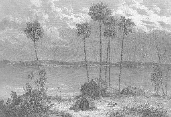 View in Sir Edward Pellew's Group--Gulph of Carpentaria
 In the old Dutch chart, Cape Vanderlin is represented to be a great projection from the main land, and the outer ends of North and West Islands to be smaller points of it. There are two indents or bights marked between the points, which may correspond to the openings between the islands; but I find difficulty in pointing out which are the four small isles laid down to the west of Cape Vanderlin; neither does the line of the coast, which is nearly W. S. W. in the old chart, correspond with that of the outer ends of the islands, and yet there is enough of similitude in the whole to show the identity. Whether any change have taken place in these shores, and made islands of what were parts of the main land a century and a half before--or whether the Dutch discoverer made a distant and cursory examination, and brought conjecture to aid him in the construction of a chart, as was too much the practice of that time--it is perhaps not now possible to ascertain; but I conceive that the great alteration produced in the geography of these parts by our survey, gives authority to apply a name which, without prejudice to the original one, should mark the nation by which the survey was made; and in compliment to a distinguished officer of the British navy, whose earnest endeavours to relieve me from oppression in a subsequent part of the voyage demand my gratitude I have called this cluster of islands SIR EDWARD PELLEW'S GROUP.
Más sobre Cape Vanderlin & Pellew's Group 13 Dec 1802100: Cape Maria 31 Dec 1802
A similar error to that at the Capes Van Diemen and Vanderlin has been made here in the Dutch chart, this island being represented as a projection of the main land, and called Cape Maria. To the west of it is marked a large bay or bight, called Limmen's Bogt, where the coast turns north-eastward to a projecting cape without name, which has a shoal, forty miles in length, running out from it; and between this shoal and Cape Maria, is laid down a small island. In these particulars, the old chart was found to be correct as to the general matter of fact, but erroneous in the forms and positions.
Más sobre Cape Maria 31 Dec 1802101: Bickerton's Island 4 Jan 1803
The weather remained squally, and wind unsettled during the night. In the morning [TUESDAY 4 JANUARY 1803] our course was continued to the northward, leaving extensive land, which I supposed to be the Groote Eylandt of the old charts, six or eight leagues on the starbord hand. Before commencing the investigation of that island, I wished to trace the main coast further on, and if possible, give the botanists an opportunity of examining its productions; for it was upon the main that they usually made the most interesting discoveries, and only once, since entering the Gulph of Carpentaria, had we been able to land there. At seven o'clock we edged in for the coast; and on coming into 3½ fathoms, dropped the anchor on a bottom of blue mud, within a mile of the shore. No part of Groote Eylandt was in sight; but an island of considerable extent and elevation, not noticed in the old chart, lay six or seven miles to the E. N. E.; and I have called it BICKERTON'S ISLAND, in compliment to admiral Sir Richard Bickerton. Between it and the main coast is an open space, from four to six or seven miles wide, through which, to all appearance from this side, a ship might safely pass.
Más sobre Bickerton's Island 4 Jan 1803102: Groote Eylandt (circumnavigated) 5 Jan 1803
Our distance from the west side of Groote Eylandt at four o'clock, was not quite three miles, and we then bore away southward along the shore, in 8 to 6 fathoms water. This depth diminished gradually to 4 fathoms, and suddenly from that to 2½; on which we steered off into 7, and then resumed our southern course.
At the north-west end of Groote Eylandt is a bluff head, the termination that way of a range of woody hills from the interior, of which the highest is what was set under the name of Central Hill. On the west side of the island these hills do not come close to the water side, but leave a space of increasing breadth to the southward, where the land is low, sandy, and sterile; and even the hills, though mostly covered with wood, had little of fertility in their appearance: the shore is partly rock, and in part sandy beach.
Más sobre Groote Eylandt (circumnavigated) 5 Jan 1803103: Blue Mud Bay & Isle Woodah 20 Jan 1803
A party of men was sent to cut wood on the following morning, and another to haul the seine; the botanists also landed, and I went to observe the latitude and take bearings from the west end of the island; every person was armed, for marks of feet had been perceived, so newly imprinted on the sand, that we expected to meet with Indians. After accomplishing my objects, I walked with a small party round the north-west end of the island; and then returned over the high land, through a most fatiguing brush wood, towards the wooders and the boat. On clearing the wood, four or five Indians were seen on a hill, half a mile to the left, and some of the wooding party advancing towards them. The sight of us seemed to give the natives an apprehension of being surrounded, for they immediately ran; but our proceeding quietly down to the boat, which I did in the hope that our people might bring on an interview, appeared to satisfy them. The scientific gentlemen accompanied me on board to dinner; and I learned from Mr. Westall, that whilst he was taking a sketch at the east end of the island, a canoe, with six men in it, came over from Woodah. He took little notice of them until, finding they saw him and landed not far off, he thought it prudent to retreat with his servant to the wooding party. The natives followed pretty smartly after him; and when they appeared on the brow of the hill, Mr. Whitewood, the master's mate, and some of his wooders went to meet them in a friendly manner. This was at the time that the appearance of my party caused them to run; but when we left the shore they had stopped, and our people were walking gently up the hill.
The natives had spears, but from the smallness of their number, and our men being armed, I did not apprehend any danger; we had, however, scarcely reached the ship, when the report of muskets was heard; and the people were making signals and carrying some one down to the boat, as if wounded or killed. I immediately despatched two armed boats to their assistance, under the direction of the master; with orders, if he met with the natives, to be friendly and give them presents, and by no means to pursue them into the wood. I suspected, indeed, that our people must have been the aggressors; but told the master, if the Indians had made a wanton attack, to bring off their canoe by way of punishment; intending myself to take such steps on the following day, as might be found expedient.
At five o'clock Mr. Whitewood was brought on board, with four spear wounds in his body. It appeared that the natives, in waiting to receive our men, kept their spears ready, as ours had their muskets. Mr. Whitewood, who was foremost, put out his hand to receive a spear which he supposed was offered; but the Indian, thinking perhaps that an attempt was made to take his arms, ran the spear into the breast of his supposed enemy. The officer snapped his firelock, but it missed, and he retreated to his men; and the Indians, encouraged by this, threw several spears after him, three of which took effect. Our people attempted to fire, and after some time two muskets went off, and the Indians fled; but not without taking away a hat which had been dropped. Thomas Morgan, a marine, having been some time exposed bare-headed to the sun, was struck with a coup-de-soleil; he was brought on board with Mr. Whitewood, and died in a state of frenzy, the same night.
Más sobre Blue Mud Bay & Isle Woodah 20 Jan 1803104: Explore Mt Grindall 28 Jan 1803
Whilst the botanists continued to follow their pursuits upon Point Blane, I went over in the whale-boat to Mount Grindall, with the landscape painter; from whence, after cutting down some small trees at the top, my view extended over all the neighbouring islands, points, and bays. Blue-mud Bay was seen to reach further north than Mount Grindall, making it to be upon a long point, which I also named Point Grindall, from respect to the present vice-admiral of that name; further west, in the bay, was a stream running five or six miles into the land, terminating in a swamp, and with shoal banks and a low island at the entrance; all the northern part of the bay, indeed, seemed to be shallow, and to have no ship passage into it on the north side of Isle Woodah. The large bight between Points Grindall and Blane extended two leagues above the ship, but it did not appear to receive any stream of water; a still larger bight, between Point Blane and Cape Shield was also visible, though not so distinct as to speak of it particularly: the extremity of the cape bore S. 76° 15' E. An observation to the north and south, taken on the outermost rocks, places Mount Grindall in 13° 15½' south; and the longitude from survey is 136° 6 1/3' east. Mr. Westall's sketch in the Atlas, taken from the ship at anchor under Point Blane, will show the appearance of this mount and of the neighbouring land. (Atlas, Plate XVIII. View 13.)
The top of Mount Grindall consists of the same kind of sand stone, with particles of quartz in it, as seen at Groote Eylandt; but the rocks on the shore are granite, and one block made a brilliant appearance from the quantity of mica it contained. There is very little soil on the surrounding land, the surface being either sandy or stony; it was however mostly covered with grass and wood, and amongst the trees was a cluster of the new species of eugenia, from which the boat's crew filled their handkerchiefs with fruit, which they called apples. Two natives were distinguished upon Round-hill Island; but none at Point Grindall, nor any thing to show that they had been there recently: the foot-marks of dogs and kangaroos were both recent and numerous.
Más sobre Explore Mt Grindall 28 Jan 1803105: Cape Grey 2 Feb 1803
We worked to windward all night, with a north-western breeze; and in the morning [WEDNESDAY 2 FEBRUARY 1803] saw two islands, the outermost rather low and flat, nearly in the situation where three are marked in the Dutch chart. These are laid down at the entrance of an opening, of a river-like form; and there appeared to be a wide opening behind them, the entrance being round a projection upon which is the hummock set at N. 2½° E. in the evening: this projection I have named CAPE GREY, in compliment to the Hon. general Grey, lately commander of the forces at the Cape of Good Hope.
Más sobre Cape Grey 2 Feb 1803106: Explore Mt Caledon 5 Feb 1803
Finding these people so determinately bent upon stealing every thing within their reach, I ordered lieutenant Fowler to watch an opportunity of seizing two of them; and after a while to release one, making him understand that the other would be carried away in the ship, if the stolen axe were not returned. In the evening, I went over with two of the gentlemen to the south side of the bay; for the purpose of taking a station upon a hill there named Mount Caledon, whose height exceeded that of any other near the water side.
We landed at dusk, at the foot of the mount; and ascended the top next morning [SUNDAY 6 FEBRUARY 1803] before the heat of the sun became excessive, passing in the way several streamlets which were coursing rapidly down to the sea. The view was fully equal to what had been anticipated, and extended to a projection half way to Point Arrowsmith on one side, and over all the islands in the entrance to Mount Alexander on the other.
Más sobre Explore Mt Caledon 5 Feb 1803107: Caledon Bay 9 Feb 1803
It has been said, that an opening of a river-like form is laid down in the Dutch chart, in the situation of this bay. No name is there given to it; and as I conceive our examination to confer the right of bestowing one, I have distinguished it by the title of CALEDON BAY, as a mark of respect to the worthy nobleman, lately governor of the Cape of Good Hope, after whom the mount on the south side was also named.
There is no other safe passage into the bay than that between the islands in the entrance and Cape Grey; which cape is remarkable for the round hummock on its extremity, and lies in latitude 13° 1' south, and longitude 136° 42' east. The western branch of the bay appeared to be shallow, and not well sheltered, so that I did not go up it to sound; but in the eastern branch, which is near three miles wide, there is from 4 to 3 fathoms on blue mud, up to within three-quarters of a mile of a rocky point at the head; and the rocks of Point Alexander may there be nearly, if not altogether brought to shut on with those of Cape Grey. Wood for fuel was plentiful every where, and there was no difficulty in procuring water from the ponds and holes in the low, sandy land near the shore of Point Alexander; but from May to December, I doubt whether they would not all be dried up, as well as the small streams which descended from Mount Caledon. Our success with the seine was very moderate, more sea slugs, or what we called sea cucumbers from their shape, being brought on shore than fish; these differed from what we had seen on the reefs of the East Coast, in being of a more firm consistence, and of a light brown or grey, instead of a black colour: when these slugs were pressed with the foot, they threw out a stream of water to some distance.
Más sobre Caledon Bay 9 Feb 1803108: Cape Arnhem 11 Feb 1803
We steered on till eight o'clock, and then anchored in 21 fathoms, blue mud. At daylight [FRIDAY 11 FEBRUARY 1803], the shore was found to be distant four or five miles; the furthest part then seen was near the eastern extremity of Arnhem's Land, and this having no name in the Dutch chart, is called CAPE ARNHEM.
At eight in the morning we passed Cape Arnhem, a smooth grassy projection which rises gently from the water's edge into the country, but is no where of much elevation; a broad rock lies near the south-eastern extremity, and its position was ascertained to be 12° 19' south, and 137° 1' east. Strong ripplings of a tide or current extended some distance off the cape, and in passing through them we had irregular soundings between 27 and 18 fathoms; beyond Cape Arnhem the shore trended N. W. by N., in rocky points and shallow bights, but the wind being from that direction, we could not follow it closely. The furthest land visible at noon was a flat-topped hill which I call Mount Saunders, and nearer to us was a higher and more woody hill, also flat-topped and steep at its north end, to which is given the name of Mount Dundas.
Más sobre Cape Arnhem 11 Feb 1803109: Melville Bay 12 Feb 1803
Two natives, with a canoe, had been seen upon the island; and as our boat stood that way, sounding ahead of the ship, they waved and called to the people. The island is about five miles long, and between one and two in breadth; it is low, mostly destitute of wood, and the shores in general are sandy; and not being laid down in the Dutch chart, I distinguish it, with the islets and rocks to the north and north-east, by the name of Melville Isles: the south end which forms the passage, lies in 12° 8½' south, and 136° 52' east. In the opposite shore, between Mount Saunders and Dundas, is a sandy bight where ships would be sheltered from all winds except those at north-east, if the water be deep enough for them. The trees upon the hills showed a dark-green foliage; but the low land, especially under Mount Saunders, was sandy and barren, and so continued for seven miles westward, to a low point near a woody islet. Further on, the coast took a northern direction, and was seen from the mast head as far as N. N. W.; but no other part could be set from the deck than the highest of several eminences on the back land, named Mount Bonner, which proved to be an useful mark in the survey.
This bay is unnoticed in the Dutch chart, and I name it MELVILLE BAY, in compliment to the Right Hon. Robert Saunders Dundas, viscount Melville, who, as first lord of the Admiralty, has continued that patronage to the voyage which it had experienced under some of his predecessors. It is the best harbour we found in the Gulph of Carpentaria; the entrance is from the N. N. W., four miles wide, and free from danger; and within side, the sole dangers not conspicuous, are a sandy spit running half a mile to the S. S. E. from Point Dundas, and the Half-tide Rock.
Más sobre Melville Bay 12 Feb 1803110: English Company's Islands 16 Feb 1803
After clearing the narrow passage between Cape Wilberforce and Bromby's Isles, we followed the main coast to the S. W.; having on the starbord hand some high and large islands, which closed in towards the coast ahead so as to make it doubtful whether there were any passage between them. Under the nearest island was perceived a canoe full of men; and in a sort of roadsted, at the south end of the same island, there were six vessels covered over like hulks, as if laid up for the bad season. Our conjectures were various as to who those people could be, and what their business here; but we had little doubt of their being the same, whose traces had been found so abundantly in the Gulph. I had inclined to the opinion that these traces had been left by Chinese, and the report of the natives in Caledon Bay that they had fire arms, strengthened the supposition; and combining this with the appearance of the vessels, I set them down for piratical Ladrones who secreted themselves here from pursuit, and issued out as the season permitted, or prey invited them. Impressed with this idea, we tacked to work up for the road; and our pendant and ensign being hoisted, each of them hung out a small white flag. On approaching, I sent lieutenant Flinders in an armed boat, to learn who they were; and soon afterward we came to an anchor in 12 fathoms, within musket shot; having a spring on the cable, and all hands at quarters.
Every motion in the whale boat, and in the vessel along-side which she was lying, was closely watched with our glasses, but all seemed to pass quietly; and on the return of lieutenant Flinders, we learned that they were prows from Macassar, and the six Malay commanders shortly afterwards came on board in a canoe. It happened fortunately that my cook was a Malay, and through his means I was able to communicate with them. The chief of the six prows was a short, elderly man, named Pobassoo; he said there were upon the coast, in different divisions, sixty prows, and that Salloo was the commander in chief. These people were Mahometans, and on looking into the launch, expressed great horror to see hogs there; nevertheless they had no objection to port wine, and even requested a bottle to carry away with them at sunset.
So soon as the prows were gone, the botanical gentlemen and myself proceeded to make our examinations. The place where the ship was anchored, and which I call Malay Road, is formed by two islands: one to the S. W.. now named Pobassoo's Island, upon which was a stream of fresh water behind a beach; the other to the north, named Cotton's Island, after captain Cotton of the India directory. The opening between them is nearly half a mile wide; but the water being shallow, the road is well sheltered on the west side, and the opposite main coast lies not further off to the east than three miles; so that N. E. is the sole quarter whence much swell can come. I landed upon Cotton's Island; and ascending a high cliff at the south-east end, saw Mount Saunders and the northernmost Melville Isle over the land of Cape Wilberforce. Cotton's Island extends six or seven miles to the north. and beyond it, to the north-east, was another large island, which I called Wigram's, whose south-east part is also a high cliff. Further off were two small isles; and at a greater distance another, named Truant Island, from its lying away from the rest. Pobassoo's Island intercepted my view to the S. W.; but on moving back to a higher station, two other islands were seen over it, close to each other; to the furthest and largest I gave the name of Inglis, and to the nearer that of Bosanquet. In the west also, and not more than three miles distant, was an island of considerable size, which was distinguished by the name of Astell. The general trending of all these islands is nearly N. E. by E., parallel with the line of the main coast and of Bromby's Isles. In the Dutch chart, if they be marked at all, it is as main land, and without distinctive appellation; I have therefore applied names to each, mostly after gentlemen in the East-India directory; and in compliment to that respectable body of men, whose liberal attention to this voyage was useful to us and honourable to them, the whole cluster is named the ENGLISH COMPANY'S ISLANDS.
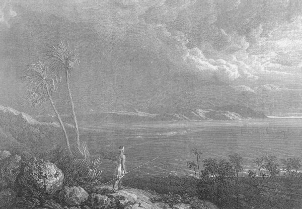 View of Malay Road, from Pobassoo's IslandMás sobre English Company's Islands 16 Feb 1803
111: Arnhem Bay 27 Feb 1803
In the morning of the 27th, we steered south-westward between Inglis' Island and the main, to explore the opening on the west side of Mallison's Island. The tide, which was in our favour, so stirred up the soft mud, that we did not perceive a shoal until from 4½, the depth diminished to 2¼ fathoms, and the ship stuck fast. This was at less than a mile from the north-east head of Inglis' Island, yet the deepest water lay within; and towards noon, by carrying out a stream anchor, we got there into 10 fathoms, without having suffered any apparent injury. On the approach of low water next morning [MONDAY 28 FEBRUARY 1803], we resumed our course, keeping nearly midway between the main coast and the island, with soundings from 13 to 7 fathoms, muddy ground; the shores are above two miles asunder, but the reefs from each side occupy more than half of the open space. On clearing the south end of the passage, the boat ahead made signal for 4 fathoms, and we tacked, but afterwards followed till noon; heavy rain then came on, and the wind dying away, an anchor was dropped in 6 fathoms.
---
On laying down the plan of this extensive bay, I was somewhat surprised to see the great similarity of its form to one marked near the same situation in the Dutch chart. It bears no name; but as not a doubt remains of Tasman, or perhaps some earlier navigator, having explored it, I have given it the appellation of the land in which it is situate, and call it ARNHEM BAY. So far as an extent of secure anchoring ground is concerned, it equals any harbour within my knowledge; there being more than a hundred square miles of space fit for the reception of ships, and the bottom seemed to be every where good. Of the inducements to visit Arnhem Bay, not much can be said. Wood is plentiful at all the shores, and the stream which ran down the hills at Mallison's Island would have supplied us conveniently with water, had it been wanted; but in three months afterwards it would probably be dried up. In the upper parts of the bay the shores are low, and over-run with mangroves in many places; but near the entrance they may be approached by a ship, and there are beaches for hauling the seine, where, however, we had not much success.
Más sobre Arnhem Bay 27 Feb 1803112: Wessel's Islands (Survey Abandoned) 6 March 1803
A third chain of islands commences here, which, like Bromby's and the English Company's Islands, extend out north-eastward from the coast. I have frequently observed a great similarity both in the ground plans and elevations of hills, and of islands in the vicinity of each other; but do not recollect another instance of such a likeness in the arrangement of clusters of islands. This third chain is doubtless what is marked in the Dutch chart as one long island, and in some charts is called Wessel's Eylandt; which name I retain with a slight modification, calling them WESSEL'S ISLANDS. They had been seen from the north end of Cotton's Island to reach as far as thirty miles out from the main coast; but this is not more than half their extent, if the Dutch chart be at all correct.
---
For the last several days the wind had inclined from the eastward, and at this time blew a steady breeze at E. by S., with fine weather; as if the north-west monsoon were passed, and the south-east trade had resumed its course. We had continued the survey of the coast for more than one-half of the six months which the master and carpenter had judged the ship might run without much risk, provided she remained in fine weather and no accident happened; and the remainder of the time being not much more than necessary for us to reach Port Jackson, I judged it imprudent to continue the investigation longer. In addition to the rottenness of the ship, the state of my own health and that of the ship's company were urgent to terminate the examination here; for nearly all had become debilitated from the heat and moisture of the climate--from being a good deal fatigued--and from the want of nourishing food. I was myself disabled by scorbutic sores from going to the mast head, or making any more expeditions in boats; and as the whole of the surveying department rested upon me, our further stay was without one of its principal objects. It was not, however, without much regret that I quitted the coast; both from its numerous harbours and better soil, and its greater proximity to our Indian possessions having made it become daily more interesting; and also, after struggling three months against foul winds, from their now being fair as could be wished for prosecuting the further examination. The accomplishment of the survey was, in fact, an object so near to my heart, that could I have foreseen the train of ills that were to follow the decay of the Investigator and prevent the survey being resumed--and had my existence depended upon the expression of a wish, I do not know that it would have received utterance; but Infinite Wisdom has, in infinite mercy, reserved the knowledge of futurity to itself.
Más sobre Wessel's Islands (Survey Abandoned) 6 March 1803113: Resupply at Coepang (Kupang) Harbour Timor 31 March - 7 Apr 1803
Coepang is a Dutch settlement at the south-west end of Timor and the determination to put in there being made, I revolved in my mind the possibility of afterwards returning to the examination of the north and north-west coasts of Terra Australis, during the winter six months, and taking the following summer to pass the higher latitudes and return to Port Jackson. There was little chance of obtaining salt provisions at Coepang, but there might be a ship or ships there, capable of furnishing a supply, and by which an officer might be conveyed to England; for it was a necessary part of my project to despatch lieutenant Fowler to the Admiralty, with an account of our proceedings, and a request that he might return as speedily as possible, with a vessel fit to accomplish all the objects of the voyage; and I calculated that six months employed upon the North and North-west Coasts, and the subsequent passage to Port Jackson, would not leave much more than the requisite time for refreshing the ship's company before his arrival might be expected. It is to be observed, that the ship had leaked very little in her sides since the caulking done at the head of the Gulph; and the carpenter being now directed to bore into some of the timbers then examined, did not find them to have become perceptibly worse; so that I was led to hope and believe that the ship might go through this service, without much more than common risk, provided we remained in fine-weather climates, as was intended.
---
Two vessels were lying under the north-east end of Samow; and on our ensign and pendant being hoisted, the one showed American, and the other Dutch colours. An officer was sent to them for information, as well of the propriety of going into Coepang Bay at this season, as of the political state of Europe; for although the intelligence of peace had arrived before we left Port Jackson, it seemed to be doubtful how long it might last. On his return with favourable intelligence, I steered through the northern outlet of the strait, which is not more than a mile and a half wide, but so deep that 65 fathoms did not reach the bottom; and at four o'clock the anchor was let go in 17 fathoms, muddy ground, half a mile from the shore, with the flag staff of Fort Concordia bearing S. S. E.
I sent the second lieutenant to present my respects to the Dutch governor, and inform him of our arrival and wants, with an offer of saluting the fort provided an equal number of guns should be returned; and the offer being accepted, mutual salutes of thirteen guns passed, and the same evening we received a boat load of refreshments. Next day [FRIDAY 1 APRIL 1803], I went with three officers and gentlemen to wait upon Mynheer Giesler, the governor, who sent the commandant of the fort and surgeon of the colony to receive us at the water side. The governor did not speak English, nor I any Dutch; and our communications would have been embarrassed but for the presence of captain Johnson, commander of the Dutch brig, who interpreted with much polite attention.
Más sobre Resupply at Coepang (Kupang) Harbour Timor 31 March - 7 Apr 1803114: Reach Cape Leeuwin on return to Port Jackson 13 May 1803
On the 13th, we had reached the parallel of Cape Leeuwin, and were steering E. by S., to make it. At six in the evening, tried for soundings with 180 fathoms, without finding ground; but after running S. 67° E. twenty-six miles, we had 75 fathoms, fine white sand; and at daylight [SATURDAY 14 MAY 1803] the land was seen, bearing N. 23° to 52° E. about eight leagues. (Atlas, Plate II.) The soundings should therefore seem not to extend more than ten or twelve leagues to the west, or but little further than the land will be visible in fine weather.
Our latitude at noon was 34° 43', and the land of Cape Leeuwin bore from N. 2° to 22° E.; the uncorrected longitude of the time keepers from Timor made the cape four or five leagues to the east of the position before ascertained, but when corrected, the difference was too small to be perceptible. At six in the evening we had 40 fathoms, coral bottom, at seven leagues from Point D'Entrecasteaux; but the weather was too thick to take any bearings which might improve my former survey. We steered along the coast at the distance of seven or eight leagues, with a fresh breeze and a strong current in our favour; and on the next day [SUNDAY 15 MAY 1803] at noon I set land, which had the appearance of Bald Head, at N. 31° W., distant about five leagues. Mount Gardner and Bald Island were distinguished in the afternoon; but the land was visible at times only, from the haziness of the weather.
Más sobre Reach Cape Leeuwin on return to Port Jackson 13 May 1803115: Resupply at Goose Island Bay on return to Port Jackson 17 May 1803
At one o'clock in steering for Douglas's Isles, a single breaker was seen right ahead of the ship, lying six miles N. E. ½ N. of the former dangerous reef, and about eight from the isles, in a W. by ½ S. direction. We passed to the northward of it, having no ground at 25 fathoms; and as we approached to do the same by the isles, Mr. Charles Douglas, the boatswain, breathed his last; and I affixed his name to the two lumps of land, which seemed to offer themselves as a monument to his memory. We hauled up close along the east side of Middle Island with the wind at west; and at six in the evening anchored in Goose-Island Bay, in 12 fathoms, fine sand, one-third of a mile from the middle rock. and nearly in a line between it and the north-east point of Middle Island.
WEDNESDAY 18 MAY 1803
In the morning, a party of men was sent to kill geese and seals upon the rocky islets to the eastward, and another upon Middle Island to cut wood and brooms. There was now so much more surf upon the shores of the bay than in January of the former year, that we could not land at the eastern beach, behind which lies the salt lake; I therefore went with the master to the middle beach, and being scarcely able to get out of the boat from scorbutic sores, sent him to examine the lake and make choice of a convenient place for filling some casks; but to my surprise he reported that no good salt could be procured, although it had been so abundant before, that according to the testimony of all those who saw the lake, it would have furnished almost any quantity: this alteration had doubtless been produced by the heavy rains which appeared to have lately fallen. I caused a hole to be dug in a sandy gully, in order to fill a few casks of water, thinking it possible that what we had taken in at Timor might have been injurious; but the water was too salt to be drinkable, although draining from land much above the level of the sea. This may afford some insight into the formation of salt in the lake; and it seems not improbable, that rock salt may be contained in some part of Middle Island.
We remained here three days, cutting wood, boiling down seal oil, and killing geese; but our success in this last occupation was very inferior to what it had been in January 1802, no more than twelve geese being now shot, whereas sixty-five had then been procured. Mr. Douglas was interred upon Middle Island, and an inscription upon copper placed over his grave; William Hillier, one of my best men, also died of dysentery and fever before quitting the bay, and the surgeon had fourteen others in his list, unable to do any duty. At his well-judged suggestion, I ordered the cables, which the small size of the ship had made it necessary to coil between decks, to be put into the holds, our present light state permitting this to be done on clearing away the empty casks; by this arrangement more room was made for the messing and sleeping places; and almost every morning they were washed with boiling water, aired with stoves, and sprinkled with vinegar, for the surgeon considered the dysentery on board to be approaching that state when it becomes contagious.
Más sobre Resupply at Goose Island Bay on return to Port Jackson 17 May 1803116: Near Hunter Island on return to Port Jackson 30 May 1803
The wind blew fresh at north, and the ship could barely lie a course to clear Albatross Island, yet we passed without seeing it, though there was moonlight; so that supposing it was the Black Pyramid we had set at ten o'clock, the tide, which I calculated to turn about that time, must have run strong to the N. E. Our least sounding between King's Island and Hunter's Isles was 28 fathoms, on red coral sand, nine or ten miles to the south, as I judge, of Reid's Rocks; but they were not seen, nor have I any certain knowledge of their position. They are laid down in the chart partly from the journal of lieutenant Murray, who saw them in going from the Bay of Seals to Three-hummock Island; but principally from a rough sketch of Mr. Bass, then commander of the brig Venus, who appears to have seen King's Island, Reid's Rocks, and the Black Pyramid, all at the same time.
It was a great mortification to be thus obliged to pass Hunter's Isles and the north coast of Van Diemen's Land, without correcting their positions in longitude from the errors which the want of a time keeper in the Norfolk had made unavoidable; but when I contemplated eighteen of my men below, several of whom were stretched in their hammocks almost without hope, and reflected that the lives of the rest depended upon our speedy arrival in port, every other consideration vanished; and I carried all possible sail, day and night, making such observations only as could be done without causing delay.
Más sobre Near Hunter Island on return to Port Jackson 30 May 1803117: Arrive Port Jackson (Investigator Condemned) 9 June 1803
Whilst beating against this foul wind the dysentery carried off another seaman, Thomas Smith, one of those obtained from governor King; and had the wind continued long in the same quarter, many others must have followed. Happily it veered to the southward at midnight, we passed Botany Bay at three in the morning [THURSDAY 9 JUNE 1803], and at daybreak tacked between the heads of Port Jackson, to work up for Sydney Cove. I left the ship at noon, above Garden Island, and waited upon His Excellency governor King, to inform him of our arrival, and concert arrangements for the reception of the sick at the colonial hospital. On the following day [FRIDAY 10 JUNE 1803] they were placed under the care of Thomas Jamison, Esq., principal surgeon of the colony; from whom they received that kind attention and care which their situation demanded; but four were too much exhausted, and died in a few days. The first of them was Mr. Peter Good, botanical gardener, a zealous, worthy man, who was regretted by all.
---
The arrangements being made which concerned the health of the ship's company, I inclosed to the governor the report of the master and carpenter upon the state of the ship when in the Gulph of Carpentaria; and requested that he would appoint officers to make a survey of her condition. A plank was ripped off all round, a little above the water's edge; and on the 14th, the officers appointed by His Excellency made the survey, and their report was as follows:
Pursuant to an order from His Excellency Philip Gidley King, esquire, principal commander of His Majesty's ship Buffalo.
We whose names are hereunto subscribed, have been on board His Majesty's ship Investigator, and taken a strict, careful, and minute survey of her defects, the state of which we find to be as follows.
One plank immediately above the wales being ripped off all round the ship, we began the examination on the larbord side forward; and out of ninety-eight timbers we find eleven to be sound, so far as the ripping off of one plank enables us to see into them, ten of which are amongst the aftermost timbers. Sixty-three of the remaining timbers are so far rotten as to make it necessary to shift them; and the remaining twenty-four entirely rotten, and these are principally in the bow and the middle of the ship.
On the starbord side forward we have minutely examined eighty-nine timbers, out of which we find only five sound; fifty-six are so far decayed as to require shifting, and the remaining twenty-eight are entirely rotten. The sound timbers are in the after part of the ship, and those totally decayed lie principally in the bow.
The stemson is so far decayed, principally in its outer part, as to make it absolutely necessary to be shifted.
As far as we could examine under the counter, both plank and timbers are rotten, and consequently necessary to be shifted.
We find generally, that the plank on both sides is so far decayed as to require shifting, even had the timbers been sound.
The above being the state of the Investigator thus far, we think it altogether unnecessary to make any further examination; being unanimously of opinion that she is not worth repairing in any country, and that it is impossible in this country to put her in a state fit for going to sea.
And we do further declare, that we have taken this survey with such care and circumspection, that we are ready, if required, to make oath to the veracity and impartiality of our proceedings.
Given under our hands on board the said ship in Sydney Cove, this 14th June 1803.
(Signed) W. Scott, Commander of H. M. armed vessel Porpoise.
E. H. Palmer, Commander of the Hon. East-India-Company's extra ship Bridgewater.
Thomas Moore, Master builder to the Territory of New South Wales.
I went round the ship with the officers in their examination, and was excessively surprised to see the state of rottenness in which the timbers were found. In the starbord bow there were thirteen close together, through any one of which a cane might have been thrust; and it was on this side that the ship had made twelve inches of water in an hour, in Torres' Strait, before the first examination. In the passage along the South Coast, the strong breezes were from the southward, and the starbord bow being out of the water, the leaks did not exceed five inches; had the wind come from the northward, the little exertion we were then capable of making at the pumps could hardly have kept the ship up; and a hard gale from any quarter must have sent us to the bottom.
Más sobre Arrive Port Jackson (Investigator Condemned) 9 June 1803118: Depart Port Jackson in the Porpoise for England 10 Aug 1803
In the beginning of August, the Porpoise was nearly ready to sail; and two ships then lying in Sydney Cove, bound to Batavia, desired leave to accompany us through the Strait. These were the Hon. East-India-Company's extra-ship Bridgewater, of about 750 tons, commanded by E. H. Palmer, Esq., and the ship Cato of London, of about 450 tons, commanded by Mr. John Park. The company of these ships gave me pleasure; for if we should be able to make a safe and expeditious passage through the strait with them, of which I had but little doubt, it would be a manifest proof of the advantage of the route discovered in the Investigator, and tend to bring it into general use.
On the 10th [WEDNESDAY 10 AUGUST 1803] I took leave of my respected friend the governor of New South Wales, and received his despatches for England; and lieutenant Fowler having given a small code of signals to the Bridgewater and Cato, we sailed out of Port Jackson together, at eleven o'clock of the same morning, and steered north-eastward for Torres' Strait.
Más sobre Depart Port Jackson in the Porpoise for England 10 Aug 1803119: Disaster at Wreck Reef 17 Aug 1803
In half an hour, and almost at the same instant by the Investigator's carpenter on the fore castle, and the master who had charge of the watch on the quarter deck--breakers were seen ahead. The helm was immediately put down, with the intention of tacking from them; but the Porpoise having only three double-reefed top sails set, scarcely came up to the wind. Lieutenant Fowler sprang upon deck, on hearing the noise; but supposing it to be occasioned by carrying away the tiller rope, a circumstance which had often occurred in the Investigator, and having no orders to give, I remained some minutes longer, conversing with the gentlemen in the gun room. On going up, I found the sails shaking in the wind, and the ship in the act of paying off; at the same time there were very high breakers at not a quarter of a cable's length to leeward. In about a minute, the ship was carried amongst the breakers; and striking upon a coral reef, took a fearful heel over on her larbord beam ends, her head being north-eastward. A gun was attempted to be fired, to warn the other vessels of the danger; but owing to the violent motion and the heavy surfs flying over, this could not be done immediately; and before lights were brought up, the Bridgewater and Cato had hauled to the wind across each other.
Our fore mast was carried away at the second or third shock; and the bottom was presently reported to be stove in, and the hold full of water. When the surfs permitted us to look to windward, the Bridgewater and Cato were perceived at not more than a cable's length distance; and approaching each other so closely, that their running aboard seemed to us inevitable. This was an aweful moment; the utmost silence prevailed; and when the bows of the two ships went to meet, even respiration seemed to be suspended. The ships advanced, and we expected to hear the dreadful crash; but presently they opened off from each other, having passed side by side without touching; the Cato steering to the north-east, and the Bridgewater to the southward. Our own safety seemed to have no other dependence than upon the two ships, and the exultation we felt at seeing this most imminent danger passed, was great, but of short duration; the Cato struck upon the reef about two cables length from the Porpoise, we saw her fall over on her broad side, and the masts almost instantly disappeared; but the darkness of the night did not admit of distinguishing, at that distance, what further might have happened.
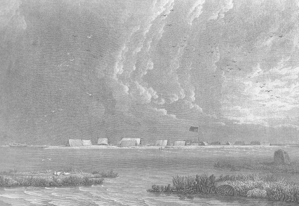
View of Wreck-Reef Bank, taken at low water.
Más sobre Disaster at Wreck Reef 17 Aug 1803120: Depart in Open Cutter to Sydney 26 Aug 1803
On August 26, the largest cutter being ready for her expedition, was launched and named the Hope. The morning was fine, and wind light from the southward; and notwithstanding the day, which in the seaman's calendar is the most unfortunate of the whole week to commence a voyage, I embarked for Port Jackson with the commander of the Cato. We had a double set of rowers, making in all fourteen persons, with three weeks provisions and two half hogsheads of water; so that the Hope was loaded rather too deeply. At eight in the morning, we pushed off amidst the cheers and good wishes of those for whom we were going to seek relief; an ensign with the union downward, had hitherto been kept hoisted as a signal to captain Palmer of our distress; but in this moment of enthusiasm a seaman quitted the crowd, and having obtained permission, ran to the flag staff, hauled down the ensign, and rehoisted it with the union in the upper canton. This symbolical expression of contempt for the Bridgewater and of confidence in the success of our voyage, I did not see without lively emotions.
Más sobre Depart in Open Cutter to Sydney 26 Aug 1803121: Sight Land off Queensland Coast 29 Aug 1803
We had fine weather next morning, with a moderate breeze at north-east; and at noon, the distance run in the preceding twenty-four hours was ninety-one miles by the log, and the observed latitude 24° 53' south: the lead was put over-board., but no bottom found at 50 fathoms. Our situation being to the south of Sandy Cape, we steered a point more west, in the hope of seeing the land before night; it being my intention to keep near the coast from thence to Port Jackson, that by landing, or running the boat on shore, we might escape foundering at sea should a gale of wind come on. At sunset, the land was visible to the westward at the distance of four or five leagues, and we then hauled up south, parallel to the coast; the night was fine, the wind light and fair, and at daylight [MONDAY 29 AUGUST 1803] the tops of the hills were seen in the west, at the same distance as before. Our latitude at noon was 26° 22', and a high hummock upon the land, somewhere between Double-island Point and Glass-house Bay, bore W. ¾ N.
Más sobre Sight Land off Queensland Coast 29 Aug 1803122: Gather Water at Point Lookout 30 Aug 1803
Our favourable breeze died away in the afternoon, and we took to the oars; it however sprung up again from the northward, and brought us within sight of Cape Moreton at sunset. Towards midnight the weather became squally with heavy rain, and gave us all a thorough drenching; but the wind not being very strong in these squalls, our course was still pursued to the southward. After the rain ceased the wind came at S. S. W.; and the weather remaining unsettled, we tacked at daylight [TUESDAY 30 AUGUST 1803] to get close in with the land, and at noon anchored under Point Look-out. This was only the fourth day of our departure from Wreck Reef, and I considered the voyage to be half accomplished, since we had got firm hold of the main coast; for the probability of being lost is greater in making three hundred miles in an open boat at sea, than in running even six hundred along shore. It would have added much to our satisfaction, could we have conveyed the intelligence of this fortunate progress to our shipmates on the bank.
The necessity for a supply of fresh water was becoming urgent, for our remaining half hogshead was much reduced. There were about twenty Indians upon the side of a hill near the shore, who seemed to be peaceably disposed, amusing us with dances in imitation of the kangaroo; we made signs of wanting water, which they understood, and pointed to a small rill falling into the sea. Two of the sailors leaped over-board, with some trifles for the natives and one end of the lead line; with the other end we slung the empty cask, which they hauled on shore and filled without molestation. A shark had followed them to the beach; and fearing they might be attacked in returning, we got up the anchor and went to a place where the surf, though too much to allow of the boat landing, permitted us to lie closer. The cask of water, a bundle of wood, and the two men were received on board without accident; the natives keeping aloof during the whole time, and even retiring when our people approached, though they were without arms and naked. It is probable that the Indians were astonished at the comparison between the moderately white skins of the sailors and their own, and perhaps had heard of my expedition to Glass-house Bay in 1799, in which I had been provoked to make one of them feel the effect of our arms; and had they attempted any thing against my two men, we were prepared to have given them a volley from the boat which would probably have been a fearful confirmation of the truth of the report; but happily for both parties, we were not reduced to the necessity.
Más sobre Gather Water at Point Lookout 30 Aug 1803123: Resupply Smoky Cape 2 Sept 1803
Smoky Cape was in sight next morning [FRIDAY 2 SEPTEMBER 1803]; but the wind coming round to south, and blowing fresh with thick weather, we tacked towards the shore; and at noon landed behind a small ledge of rocks, about three leagues short of the Cape. The distance run these twenty-four hours was eighty five miles, and the southwardly current had moreover given its assistance.
This ledge of rocks lies on the north side of a point upon which there are some hummocks; and on ascending the highest, I saw a lagoon into which the tide flowed by a narrow passage on the inner side of the point. The pandanus grows here; and as it was a tree unknown to Bongaree, this latitude (about 30° 45') is probably near its southern limit. We took in a supply of fuel and gathered some fine oysters, and the wind dying away to a calm in the afternoon, rowed out for Smoky Cape; but on reaching abreast of it the wind again rose ahead; and at one in the morning we anchored in a small bight at the extremity of the Cape, and remained until daylight.
Más sobre Resupply Smoky Cape 2 Sept 1803124: Rest at Port Hunter 6 Sept 1803
At this time the wind blew a moderate sea breeze at E. S. E, Cape Hawke was seen soon afterward, and at eight in the evening we steered between Sugar-loaf Point and the two rocks lying from it three or four miles to the south-east. At four next morning [TUESDAY 6 SEPTEMBER 1803], passed the islands at the entrance of Port Stephens, and at noon the Coal Island in the mouth of Port Hunter bore N. W. by N.; the wind then shifted more to the southward, with squally weather, and both prevented the boat from lying along the coast and made it unsafe to be at sea. After struggling till four in the afternoon, with little advantage, we bore up to look for shelter behind some of the small projecting points; and almost immediately found it in a shallow cove, exposed only to the north-eastward. This was the eleventh day of our departure from Wreck Reef, and the distance of Port Jackson did not now exceed fifty miles.
At this place we slept on shore for the first time; but the weather being squally, rainy, and cold, and the boat's sails our best shelter, it was not with any great share of comfort; a good watch was kept during the night, but no molestation was received from the natives. Notwithstanding our cramped-up position in the boat, and exposure to all kinds of weather, we enjoyed excellent health; one man excepted, upon whom the dysentery, which had made such ravages in the Investigator, now returned with some violence.
Más sobre Rest at Port Hunter 6 Sept 1803125: Safe Arrival in The Hope at Sydney Cove 8 Sept 1803
A cask of water was filled on the morning of the 7th, and our biscuit being all expended or spoiled, some cakes were baked in the ashes for our future subsistence. At eleven o'clock, the rain having cleared away, we stood out to the offing with light baffling winds, and towards evening were enabled to lie along the coast; but the breeze at south-east not giving much assistance, we took to the oars and laboured hard all the following night, being animated with the prospect of a speedy termination to our voyage. The north head of Broken Bay was in sight next morning [THURSDAY 8 SEPTEMBER 1803], and at noon the south head was abreast of the boat; a sea breeze then setting in at E. N. E., we crowded all sail for Port Jackson, and soon after two o'clock had the happiness to enter between the heads.
The reader has perhaps never gone 250 leagues at sea in an open boat, or along a strange coast inhabited by savages; but if he recollect the eighty officers and men upon Wreck-Reef Bank, and how important was our arrival to their safety, and to the saving of the charts, journals, and papers of the Investigator's voyage, he may have some idea of the pleasure we felt, but particularly myself, at entering our destined port.
I proceeded immediately to the town of Sydney, and went with captain Park to wait upon His Excellency governor King, whom we found at dinner with his family. A razor had not passed over our faces from the time of the shipwreck, and the surprise of the governor was not little at seeing two persons thus appear whom he supposed to be many hundred leagues on their way to England; but so soon as he was convinced of the truth of the vision before him, and learned the melancholy cause, an involuntary tear started from the eye of friendship and compassion, and we were received in the most affectionate manner.
His Excellency lost no time in engaging the ship Rolla, then lying in port, bound to China, to go to the rescue of the officers and crews of the Porpoise and Cato; I accompanied the governor on board the Rolla a day or two afterwards, and articles were signed by which the commander, Mr. Robert Cumming, engaged to call at Wreck Reef, take every person on board and carry them to Canton, upon terms which showed him to take the interest in our misfortune which might be expected from a British seaman. The governor ordered two colonial schooners to accompany the Rolla, to bring back those who preferred returning to Port Jackson, with such stores of the Porpoise as could be procured; and every thing was done that an anxious desire to forward His Majesty's service and alleviate misfortune could devise; even private individuals put wine, live stock, and vegetables, unasked, on board the Rolla for the officers upon the reef.
Más sobre Safe Arrival in The Hope at Sydney Cove 8 Sept 1803126: Depart Port Jackson in Cumberland for Wreck Reef 21 Sept 1803
Every thing being prepared for our departure, I sailed out of the harbour in the Cumberland on the 21st at daylight, with the Rolla and Francis in company. Mr. Inman, the astronomer, had taken a passage in the Rolla with his instruments; and of the thirteen persons who came with me in the boat, captain Park and his second mate were on board that ship, and the boatswain of the Investigator with the ten seamen composed my crew in the schooner. We had a fresh breeze at south-east, and the Cumberland appeared to sail as well as could be expected; but the wind becoming stronger towards night, she lay over so much upon the broad side that little sail could be carried; and instead of being tight, as had been represented, her upper works then admitted a great deal of water.
Más sobre Depart Port Jackson in Cumberland for Wreck Reef 21 Sept 1803127: Overnight stay at Port Stephens 22 Sept 1803
Next morning [THURSDAY 22 SEPTEMBER 1803], the wind having rather increased than diminished, I found we should soon be obliged to lie to altogether, and that if we passed Port Stephens there was no place of shelter for a long distance where the schooner could be saved from drifting on shore; the signal was therefore made to tack, and at dusk the Rolla and Francis ran into Port Stephens. Not being able to reach so far, I anchored in a small bight under Point Stephens, in very bad plight; the pumps proving to be so nearly useless, that we could not prevent the water from half filling the hold; and two hours longer would have reduced us to baling with buckets, and perhaps have been fatal. This essay did not lead me to think favourably of the vessel, in which I had undertaken a voyage half round the globe.
Más sobre Overnight stay at Port Stephens 22 Sept 1803128: Rescue Ships Arrive at Wreck Reef 7 Oct 1803
It was six weeks on this day that I had quitted the reef in the boat, for the purpose of seeking the means to relieve my officers and people. The bank was first seen from the Rolla's mast head, and soon afterward two boats were perceived under sail; and advancing nearer, we saw one boat make for the Rolla and the other returning to the bank. The Porpoise had not yet gone to pieces; but was still lying on her beam ends, high up on the reef, a frail, but impressive monument of our misfortune.
In the afternoon I anchored under the lee of the bank, in 18 fathoms coral sand, and a salute of eleven guns from it was immediately fired, the carronades of the Porpoise having been transported from the wreck. On landing, I was greeted with three hearty cheers, and the utmost joy by my officers and people; and the pleasure of rejoining my companions so amply provided with the means of relieving their distress, made this one of the happiest moments of my life.
The two boats we had seen, were the Porpoise's remaining cutter and a new boat constructed during my absence; it was just completed, and lieutenant Fowler had this morning gone out to try its sailing against the cutter. My safe arrival at Port Jackson became a subject of much doubt after the first month; and they had begun to reconcile their minds to making the best use of the means they possessed to reach some frequented port. The Rolla's top-gallant sail was first seen in the horizon by a man in the new boat, and was taken for a bird; but regarding it more steadfastly, he started up and exclaimed, d--n my bl--d what's that! It was soon recognised to be a sail, and caused a general acclamation of joy, for they doubted not it was a ship coming to their succour. Lieutenant Flinders, then commanding officer on the bank, was in his tent calculating some lunar distances, when one of the young gentlemen ran to him, calling, "Sir, Sir! A ship and two schooners in sight!" After a little consideration, Mr. Flinders said he supposed it was his brother come back, and asked if the vessels were near? He was answered, not yet; upon which he desired to be informed when they should reach the anchorage, and very calmly resumed his calculations: such are the varied effects produced by the same circumstance upon different minds. When the desired report was made, he ordered the salute to be fired, and took part in the general satisfaction.
Más sobre Rescue Ships Arrive at Wreck Reef 7 Oct 1803129: Depart in Cumberland for England 10 Oct 1803
The officers journals, which were to be sent to the Admiralty at the conclusion of the voyage, had not been demanded at the time of our shipwreck; lieutenant Fowler was therefore directed to take all that were saved belonging to the officers embarked with him in the Rolla; and lest any accident should happen to the Cumberland, I committed to his charge a copy of four charts, being all of the East and North Coasts which there had been time to get ready; with these he took a short letter to the secretary of the Admiralty, and one to the Victualling Board inclosing such vouchers as had been saved from the wreck. To Mr. Inman I gave the remaining instruments belonging to the Board of Longitude, reserving only a time keeper and a telescope; the large and most valuable instruments had very fortunately been delivered to him before we had sailed from Port Jackson in the Porpoise.
These matters being arranged, I pressed captain Cumming to depart, fearing that a change of wind might expose the Rolla to danger; but finding him desirous to take off more provisions and stores, I made sail for a bank or rather islet seven miles distant at the eastern extremity of Wreck Reef, for the purpose of collecting seabirds eggs, and if possible taking a turtle. The Rolla joined on the following day [TUESDAY 11 OCTOBER 1803], and I went on board to take leave of Messrs. Fowler and Flinders and the other officers and gentlemen; at noon we parted company with three cheers, the Rolla steering north-eastward for China, whilst my course was directed for Torres' Strait.
Más sobre Depart in Cumberland for England 10 Oct 1803130: Pass Murray Islands on return to England 22 Oct 1803
I hauled up under the lee side of the reef, intending to anchor and go in a boat to sound the deep water within; but not finding any ground with 70 fathoms at a mile off, we bore away at two o'clock to make Murray's Islands. At three, breakers were seen four or five miles to the southward, and others, perhaps on the same reef, about three miles W. S. W. from them; in half an hour the largest of Murray's Islands came in sight to the W. by N.; and our course being continued to six o'clock, the centre then bore N. 78° W. nearly four leagues, but the front reefs, which could not be more than half that distance in the same direction, were not visible. We then hauled to the wind, and stood off and on till daylight [SATURDAY 22 OCTOBER 1803], when the largest island bore W. by S.
Murray's Islands may be considered as the key to the best passage yet known through Torres' Strait, and my route to them in the Investigator being circuitous, I wished to ascertain whether a more direct track might not be found; we therefore steered to make the north-eastern reefs, and on coming in with the breakers, ran along their south side at the distance of one or two miles. At half past seven, the termination of these reefs bore N. N. W.; but another reef, which extended far to the south, had for some time been in sight, and a dry sand on its north end now bore S. W. by W. one mile. In the opening between them was a small patch of coral, and several green spots in the water round it; but there appearing to be room for the Cumberland to pass on the north side, I ventured through, sounding in 20 and 23 fathoms without finding bottom.
Más sobre Pass Murray Islands on return to England 22 Oct 1803131: Anchored off Booby Island 24 Oct 1803
Booby Isle was in sight from the mast head at one o'clock, bearing nearly W. S. W.; and soon after three we anchored one mile to leeward of it, in 7 fathoms, soft sand. A boat was sent on shore, which presently came back loaded with boobies; and fresh turtle tracks having been perceived, the crew returned to watch, and at midnight we received five turtle. These appeared to be of the species called hawkes-bill; the shells and skins, as also their fat, were of a red tinge, and they had longer necks than the turtle procured at Wellesley's Islands, to which they were much inferior, both in size and quality.
When entering the Gulph of Carpentaria in the Investigator, I had remarked what appeared to be a considerable error in the relative positions of Booby Isle and the flat-topped York Island, as they are laid down by captain Cook; and to obtain more certainty, the longitude of the flat top had been observed this morning from the time keeper, and I anchored here this afternoon to do the same by Booby Isle. The result showed the difference of longitude between them to be 43½', differing less than 1' from what had been deduced in the Investigator, whereas, by captain Cook, they are placed 63' asunder. The high respect to which the labours of that great man are entitled, had caused me to entertain some doubt of the reality of this error until the present verification. It is to be wholly ascribed to the circumstance of his not having had a time keeper in his first voyage; and a more eminent proof of the utility of this valuable instrument cannot be given, than that so able a navigator could not always avoid making errors so considerable as this, when deprived of its assistance.
Más sobre Anchored off Booby Island 24 Oct 1803132: Resupply Cumberland at Coepang 10 Nov 1803
Mynheer Geisler, the former governor of Coepang, died a month before our arrival, and Mr. Viertzen at this time commanded. He supplied us with almost every thing our situation required, and endeavoured to make my time pass as pleasantly as was in his power, furnishing me with a house near the fort to which I took the time keeper and instruments to ascertain a new rate and error; but my anxious desire to reach England, and the apprehension of being met by the north-west monsoon before passing Java, induced me to leave him as soon as we could be ready to sail, which was on the fourth day. The schooner had continued to be very leaky whenever the wind caused her to lie over on the side, and one of the pumps had nearly become useless; I should have risked staying two or three days longer, had Coepang furnished the means of fresh boring and fitting the pumps, or if pitch could have been procured to pay the seams in the upper works after they were caulked; but no assistance in this way could be obtained; we however got a leak stopped in the bow, and the vessel was afterwards tight so long as she remained at anchor.
Más sobre Resupply Cumberland at Coepang 10 Nov 1803133: Arrive and Imprisoned at Mauritius 6 Dec 1803
In the orders from governor King, the ports to be touched at on the way to England were left to my own choice; but when Mauritius had been mentioned amongst others in conversation, the governor had objected to it, both on account of the hurricanes in that neighbourhood, and from not wishing to encourage a communication between a French colony and a settlement composed as is that of Port Jackson. It was these considerations which had made me hesitate to take the step, though the necessity for it was pressing; and as, in the case of accident happening to the schooner, I might be called to answer before a court martial for going in opposition to the wish of a superior officer, it seemed proper to state in my journal all the reasons which had any influence on my decision. This journal is not in my possession; but notes of the statement were made whilst the recollection of it was strong, and the following was the substance and not far from the words.
---
That the captain-general being convinced from the examination of my journal, that I had absolutely changed the nature of the mission for which the First Consul had granted a passport, wherein I was certainly not authorised to stop at the Isle of France to make myself acquainted with the periodical winds, the port, present state Of the colony, etc. That such conduct being a violation of neutrality, he ordered colonel Monistrol to go on board the Cumberland, and in my presence to collect into one or more trunks all other papers which might add to the proofs already acquired; and after sealing the trunks, I was to be taken back to the house where my suspicious conduct had made it necessary to confine me from the instant of arriving in the port. It was further ordered, that the crew of the schooner should be kept on board the prison ship; and that an inventory should be taken of every thing in the Cumberland, and the stores put under seal and guarded conformably to the regulations.
Más sobre Arrive and Imprisoned at Mauritius 6 Dec 1803134: Freed. Depart for Cape of Good Hope on the Otter 10 June 1810
It may probably be asked, what could be general De Caen's object in refusing throughout to give up this log book, or to suffer any copy to be taken? I can see no other reasonable one, than that the statements from it, sent to the French government as reasons for detaining me a prisoner, might have been partial and mutilated extracts; and he did not choose to have his accusations disproved by the production either of the original or an authentic copy. Besides this book and the little schooner, I lost a cask containing pieces of rock collected from different parts of Terra Australis, the two spy-glasses taken in the Garden Prison, and various small articles belonging to myself; but I was too happy at the prospect of getting out of the island to make any difficulty upon these heads.
[OFF MAURITIUS.]
On the same morning that the pilot came on board, the anchors were weighed; but in swinging out, the ship touched the ground, and hung till past four in the afternoon. During this time we saw L'Estafette coming in with a flag of truce from the squadron; and the boat that went to meet her was returning when the cartel had floated off, and sail was made. We were a good deal alarmed at what might be the subject of L'Estafette's communication, and particularly anxious to get without side of the port before any counter order should come from the general; at sunset it was effected, the French pilot left us, and after a captivity of six years, five months and twenty-seven days, I at length had the inexpressible pleasure of being out of the reach of general De Caen.
Three frigates and a sloop of war composed the squadron cruising before the port; but instead of coming to speak us for information, as was expected, we observed them standing away to the southward; a proceeding which could be reconciled only upon the supposition, that commodore Rowley had sent in an offer not to communicate with the cartel. This was too important an affair to me to be let pass without due inquiry; my endeavours were therefore used with Mr. Ramsden, the commander, to induce him to run down to the ships; and this was done, on finding they persisted in stretching to the southward. At nine o'clock Mr. Ramsden went in a boat to the Boadicea, but was desired to keep off; a letter was handed to him for the commissary, containing a copy of one sent in by L'Estafette, wherein it was proposed, if general De Caen would suffer the cartel to sail, that she should not be visited by any ship under the commodore's orders. Mr. Hope replied that the cartel had not come out in consequence of this proposal, nor had the boat reached the shore at the time; and this point being clearly ascertained, a communication was opened, and I applied for a passage to the Cape of Good Hope. It happened fortunately, that the Otter sloop of war was required to go there immediately with despatches; and the commodore having satisfied himself that no engagement of the commissary opposed it, complied with my request. Next day I took leave of Mr. Hope, to whose zeal and address I owed so much, and wished my companions in the cartel, with her worthy commander, a good voyage; and after dining with commodore Rowley, embarked in the evening on board the Otter with captain Tomkinson.
Más sobre Freed. Depart for Cape of Good Hope on the Otter 10 June 1810135: Depart Cape of Good Hope for England 28 Aug 1810
We sailed from Simon's Bay on the 28th August, in the Olympia, commanded by lieutenant Henry Taylor; and after a passage of fourteen days, anchored in St. Helena road on the afternoon of September 11; and having obtained water and a few supplies from the town, sailed again the same night. On the 16th, passed close to the north side of Ascension, in the hope of procuring a turtle should any vessel be lying there; but seeing none, steered onward and crossed the Line on the 19th, in longitude 19½° west. The trade wind shifted to the S. W. in latitude 5° north, and continued to blow until we had reached abreast of the Cape-Verde Islands, as it had done at the same time of year in 1801. At my recommendation lieutenant Taylor did not run so far west as ships usually do in returning to England, but passed the Cape-Verdes not further distant than sixty leagues; we there met the north-east trade, and on the 29th Mr. Taylor took the brig Atalante from Mauritius.
Más sobre Depart Cape of Good Hope for England 28 Aug 1810136: Arrive Spithead 24 Oct 1810 after 9 years 3 months
On reaching the latitude 22¾° north and longitude 33° west, the north-east trade veered to east and south-eastward, which enabled us to make some easting; and being succeeded by north-west winds, we passed within the Azores, and took a fresh departure from St. Mary's on the 15th of October. Soundings in 75 fathoms were obtained on the 21st, at the entrance of the English Channel; but it then blew a gale of wind from the westward, and obliged us to lie to on this, as it did on the following night; and it was greatly feared that the cutter would be driven on the coast of France, near the Casket rocks. In the morning of the 23rd, the wind being more moderate, we made sail to the northward, and got sight of the Bill of Portland; and at five in the evening came to an anchor in Studland Bay, off the entrance of Pool Harbour, after a run from St. Helena of six weeks; which in an indifferent sailing vessel, very leaky, and excessively ill found, must be considered an excellent passage.
Captain Parkinson and lieutenant Robb went off the same night with their despatches; and next morning we ran through the Needles and came to at Spithead, where the prize brig, from which we had been long separated, had just before dropped her anchor. I went on shore to wait upon admiral sir Roger Curtis, and the same evening set off for London; having been absent from England nine years and three months, and nearly four years and a half without intelligence from any part of my connexions.
Más sobre Arrive Spithead 24 Oct 1810 after 9 years 3 months137: Death of Flinders Aged 40, London, 19 July 1814
The illness increased during 1814, while the "Voyage" and its accompanying atlas were passing through the press. He never saw the finished book. The first copy of it came from the publishers, G. and W. Nicol, of Pall Mall, on July 18th, on the day before he died; but he was then unconscious. His wife took the volumes and laid them upon his bed, so that the hand that fashioned them could touch them. But he never understood. He was fast wrapped in the deep slumber that preceded the end. On the 19th he died. His devoted wife stood by his pillow, his infant daughter (born April 1st, 1812) was in an adjoining room, and there was one other friend present. Just before the brave life flickered out, he started up, and called in a hoarse voice for "my papers." Then he fell back and died.
Flinders died at 14 London Street, Fitzroy Square, and was buried in the graveyard of St. James's, Hampstead Road, which was a burial ground for St. James's, Piccadilly. No man now knows exactly where his bones were laid.* (* The vicar of St. James's, Piccadilly, who examined the burial register in response to an enquiry by Mr. George Gordon McCrae, of Melbourne, in 1912, states that the entry was made, by a clerical error, in the name of Captain Matthew Flanders, aged 40.) A letter written years later by his daughter, Mrs. Petrie, says: "Many years afterwards my aunt Tyler went to look for his grave, but found the churchyard remodelled, and quantities of tombstones and graves with their contents had been carted away as rubbish, among them that of my unfortunate father, thus pursued by disaster after death as in life."
From the public domain biography The Life of Captain Matthew Flinders R.N. by Ernest Scott published in 1914, Angus & Robertson Ltd.
Más sobre Death of Flinders Aged 40, London, 19 July 1814138: Flinders Bay, West Australia
This bay was one of the first areas surveyed by Matthew Flinders upon the start of his circumnavigation of Australia - and was therefore named in his honour.
Más sobre Flinders Bay, West Australia140: Flinders Monument, Port Lincoln, South Australia
Flinders discovered Port Lincoln in 1802, naming it after his native Lincolnshire.
Many of the features around Port Lincoln are also named after places in Lincolnshire such as Cape Donington (for his birthplace), Sleaford Bay and Sleaford Meer (for Sleaford, a town near Donington), and Boston Bay (after Boston - another town near Donington.)
The hill upon which Flinders Monument stands he named Stamford Hill (for Stamford, also in Lincolnshire)
Más sobre Flinders Monument, Port Lincoln, South Australia143: Flinders Park (Suburb), Adelaide
The entire suburb of Flinders Park in Adelaide could be called one large dedication to the sea explorers of the Australian continent - with most streets taking their names from said explorers.
Running up the middle of the suburb we, of course, have Flinders Parade.
Other explorers celebrated by the street names are:
- Bass Place - named for Flinder's earlier exploration companion George Bass
- Westall Avenue - named for the artist on the Investigator William Westall.
- Thistle Avenue - named for the Master of the Investigator who drowned along with 7 other crewmembers of the Investigator at Cape Catastrophe.
- Drake and Nelson Avenues - named for the respective British naval heroes.
- Captain Cook Avenue - named for the famous explorer that Flinders admired so much.
- La Perouse Avenue - named for the French explorer who arrived in Botany Bay only days after the First Fleet had arrived.
- Baudin Avenue - named for the French explorer who met Captain Flinders at Encounter Bay in 1802
- Torres Avenue - named for the Spanish explorer who first explored Cape York & the Torres Strait
- Dampier Avenue - named for William Dampier who twice explored the North-West coast of Australia (1688 & 1699) before Cook
- Hartog Street - named for Dutch explorer Dirk Hartog who landed on an island off Western Australia in Shark Bay in 1616
- Tasman Avenue - named for Abel Tasman who discovered Van Diemen's Land (Tasmania) and New Zealand (1642) after sailing under the South Coast of Australia. He later made a journey to the Gulf of Carpenteria (1644).
- Van Diemen's Street - named for Governor Van Diemen of Batavia who supported the voyages of Abel Tasman.
Más sobre Flinders Park (Suburb), Adelaide147: Flinders Cairn, Arthur's Seat, Victoria
Arthur's Seat was named by named by Lieutenant John Murray after Arthur's Seat in Edinburgh in 1802, whilst aboard the Investigator. Flinders climbed the peak himself.
In 1912 a cairn was erected in honour of Flinders' circumnavigation of Tasmania, and George Bass' earlier discovery of Westernport.

View of Flinders Cairn. Copyright © 2006 cadland
The plaque on the cairn reads:
In COMMEMORATION OF
The Discovery and Naming of Western Port
- By -
Surgeon GEORGE BASS
January 4,1798.
and the passage of Bass Strait the same year by him and
Lieut. MATTHEW FLINDERS
(both of HMS "Reliance")
-----------
Erected by the people of Flinders.
Assisted by the National Parks Association
---- 1912 ---- |
Más sobre Flinders Cairn, Arthur's Seat, Victoria148: Flinders (Suburb), Victoria, Australia
The township of Flinders, Victoria lies on the Mornington Peninsula.
Some of the streets named for famous explorers are:
- Mornington-Flinders Road - named for Flinders
- Cook Street - named for the famous explorer that inspired Flinders
- Bass Street - named for George Bass: Flinder's companion in his earlier explorations
- King Street - possibly named for Philip Parker King, a naval explorer who completed more of the survey that Flinders' was unable to complete from 1817 to 1822.
- Stokes Street - possibly named for John Lort Stokes, a naval explorer of Australia in the 1840's who lauded Flinders and helped complete the survey of the North of Australia after Flinders and King
Más sobre Flinders (Suburb), Victoria, Australia149: Flinders Bay, Tasmania
Flinders Bay, Tasmania - near Norfolk Bay which was named by Flinders in 1798 for his exploration sloop The Norfolk - which in turn was built at Norfolk Island.
Más sobre Flinders Bay, Tasmania150: Flinders Island, Tasmania
Flinders Island is the largest of the Furneaux Group of islands, off the North-East cape of Tasmania.
It was sighted originally by British naval explorer Tobias Furneaux who was commanding the Adventure - Captain Cook's support vessel during his second Voyage.
After the circumnavigation of Tasmania by Flinders and Bass in The Norfolk in 1798, Governor Gidley King of New South Wales named the island after Flinders, and the strait they had found between the mainland and Tasmania as Bass Strait.
These days Flinders Island is a popular tourist destination.
Más sobre Flinders Island, Tasmania151: Flinders (Suburb) New South Wales
Another suburb dedicated to the great explorers of Australia - much like the suburb of Flinders Park in Adelaide (previously on this tour.)
This suburb is in the Illawarra region, near Shellharbour (named by Bass), south of Wollongong.
Streets named after the explorers are:
- Captain Cook Parkway - named for the famous explorer that Flinders admired so much.
- Baudin Avenue - named for the French explorer who met Captain Flinders at Encounter Bay in 1802
- Dampier Creek - named for William Dampier who twice explored the North-West coast of Australia (1688 & 1699) before Cook
- Tasman Drive - named for Abel Tasman who discovered Van Diemen's Land (Tasmania) and New Zealand (1642) after sailing under the South Coast of Australia. He later made a journey to the Gulf of Carpenteria (1644).
- Solander Avenue - named for Doctor Solander, Banks' fellow naturalist on Cook's voyage in the Endeavour.
- Hartog Court - named for Dutch explorer Dirk Hartog who landed on an island off Western Australia in Shark Bay in 1616
- Torres Circuit - named for the Spanish explorer who first explored Cape York & the Torres Strait
As well as these better known names, some of the streets are named after favoured members of Captain Cook's crew on the Endeavour including the surgeon William Monkhouse, the artist Sidney Parkinson, Lieutenants Zachary Hicks and John Gore, and the astronomer Charles Green. Oxley Way is named after the explorer and surveyor of New South Wales John Oxley.
Más sobre Flinders (Suburb) New South Wales152: Flinders St. Port Kembla, New South Wales
Flinders St, Port Kembla near Tom Thumb Lagoon
Tom Thumb Lagoon is named after the small boat that Flinders and Bass used to explore the coast line of the Illawarra region in 1796.
Once part of an extensive wetland, Tom Thumb Lagoon is now part of the highly industrial Inner Harbour at Port Kembla.
It should be noted that Flinders and Bass did not land in Tom Thumb Lagoon - but further south in Lake Illawarra. The lagoon was named at a later time in honour of the (somewhat accidental) expedition.
Más sobre Flinders St. Port Kembla, New South Wales155: Flinders St. Darlinghurst, Sydney
Flinders St. Darlinghurst, Sydney is one of the major roads which leads from Taylors Square, heading towards the southern suburbs.
These days Flinders Street is part of Sydney's "Gay Hub" with a number of gay venues lining the street. It is also part of the route for the Sydney Gay and Lesbian Mardi Gras Parade.
Más sobre Flinders St. Darlinghurst, Sydney156: Flinders Statue, State Library of NSW, Sydney
Statues to Matthew Flinders, and his cat Trim, are to be found outside the State Library of NSW (also known as The Mitchell Library), Macquarie Street, Sydney.
The library also hosts a "huge collection of Flinders manuscripts.

Statue of Flinders outside the library © Joe Siudzinski. (Note the statue of Flinders' cat Trim under the left-hand window)
The statue of Trim from this Wikipedia image.
Flinders was very devoted to his cat Trim, even writing a loving biography to his feline companion whilst imprisioned in Mauritius.When Trim disappeared on Mauritius, Flinders assumed that the native inhabitants had caught Trim and cooked him.
Más sobre Flinders Statue, State Library of NSW, Sydney158: Flinders Highway, Queensland
The Flinders Highway in Queensland is a major highway linking the North Coast at Townsville, running through central Queensland, and terminating in Western Queensland at Cloncurry.
Más sobre Flinders Highway, Queensland160: Flinders Statue Erected Donington March 2006
Matthew Flinders was born in Donington, Lincolnshire, England on the 16th of March, 1774.
In March 2006, a statue was erected to Captain Flinders and his ship's cat Trim - a constant companion to Flinders throughout his voyages - in the Market Square in Donington.

Image © Copyright 2006 Rodney Burton from the Geograph British Isles site.
(Editor's Note: this is one of my favourite statues of Flinders. He doesn't look all that happy - and given the poor luck he had on his voyages, this is not surprising. But I love the counterpoint with Trim lovingly bunting up against Matthew's leg.)
There is also a stained glass window in the Church of St Mary and the Holy Rood in Donington, which is dedicated to Flinders. You will see Flinders in the centre panel, with the Investigator below him. In the background of the whole image is the outline of some of the South Coast of Australia: The Great Australian Bight in the left panel; the coast of South Australia in the centre panel; and the south coast of Victoria, and Tasmania, in the lower right panel.

Image © Copyright Boston Today
Más sobre Flinders Statue Erected Donington March 2006


